Newark Information
☀️
UV Index Today
--
Loading...
🍃
Air Quality
--
Loading...
🌡️
Average High / Low
-- / --
1991-2020 Normals
EWR Climate
🏆
Record High / Low
-- / --
Loading...
EWR Climate
Loading latest Newark information...
FORECAST:
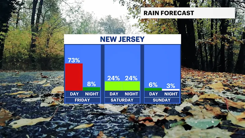
The rain will pick up mainly after midnight with a few embedded thunderstorms. Temperatures will stay very mild, with lows in the 50s and 60s. Winds are southwesterly for now but will turn northerly as the cold front slowly moves into the area. Visibility may be poor due to fog in spots, followed by isolated heavy pockets of rain.
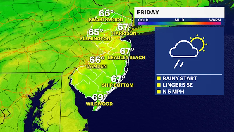
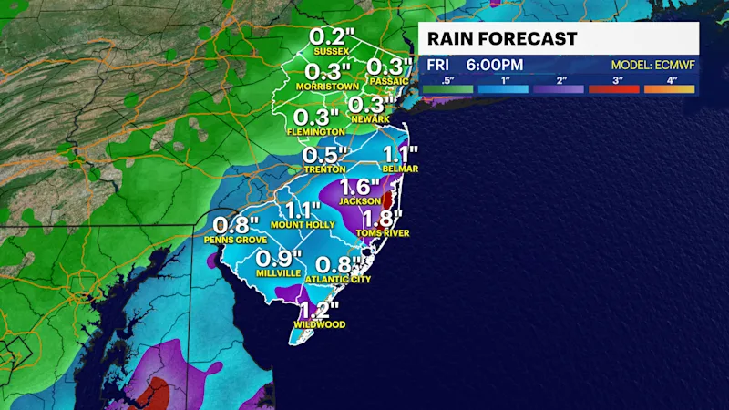
Rain totals are expected to range from under 1/2 an inch north to 1-3 inches south and east. There will be a narrow swath of some heavier downpours, and this will most likely hit areas along and east of the Parkway early Friday. This is also the part of the state where the rain will linger into the afternoon. The rain will fall over a period of several hours and will not lead to flash flooding. Roads will be wet. The wet leaves could clog drains and make things slippery - so be careful!
Colder temperatures will follow, but technically temperatures over the weekend will still be above normal. Highs will be in the 60s with a few showers and clouds on Saturday. Sunday looks sunnier and brighter. Temperatures next week will gradually cool, with highs near 60 most days.
FUTURECAST:
TIDES:
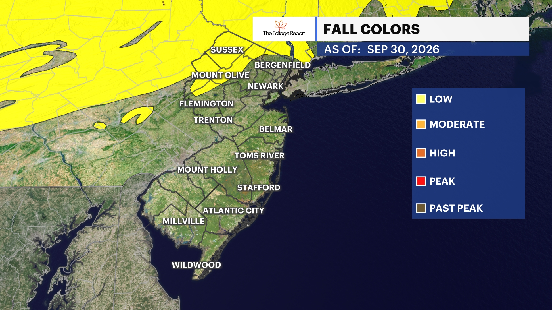
FOLIAGE UPDATE (New report every Wednesday):