Cold front moves in overnight with rain, light snow possible
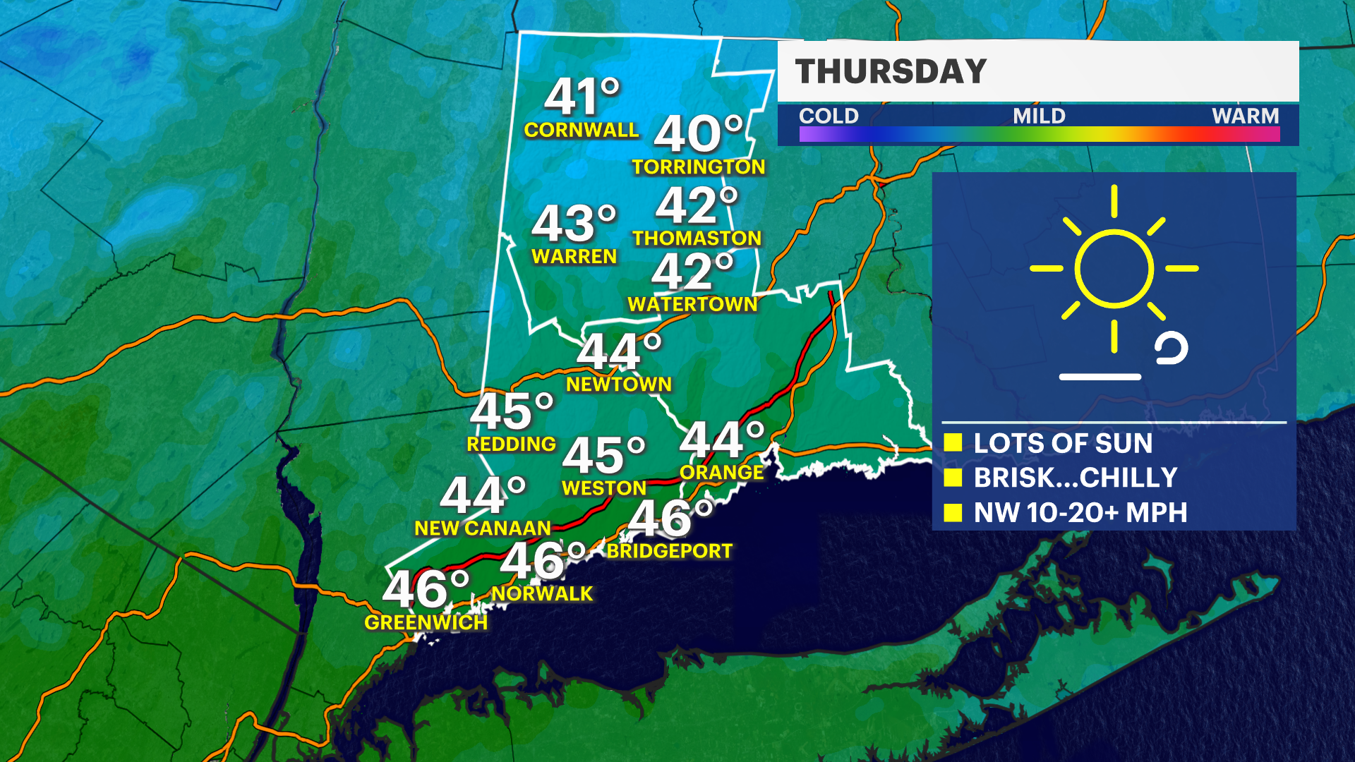
There will be a lot of sun for Thursday, but it will be windy and cold with highs in the low- to mid-40s with wind chills in the low- to mid-30s.
•
Mar 28, 2023, 9:15 AM
•
Updated 527 days ago
Share:
More Stories
2:26

The best time of the year to view Saturn is on Sunday when the planet will be in opposition
21h ago1:39

Why has hurricane season quieted down?
yesterday2:30

Goodbye to summer 2024
7ds ago
LIVE BLOG: News 12 weather updates
10ds ago1:04

Cooler temperature trend into start of meteorological fall
10ds ago1:06

Naugatuck farmer impacted by recent flooding discusses state grant for emergency assistance
10ds ago2:26
The best time of the year to view Saturn is on Sunday when the planet will be in opposition
21h ago1:39
Why has hurricane season quieted down?
yesterday2:30
Goodbye to summer 2024
7ds agoLIVE BLOG: News 12 weather updates
10ds ago1:04
Cooler temperature trend into start of meteorological fall
10ds ago1:06
Naugatuck farmer impacted by recent flooding discusses state grant for emergency assistance
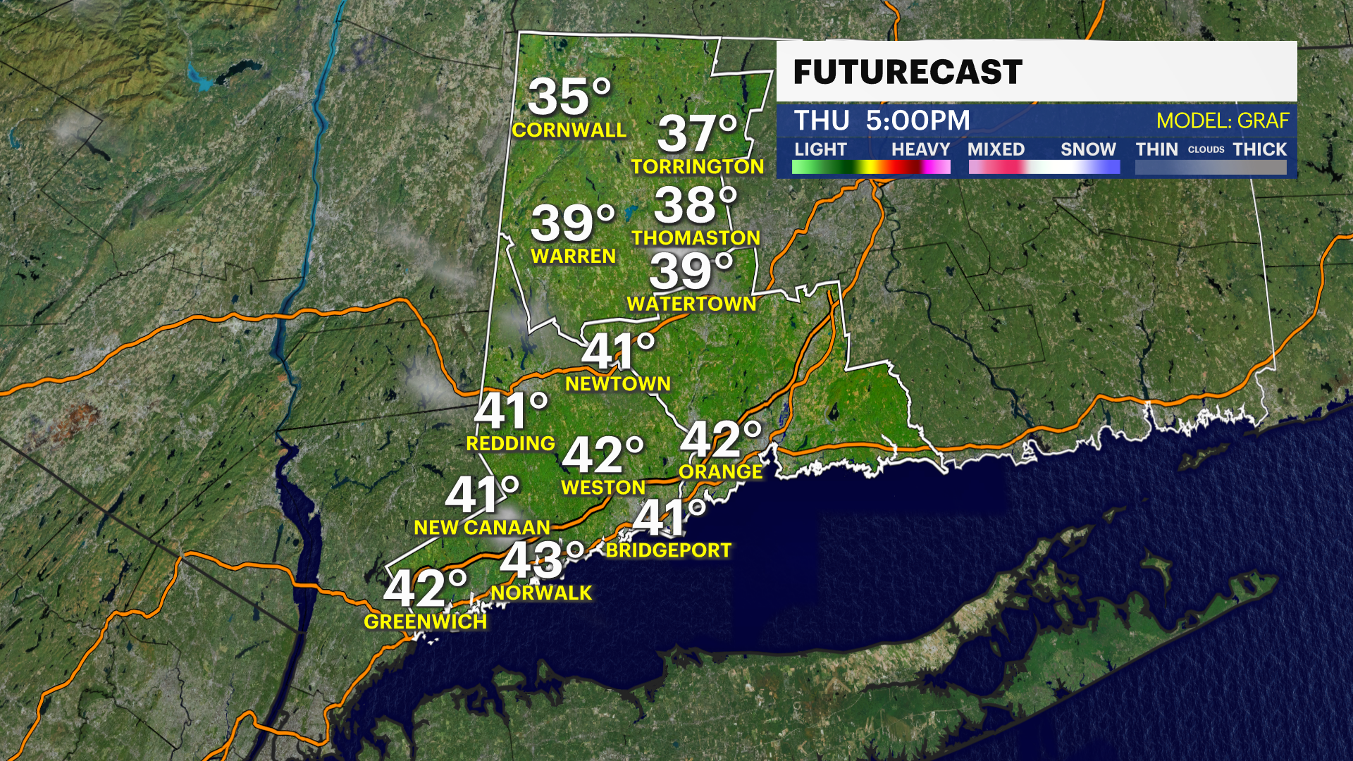
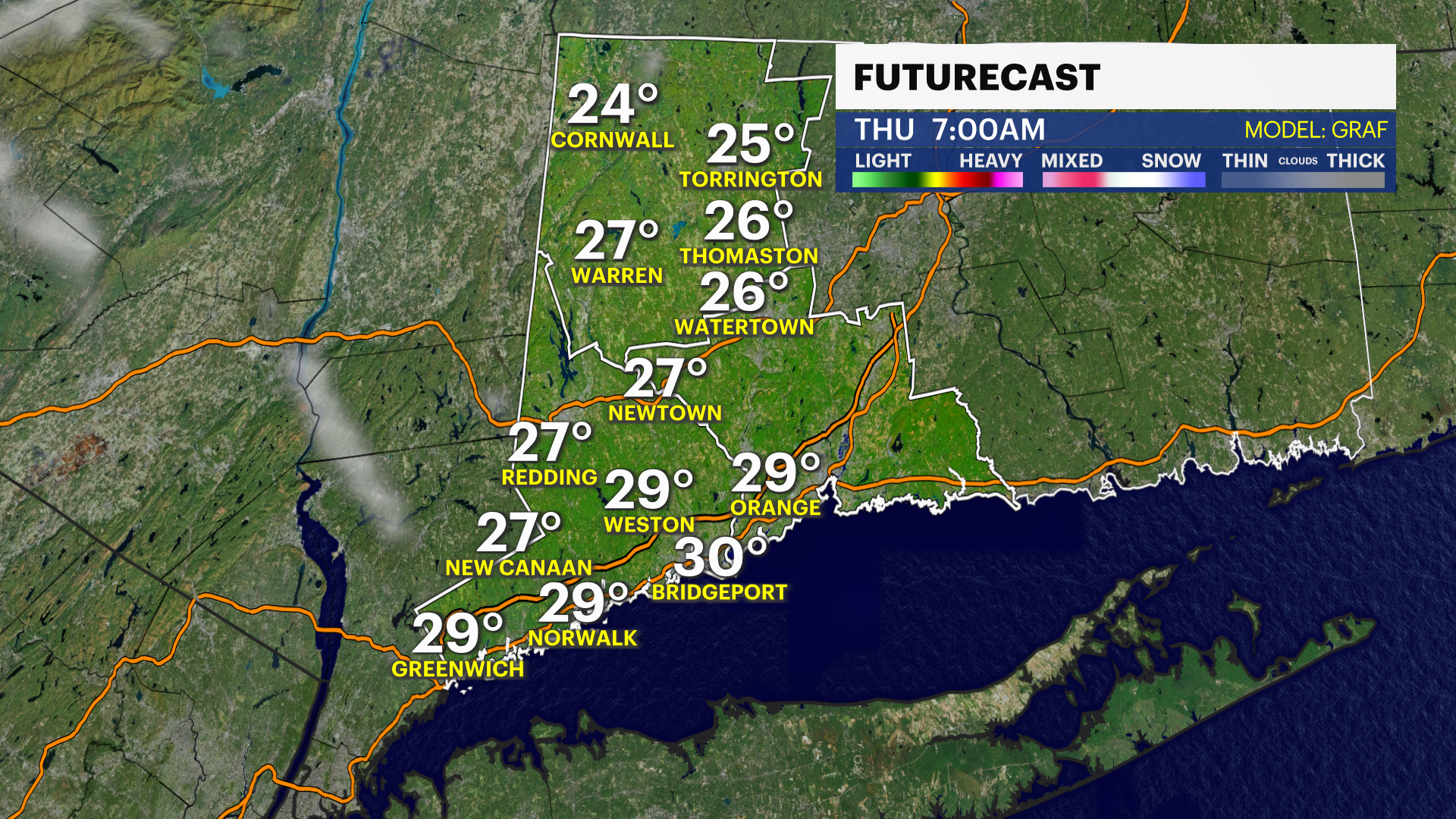
10ds agoNOW AND NEW: Storm Watch Team Meteorologist Steve Teeling says an arctic cold front will barrel through the region between 11 p.m. and 2 a.m. During that time frame, a brief period of rain and snow will occur with a coating of snow possible in Litchfield County. It will clear and turn windy and colder by morning. There will be a lot of sun for Thursday, but it will be windy and cold with highs in the low- to mid-40s with wind chills in the low- to mid-30s.

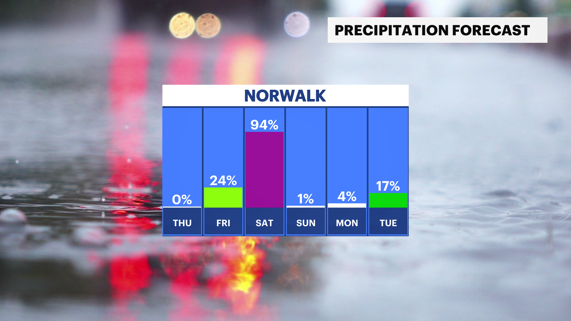
NEXT: Friday will be cloudy with showers developing during the afternoon. Periods of rain with mild conditions are likely for Saturday, while Sunday will be sunny but windy and cooler. Right now, Monday looks fair and milder.
TONIGHT: Clouding up with a brief period of rain and snow between 11 p.m. and 2 a.m. A coating possible in Litchfield County. Clearing, windy and colder by morning. Low of 29.
THURSDAY: Mostly sunny, windy and chilly. High of 44.
FRIDAY: Becoming cloudy with showers developing during the afternoon. High of 53.
SATURDAY: Periods of rain likely, breezy and mild. High of 65.
SUNDAY: Mostly sunny, breezy and cooler. High of 50.
MONDAY: Mostly sunny and milder. High of 58.
More from News 12
1:37

‘Community Rising’ music festival raises funds for CT residents impacted by historic flooding
2:19

Chilly morning, pleasant afternoon Sunday in Connecticut
0:33

Norwalk police: 2 juveniles stabbed at Norwalk Oyster Festival; arrest made
0:55

Stamford PD: Student who threatened to ‘shoot up the school’ on Snapchat arrested
1:05

Stratford boxer takes on 2nd professional bout at Foxwoods
0:43
