Summer is here early for Western Connecticut
Sunscreen, sunglasses, and A/C - everything you need to start the week.
More Stories


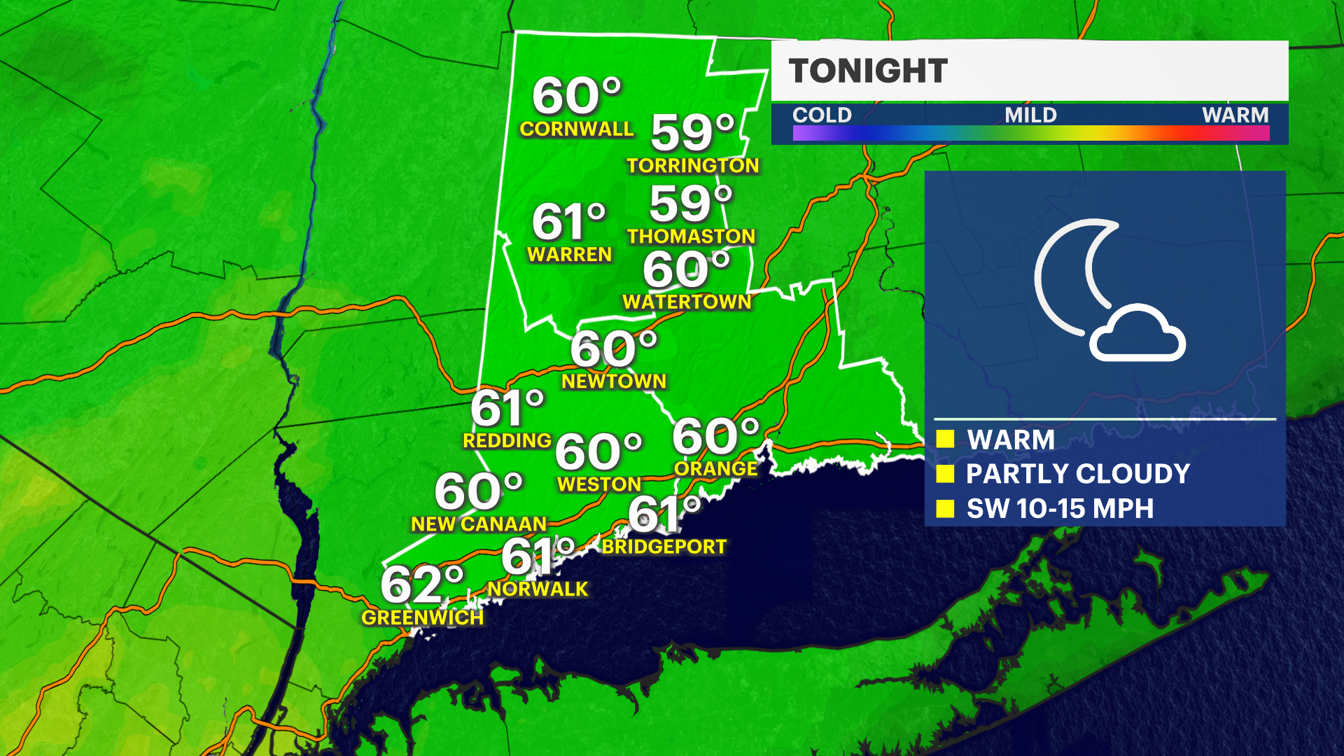
Overnight: Expect extra clouds to filter in for an exceptionally mild night across the Bridgeport area, setting a very warm foundation for the upcoming workweek.
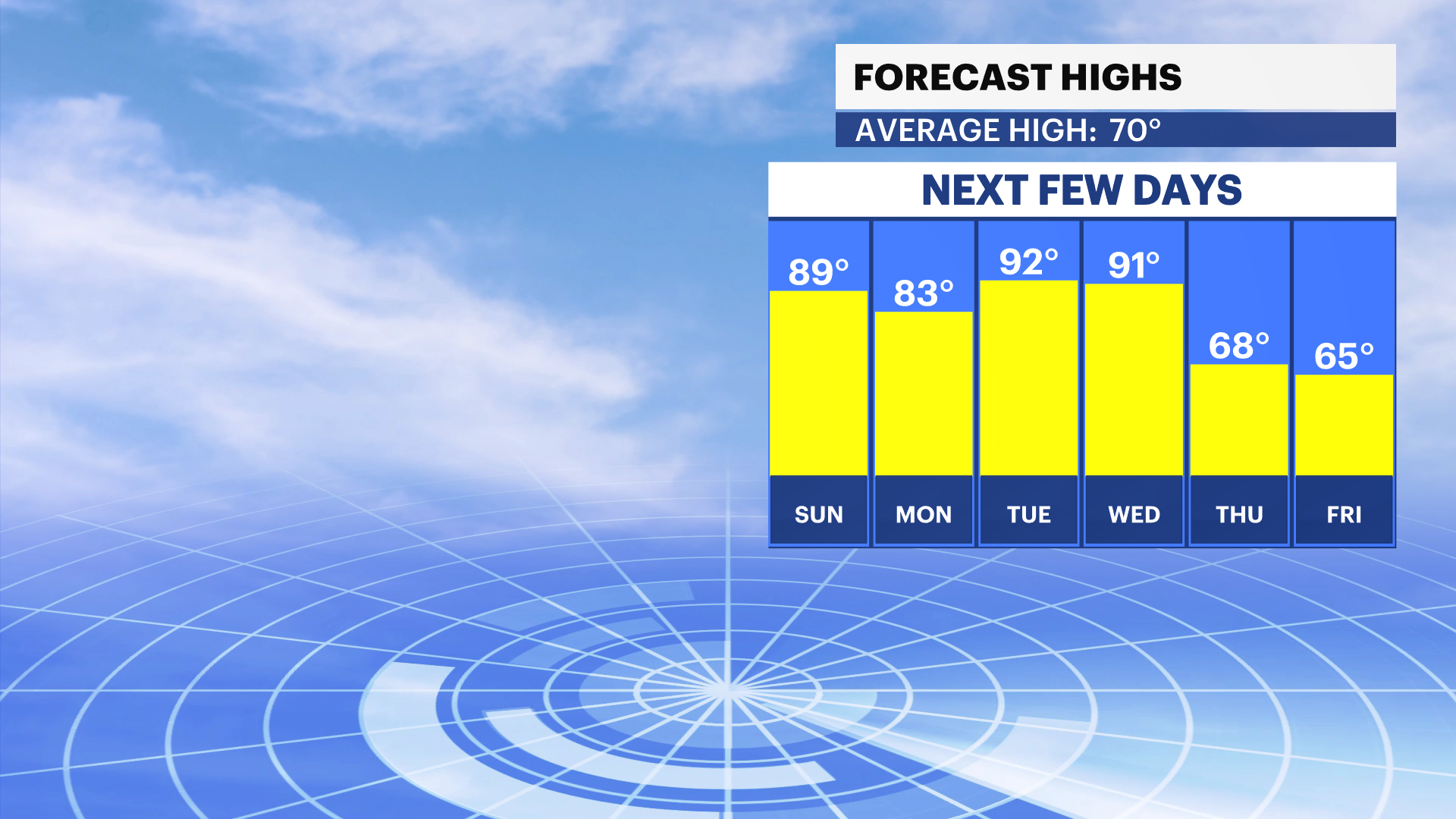
Next Week: Unseasonably warm air takes charge across the region to start the week. While inland areas heat up into the 80s, Bridgeport and neighboring shore points will benefit from a sea breeze, keeping daytime highs slightly cooler in the 70s. Despite the coastal relief, the May sun will remain intense. The UV Index will rise to a level 8, making sunscreen essential if you are outdoors, particularly during peak hours between 11 a.m. and 3 p.m.
Marine Warning: If you are heading down to the waterfront, please note that water temperatures in the Long Island Sound remain dangerously cold stubbornly hovering in the low to mid-50s. Swimming is highly discouraged, as water this cold can rapidly cause hypothermia.
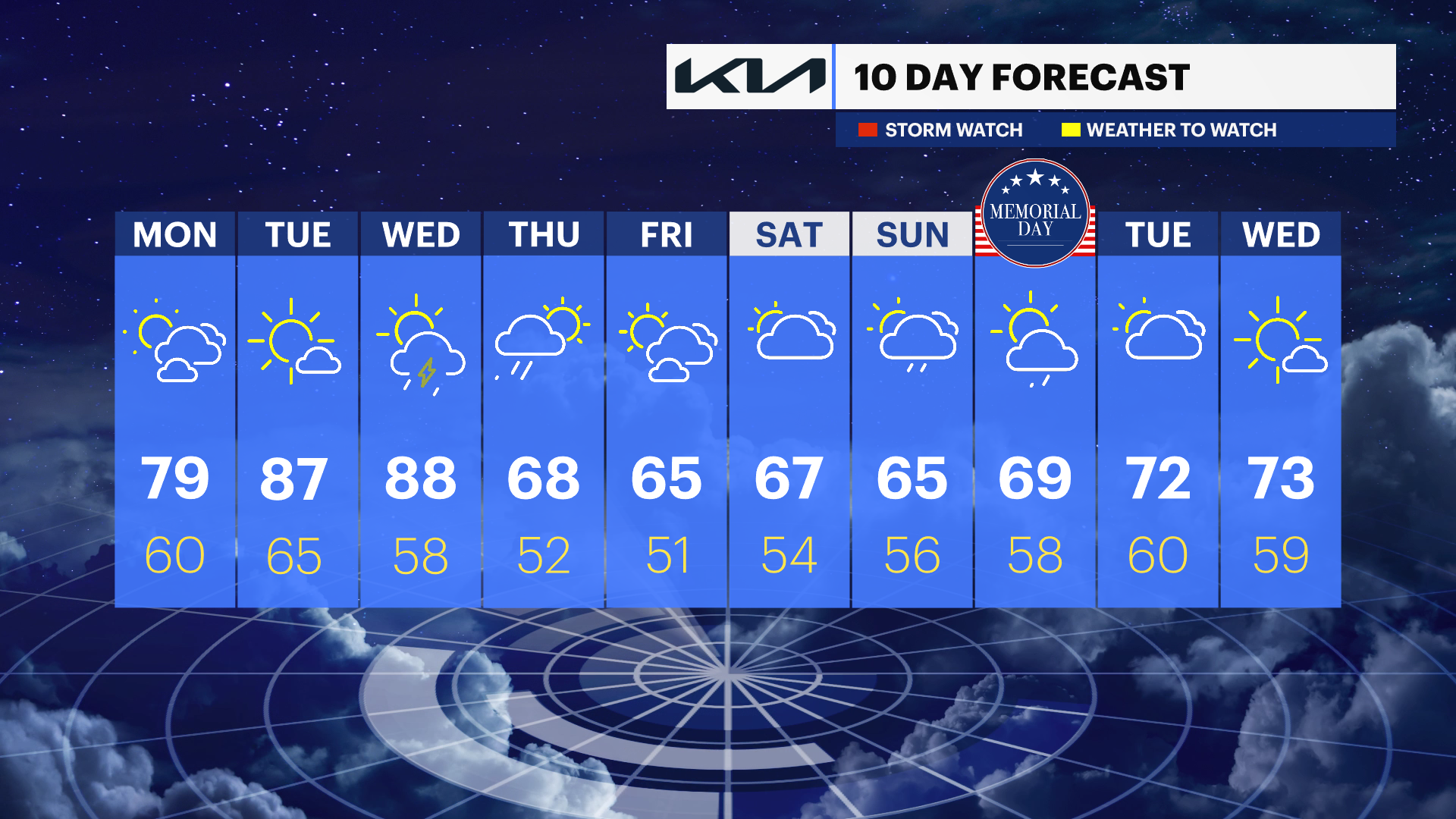
Mid-Week Transition: This unseasonably warm pattern holds steady until Wednesday of next week, which brings our next distinct chance for rain. A passing cold front will introduce a risk of thunderstorms, eventually clearing the way for much cooler, more comfortable temperatures for the end of the week and next weekend.