HEAT ALERT: Summer-like weather ahead, with strong storms to break the heat
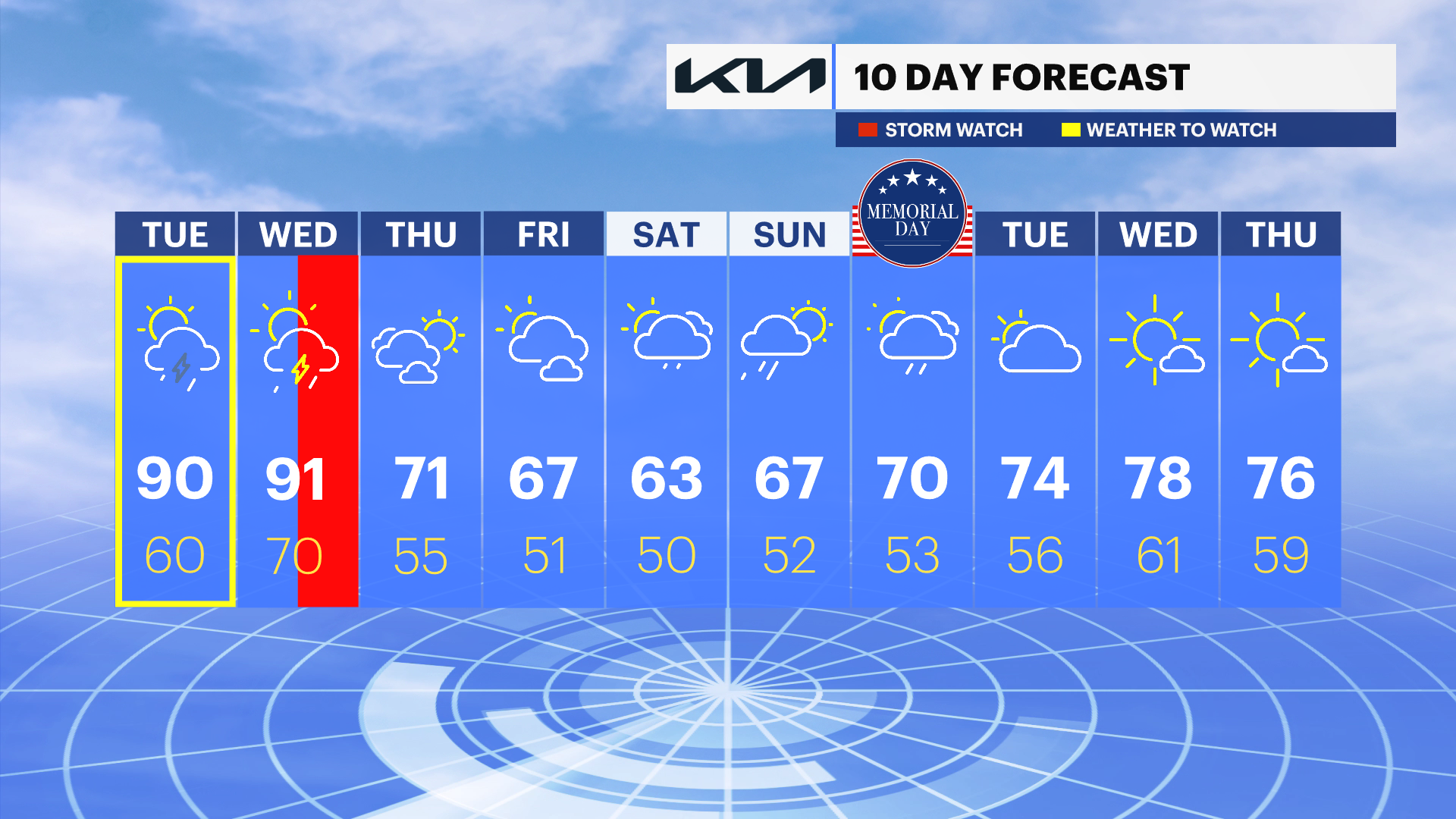
There is a risk of a strong to severe thunderstorm today, but it could be more widespread on Wednesday.
More Stories


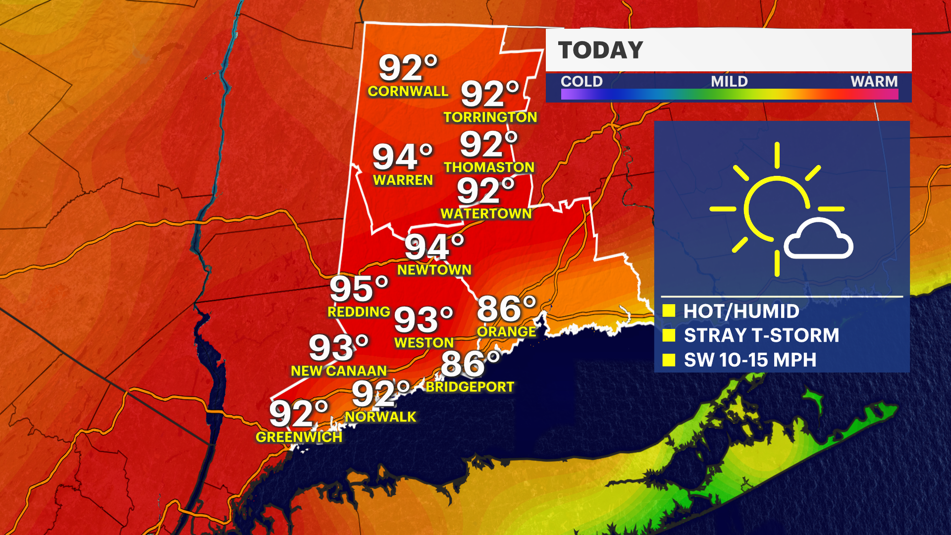
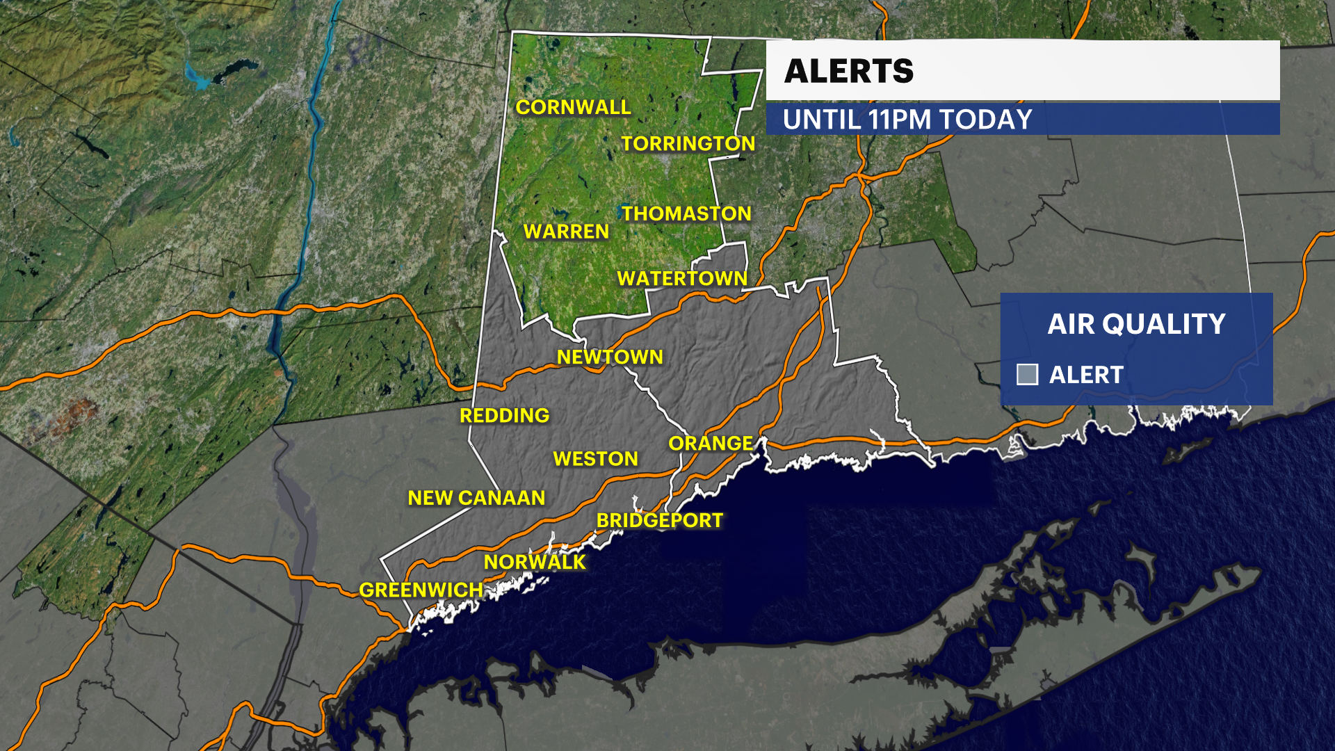
High temperatures today will vary from the mid- and upper 80s closer to the water, to the low 90s inland. Humidity levels will also climb, making it feel even hotter and making the air quality worse. The air quality alert will pick up again on Tuesday from 11 a.m.-11 p.m.
The record-high temperature for Tuesday in Bridgeport is 89 from 2017 and in Danbury it's 88 from 2017 as well. These records are in reach for Bridgeport and Danbury will likely see a new temperature record set. Stay weather aware the next two days. First because of the heat and second with the storm potential. Look for a few storms to develop in the afternoon and evening. Any storm that develops today has the potential to become strong to severe, with damaging winds and even some hail.
Storms on Wednesday will be more widespread with the passage of a cold front. Those storms could also have damaging winds and hail.
If you are heading down to the waterfront and beaches, please note that water temperatures in the Long Island Sound remain dangerously cold. Swimming is highly discouraged, as water this cold can rapidly cause hypothermia.
Much cooler temperatures will filter in starting Thursday and on into the weekend. There is also a chance of rain over the Memorial Day holiday weekend as well.