Near record warmth expected in New Jersey by the end of the week
Rain chances are limited this week. Favorable winds help push temperatures to near record level by the end of the week.
More Stories


WHAT TO KNOW
Expect premiere weather this week. Sunny and dry all week long. Temperatures will rise from the 70s into the 80s, then into the low and mid-90s by the end of the week and into the start of the upcoming weekend. The chance of beneficial rain, however, isn't expected until late this weekend or early next week.
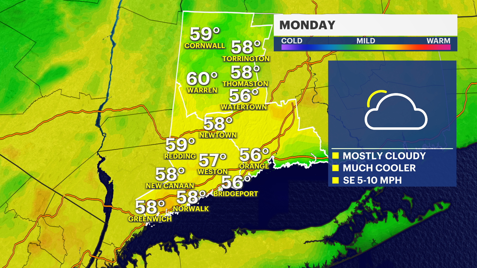
Fair weather will continue to gain a very stubborn foothold over the region. This will inhibit clouds from becoming too prominent in the skies. Obviously, without clouds, the chance for rain is very low. The forecast is calling for this fair-weather maker to slowly drift off the Mid-Atlantic coastline. It will be close enough to continue to keep the weather fairly dry and sunny. However, it will also return a very favorable wind that will allow the temperatures and the humidity to roll back into the region starting on Thursday.
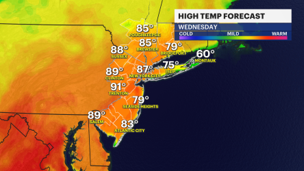
Afternoon temperatures are expected to be in the mid-90s by the time Friday rolls around. The record high temperature for the date is 95, which was set only five years ago in 2021. The News 12 Storm Watch Team will have to see how the forecast evolves this week.
The weekend isn't looking spectacular as of Monday afternoon's forecast. It is still a meteorological lifetime down the road, but the guidance is calling for more overcast skies on Saturday, with the heat and humidity continuing. By Sunday, the weather begins to unravel with possible showers that might linger into Monday.
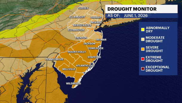
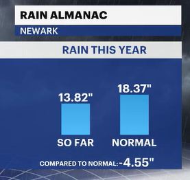
The region needs the rain. The more days the region goes without it, the bigger (drier) the drought becomes.