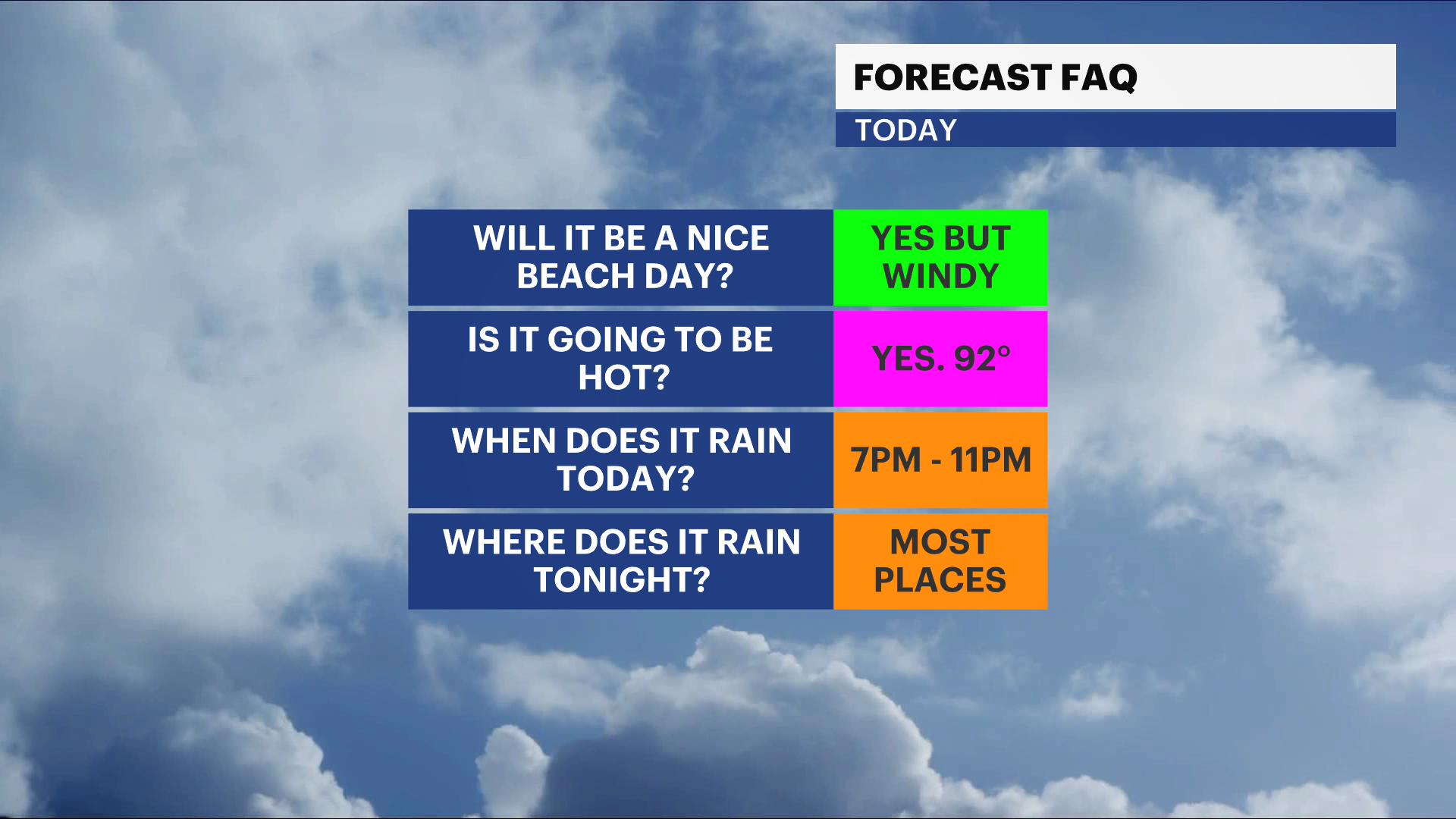
Sunny, hot, and breezy today ahead of thunderstorms tonight
It will be a great beach day ahead of late evening storms from 7 p.m. through midnight.
More Stories


What to Expect
Today's high will be near 92 degrees which continues our heat wave marking today as day 4. Thin clouds begin to develop this afternoon, and the wind along the beaches picks up to near 25mph from the south. It's important to be careful with the umbrellas!
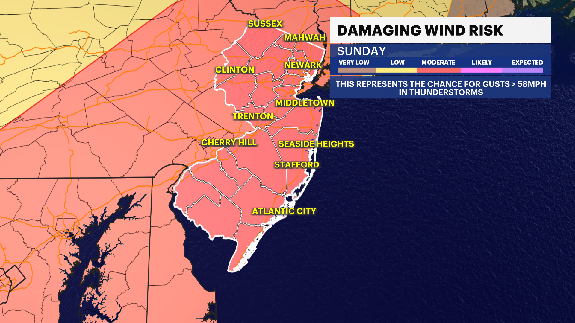
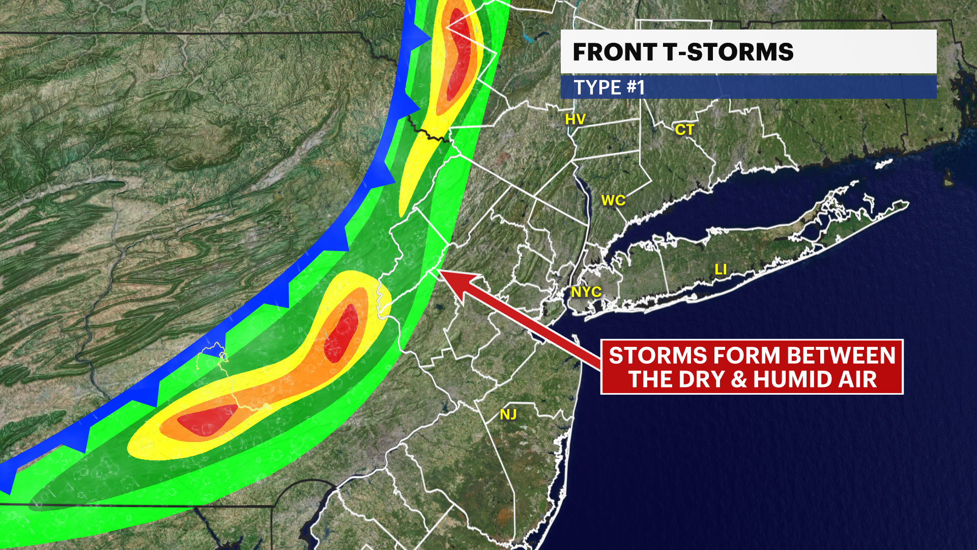
Storms arrive tonight near 7 p.m., starting west then moving eastward. This front is going to wring out the heat for the next few days where it becomes more comfortable yet still warm. Storms can be capable of producing damaging winds in excess of 60mph as they move through. There is limited concern for flooding, but downpours are expected. Storms are expected to be stronger across western New Jersey as they arrive to the state.
The week ahead is generally quiet with another round of stronger storms expected for Thursday.