STORM WATCH: Stormy and wet start to September across Brooklyn
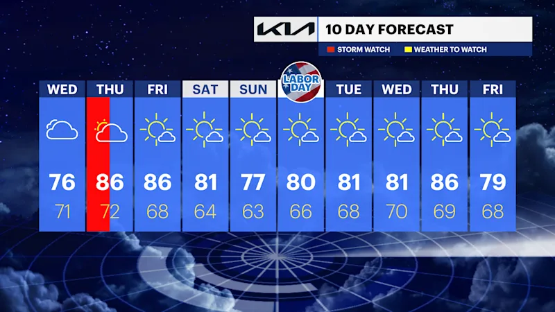
There is a potential for severe storms late Tuesday, with a pleasant, mostly dry forecast just in time for the Labor Day weekend.
Share:
More Stories


Brooklyn Information
Brooklyn, New York
Updating...
🌅
Sunrise
--
Brooklyn
🌇
Sunset
--
Brooklyn
☀️
UV Index Today
--
Loading...
🌙
Moon Phase
--
Tonight
🍃
Air Quality
--
Loading...
Loading latest Brooklyn information...
WHAT TO KNOW
There is a severe thunderstorm threat into Tuesday evening. The main threat would be damaging winds and flash flooding. However, other threats such as spin-up tornadoes can't be ruled out. The further west you go, the greater the threat.
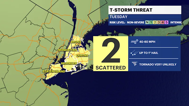
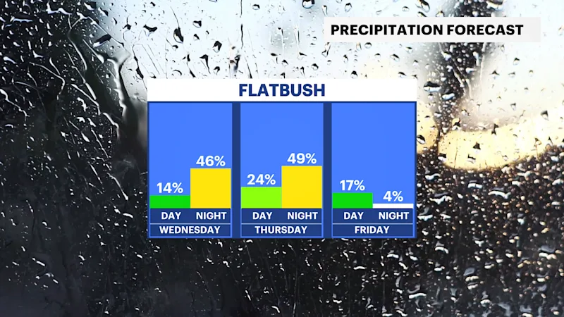
Storms will move through the overnight hours Wednesday into Thursday. A low-end severe risk is there for strong-to-damaging winds in these storms. But the threat has lowered since previous forecasts. Flash flood threat still remains the same.
Labor Day weekend as of Tuesday evening's forecast looks mainly dry and cooler but still pleasant. Expect 70s for highs, 50s and 60s for lows. An isolated shower is possible on Saturday afternoon. Check back with the News 12 Storm Watch Team for updates.