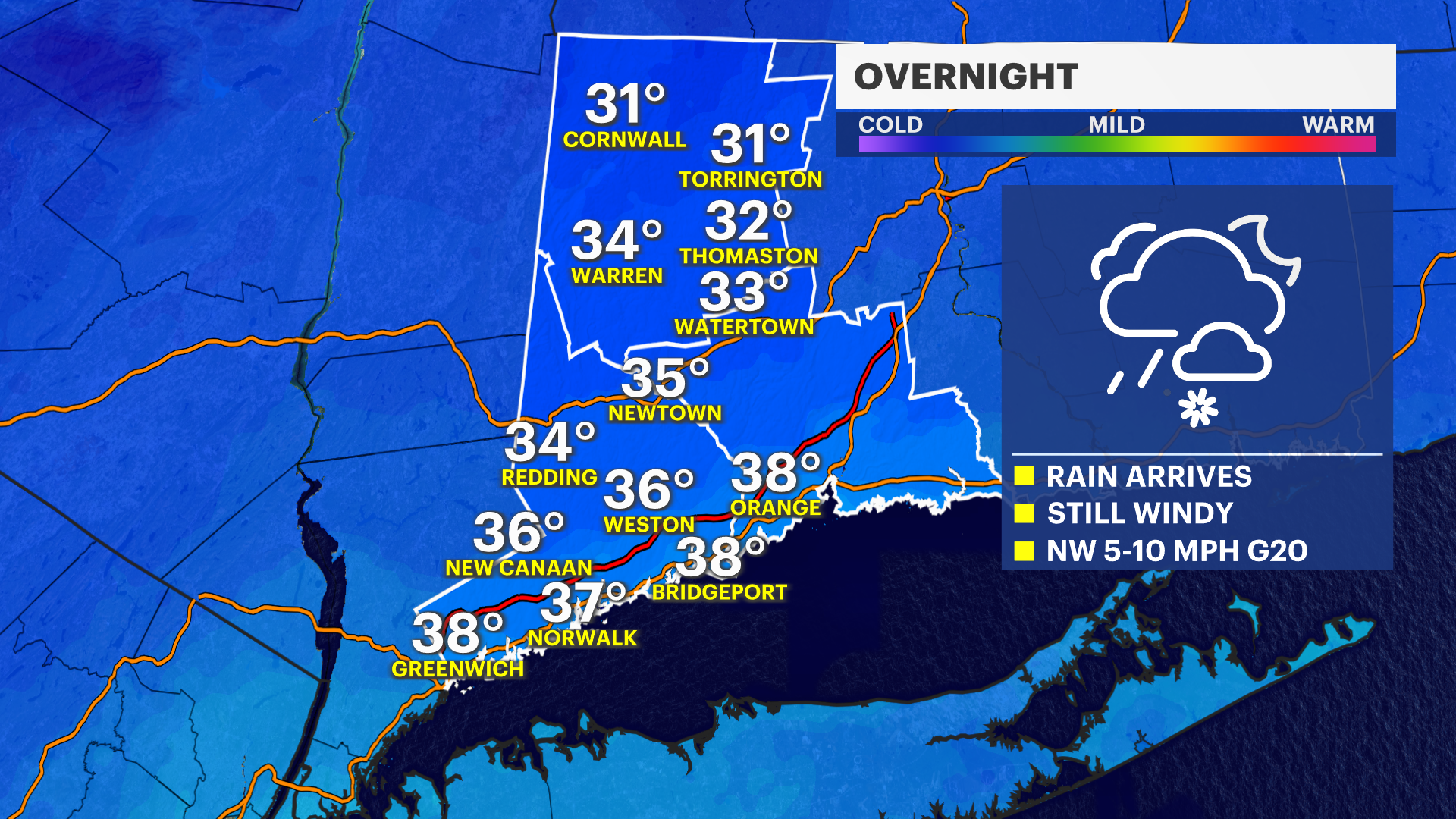
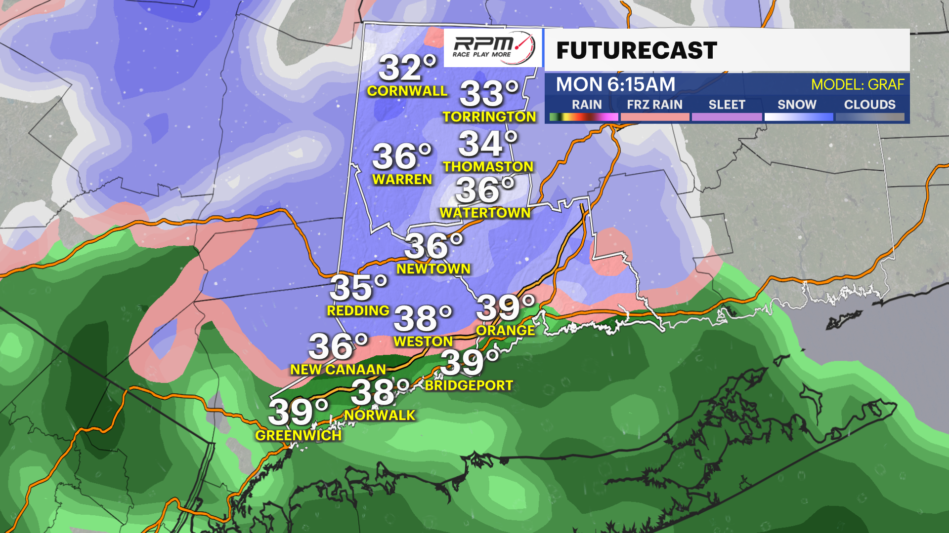
STORM WATCH: Steady rain, wintry mix overnight in Connecticut
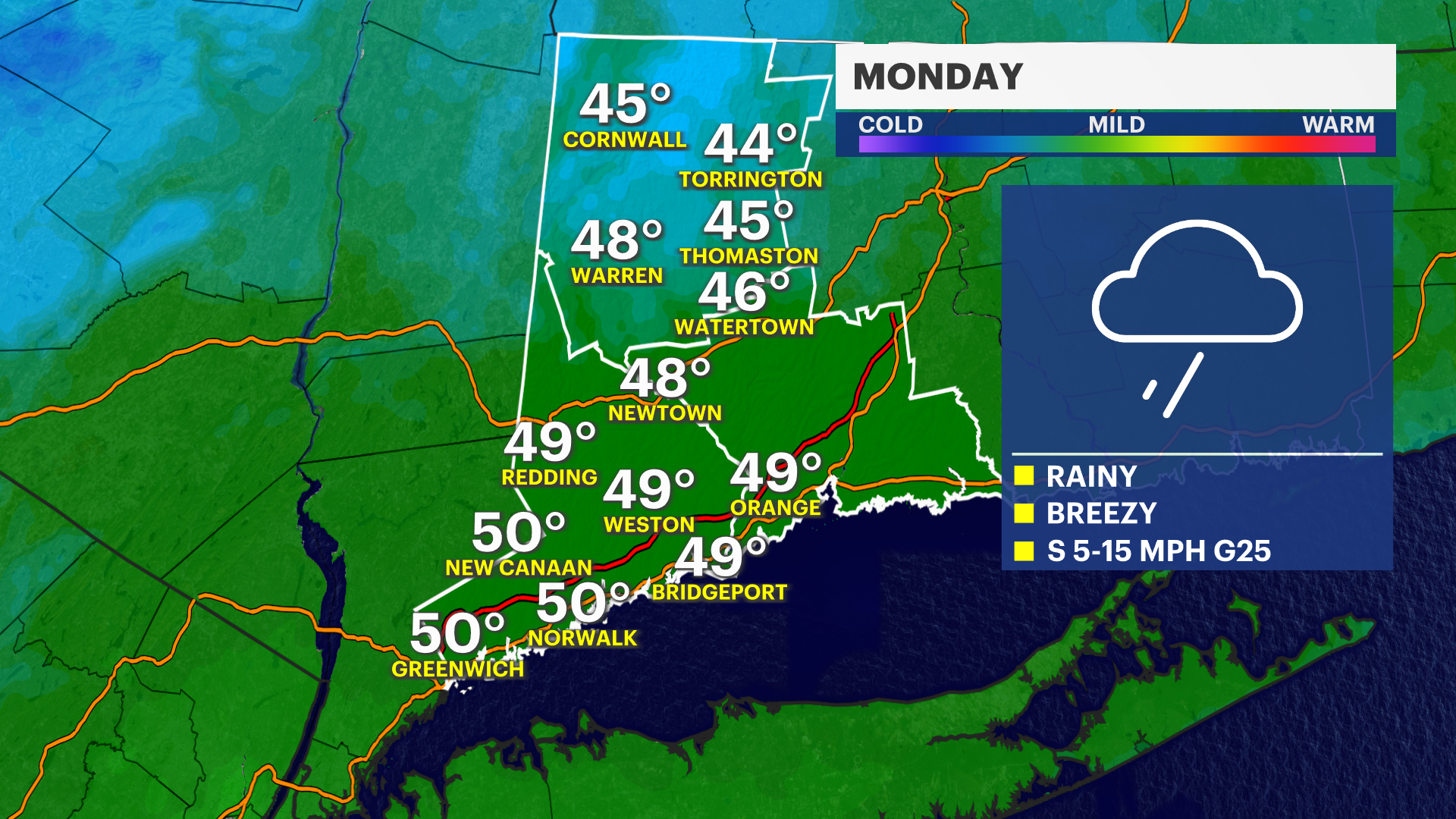
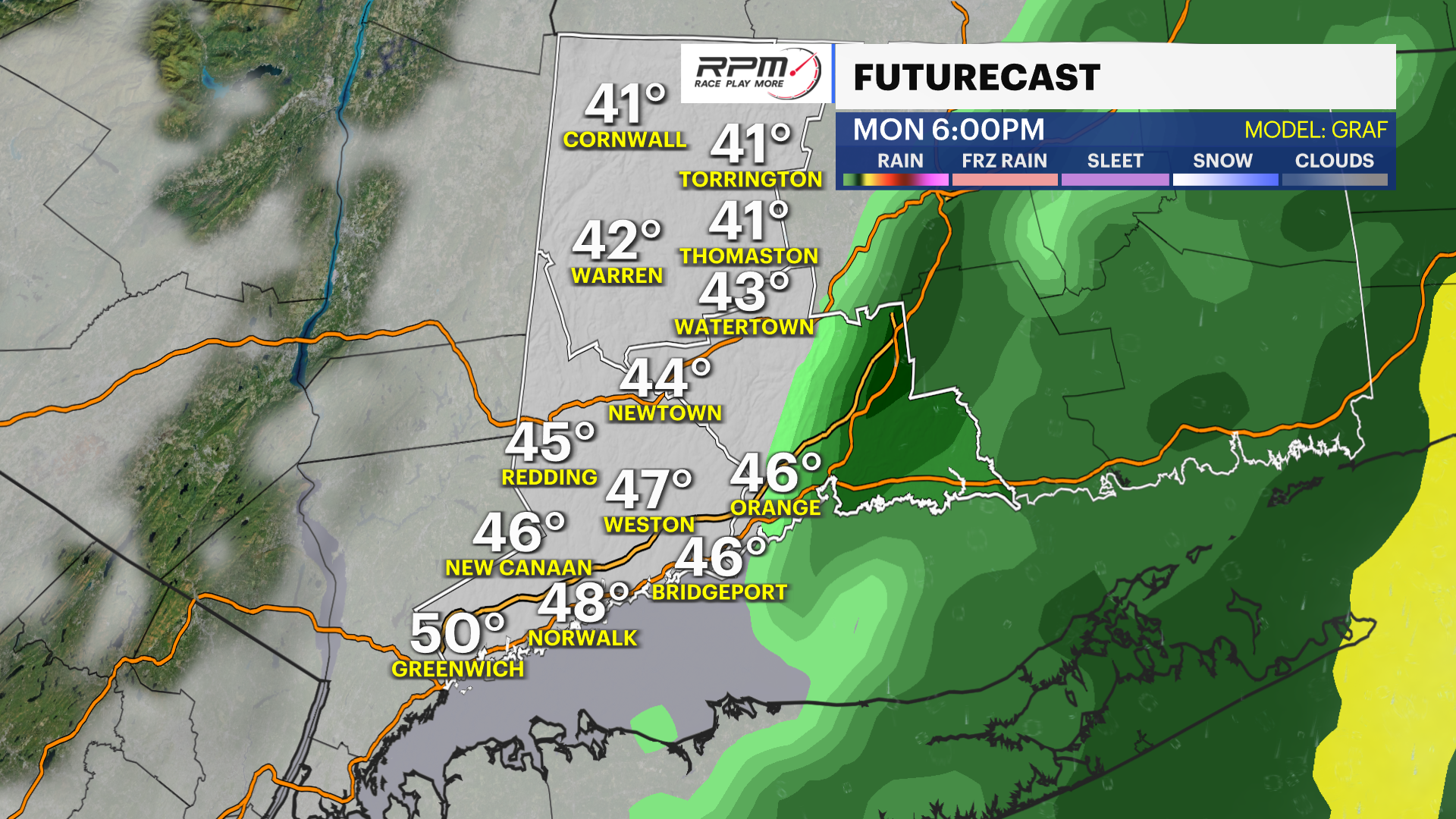
Expect rain and some snow on Monday before the sun returns on Tuesday.
Share:
More Stories


OVERNIGHT: Rain developing late. Lows near 38.
MONDAY: Steady rain, some clearing late PM. High near 49.
TUESDAY: Partly cloudy. Highs near 54. Lows near 36.
WEDNESDAY: Partly cloudy. Highs near 51. Lows near 33.
THURSDAY: Partly cloudy. Highs near 49. Lows near 37.
FRIDAY: Partly cloudy. Milder. Highs near 54. Lows near 40.