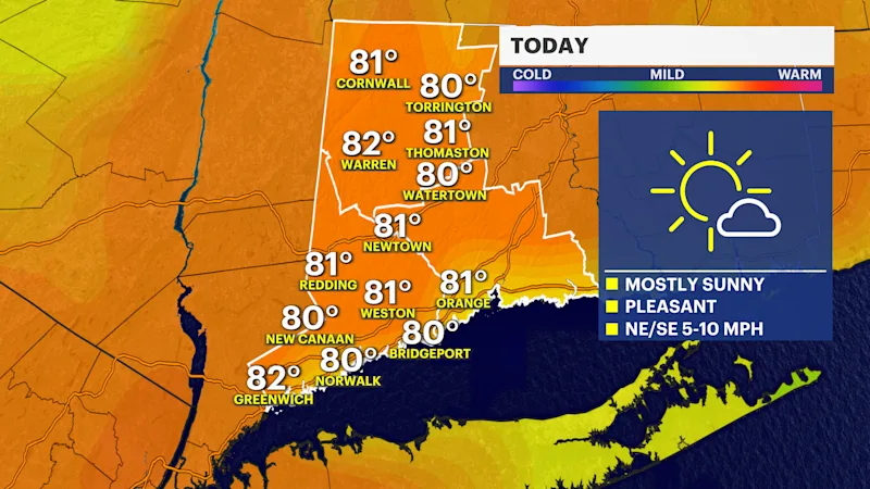
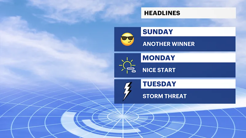
Mostly sunny skies for Sunday with pleasant temperatures and comfortable levels of humidity
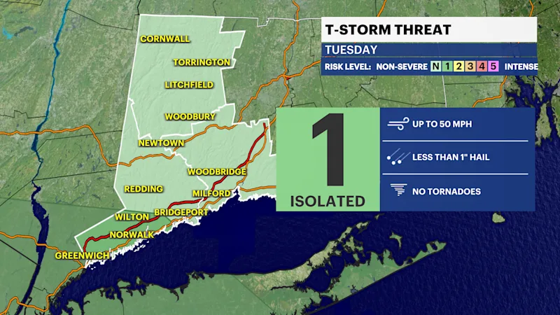
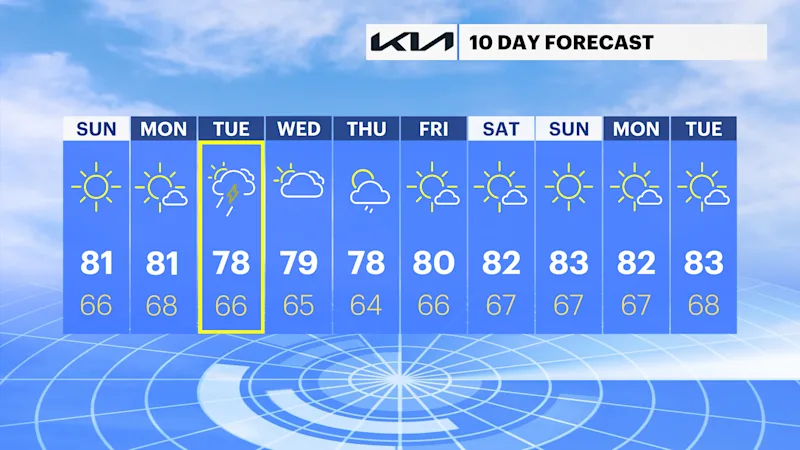
Scattered thunderstorms are possible on Tuesday.
Share:
More Stories


It will be a spectacular Sunday across the region today.
Temperatures will be comfortable. Readings will be below the average highs of the mid 80s by a few degrees. Humidity levels will be quite low by Summertime standards.
Monday will be decent with a mix of sun and clouds.
Tuesday looks to become active with the chance of showers and storms.