HEAT ALERT: Extreme heat warning through Tuesday in Connecticut
Our hottest stretch of weather in several years is expected over the next few days. Here's the latest on how long it will last.
Share:
More Stories
1:50

High humidity persists, heat index of 95-100 this week
9h ago1:57

Hot, humid and stormy week ahead in Connecticut
2ds ago1:48

Thunderbolt 12 tracks severe thunderstorms, showers in Connecticut
7ds ago
News 12 weather blog
7ds ago1:07

2024 was deadliest year in past 2 decades for hot car deaths, NSC says
7ds ago2:06

Tropical humidity, storm chances this week in Connecticut
9ds ago1:50
High humidity persists, heat index of 95-100 this week
9h ago1:57
Hot, humid and stormy week ahead in Connecticut
2ds ago1:48
Thunderbolt 12 tracks severe thunderstorms, showers in Connecticut
7ds agoNews 12 weather blog
7ds ago1:07
2024 was deadliest year in past 2 decades for hot car deaths, NSC says
7ds ago2:06
Tropical humidity, storm chances this week in Connecticut
9ds agoThe heat index starting Monday will be above 100 degrees until Wednesday. Monday and Tuesday could have high temperatures in the triple digits.
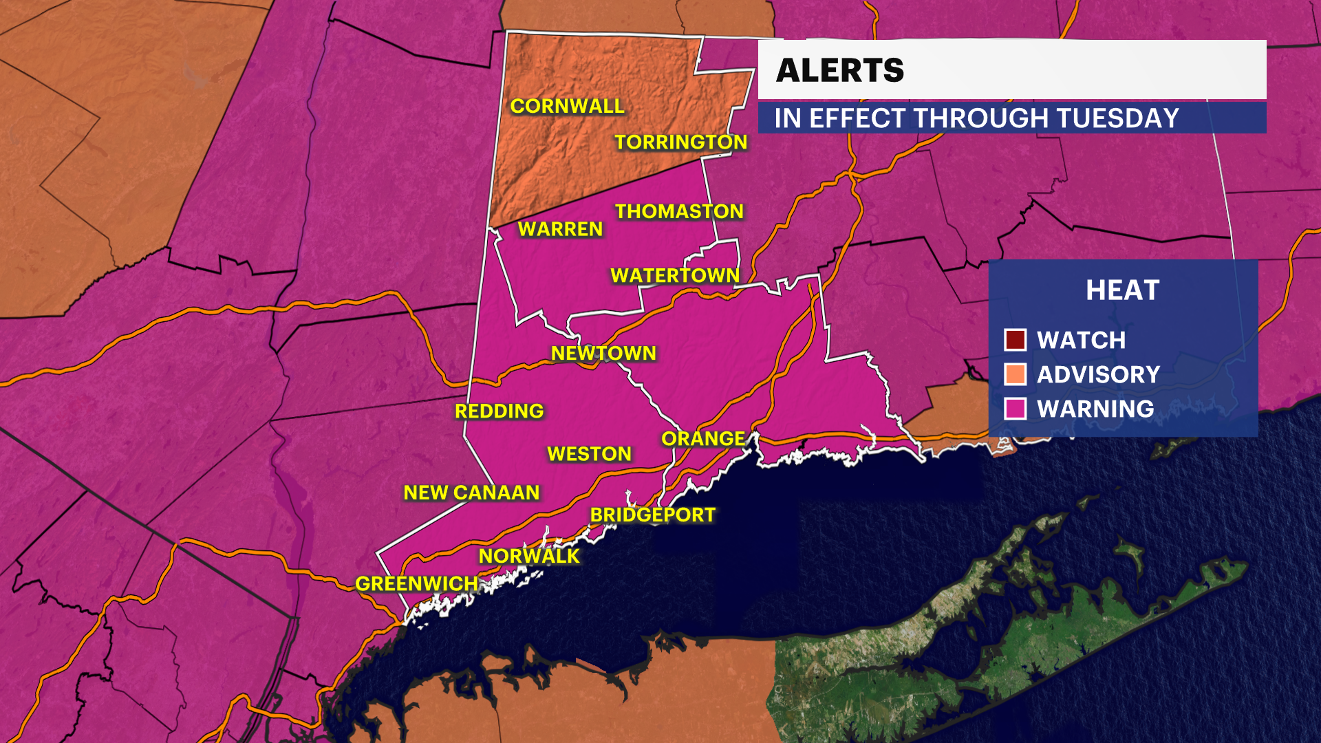
The humidity both days will be very high and create hazardous conditions. The air quality is also poor.

There will be no relief until the end of next week. There is a risk of thunderstorms by Thursday.
TONIGHT: Mostly clear, warm & muggy. Low 75.

MONDAY: Mostly sunny High 95. Feels like 105-110.

TUESDAY: Mostly sunny. High 97.

WEDNESDAY: Mostly sunny, risk of a shower or storm. High 94.
THURSDAY: Partly sunny, thunderstorms. High 83.
FRIDAY: Partly sunny, PM storms. High 76.
SATURDAY: Early clouds and showers, then sunshine. High 79.

