Temps swing upward for Connecticut; light rain and wintry mix ahead
Storm Watch Team Meteorologist Michele Powers says we have a warmer week ahead, but there’s a chance for wintry mix showers tomorrow.
More Stories


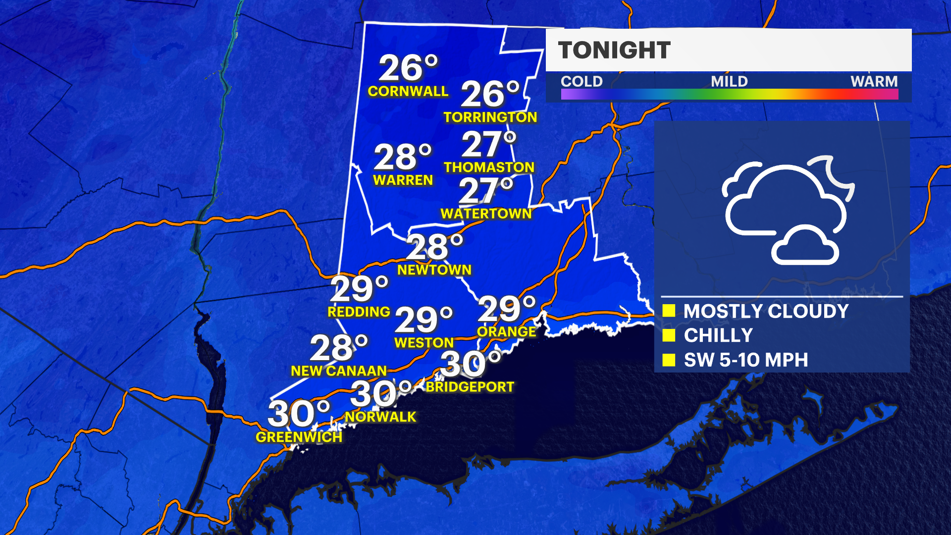
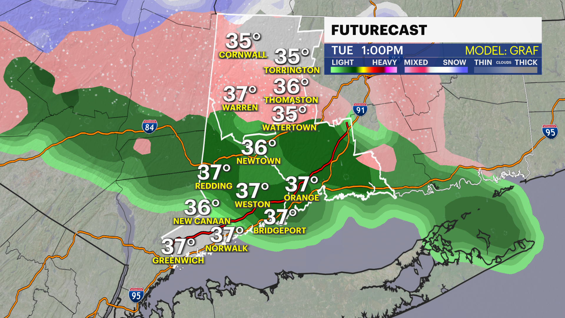
WHAT’S NOW: Storm Watch Team Meteorologist Michele Powers says we have a warmer week ahead, but there’s a chance for wintry mix showers tomorrow. Temperatures will drop into the upper 20s and near 30 degrees overnight, but they will warm up throughout the week.
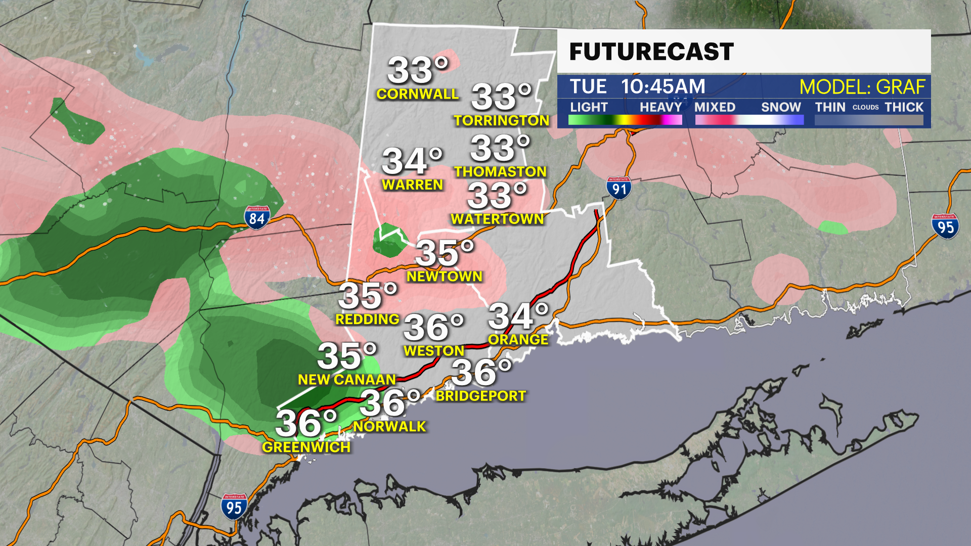
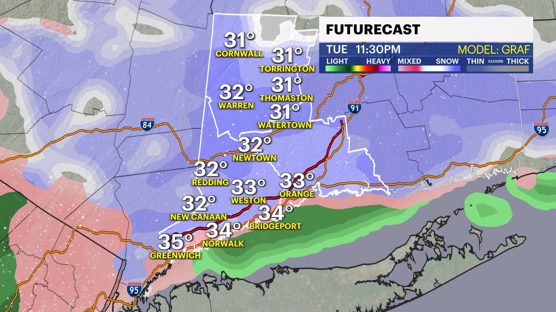
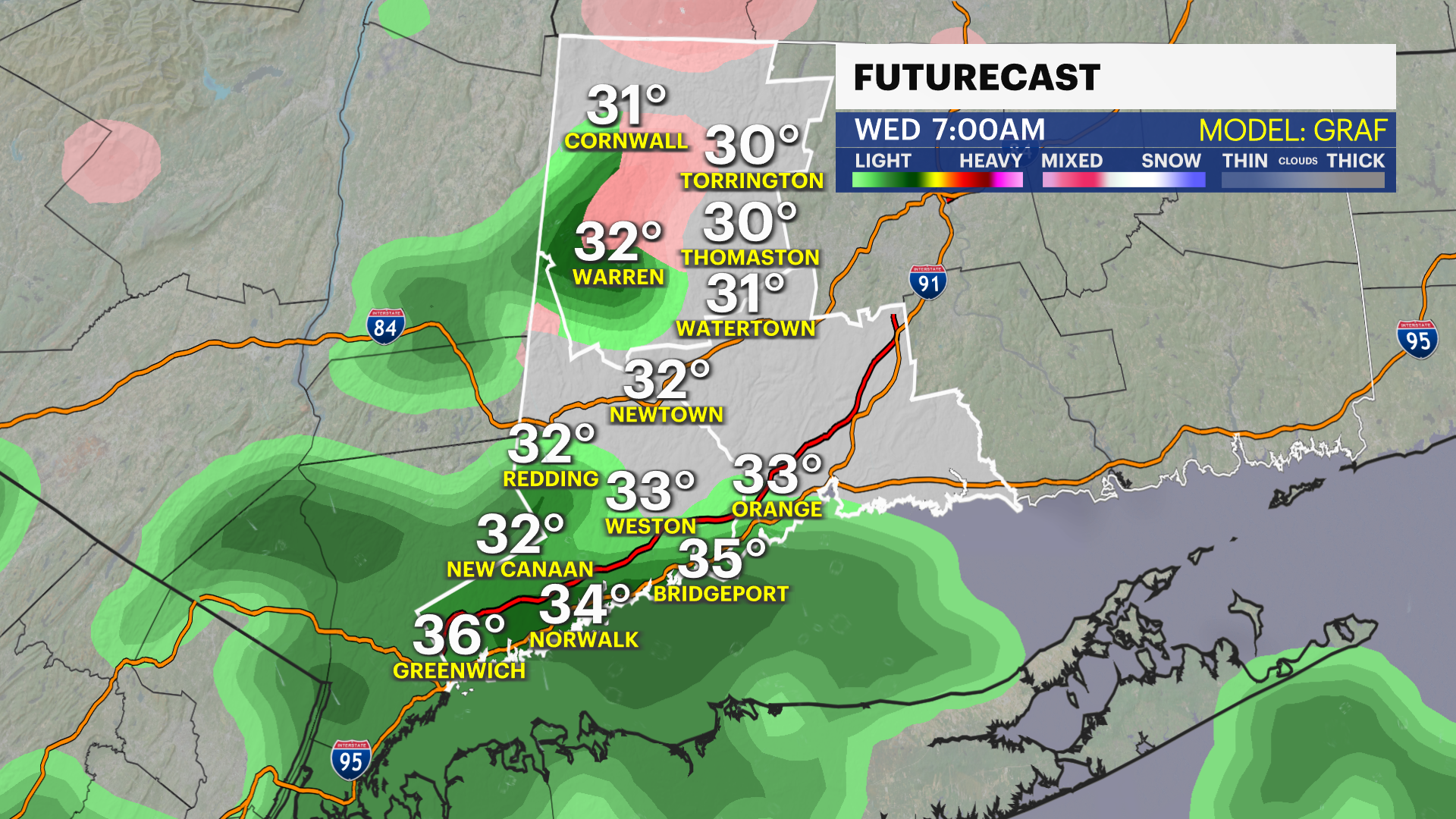
WHAT'S NEXT: Mostly cloudy Tuesday morning. A cold front will drop down from the north. Rain/wintry mixes on the way for this week. Ice is possible. Most of the mixing and snow will be north of the Merritt and I-84. Best chance of snow will be in the hills of Litchfield County. Accumulations, if any, will be very limited. Temperatures will warm into the 40s and even lower 50s. Cool air this weekend with a risk of rain Sunday. Monday may feature some snow if it's cold enough.
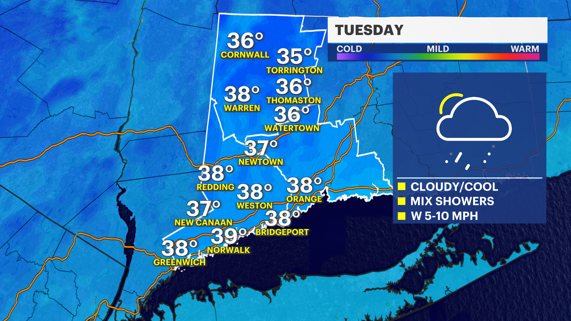
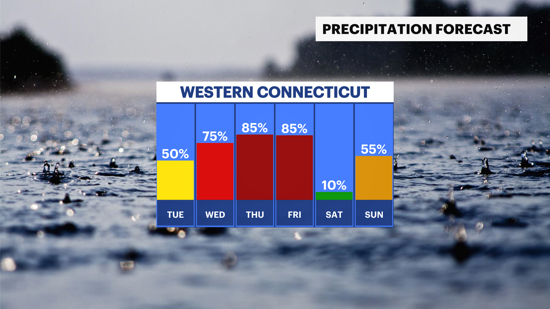
TUESDAY: Mostly cloudy. Risk of light rain/wintry mix. High of 38 degrees.
WEDNESDAY: Mostly cloudy. Rain. High of 41 degrees.
THURSDAY: Rain. High near 54 degrees.
FRIDAY: Early rain, then cloudy. High near 52 degrees.
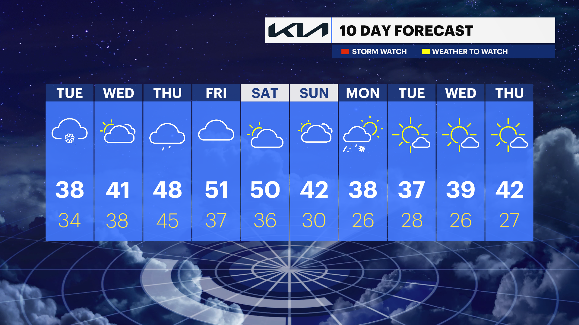
SATURDAY: Partly sunny to mostly cloudy. High of 47 degrees.
SUNDAY: Mostly cloudy with showers. High of 44 degrees.


