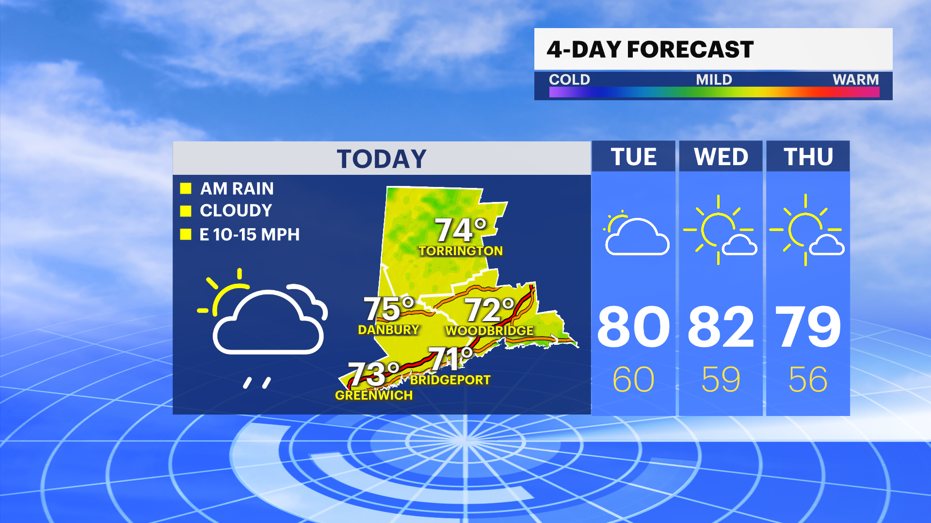
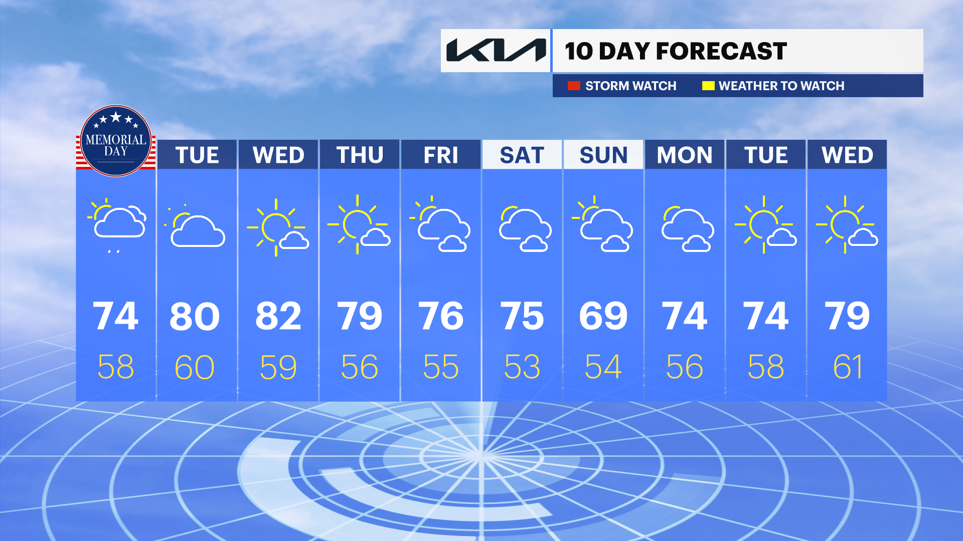
Drier and warmer conditions to settle in for several days
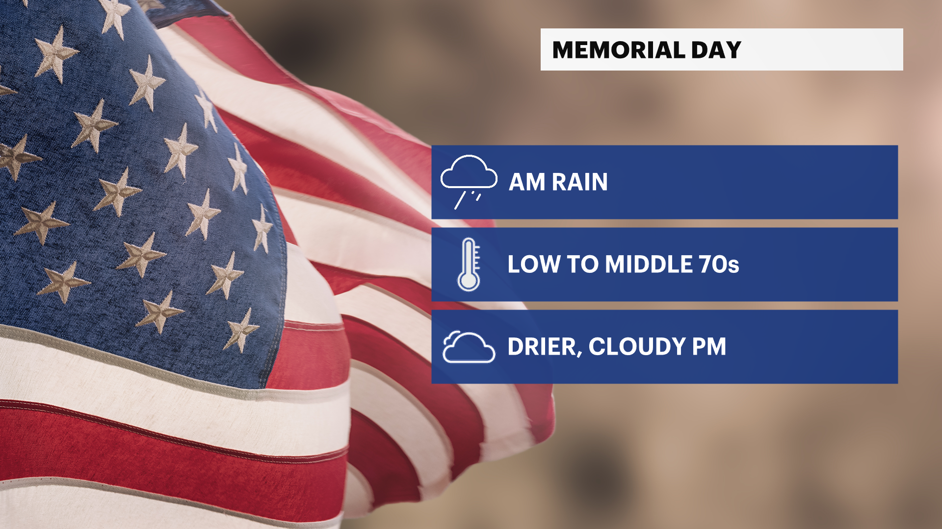
Less than ideal for the holiday, but better weather is on the way.
Share:
More Stories


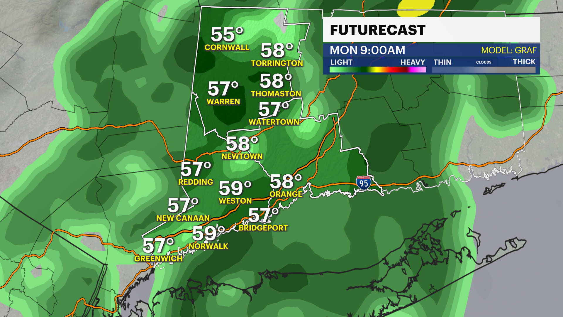
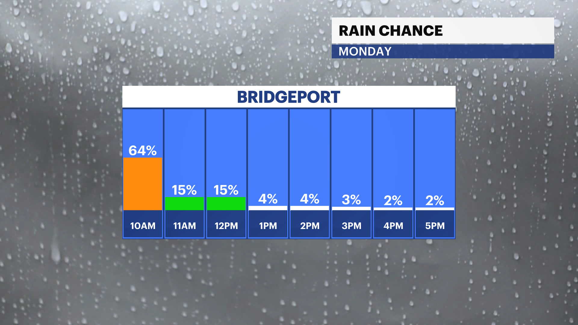
Showers, drizzle, and fog this morning give way to drier but cloudy skies for this afternoon.
Noticeably warmer with highs in the 70s for most, a big improvement from days prior.
After 1-2" of rain, the dent will be put in the ongoing drought across portions of the state,
so, while the timing of the wet weather was poor, the rain was certainly beneficial.
Dry and warmer times for the upcoming week with highs in the 70s and 80s with a mix of sun and clouds.
Next weekend also looks dry as of now with Saturday being warmer and Sunday a bit cooler under partly cloudy skies.