More Stories
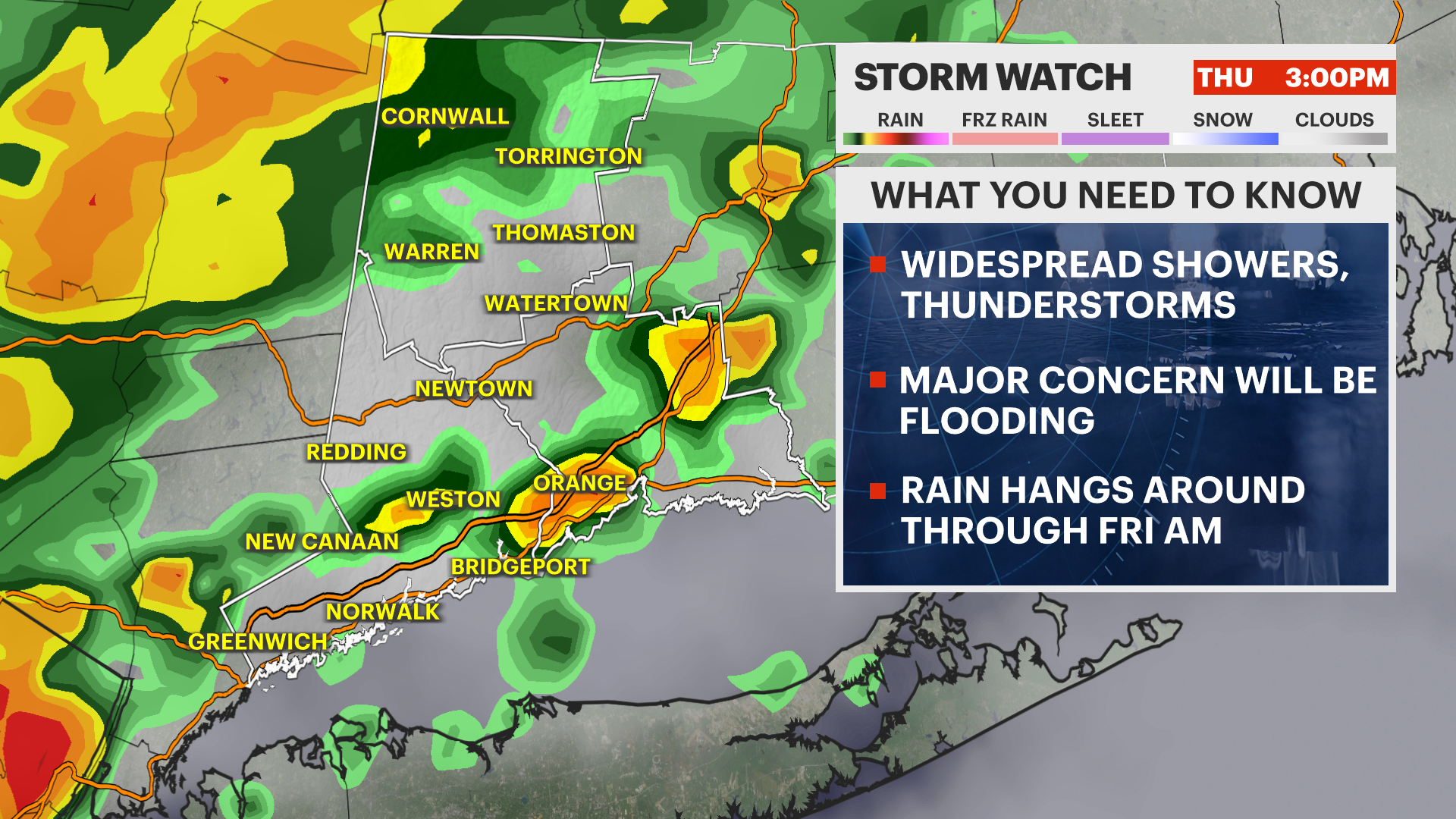
A stalled out frontal boundary continues to sit south of our area. This has been the focus for some of the heaviest rain in the tri-state area Thursday evening.
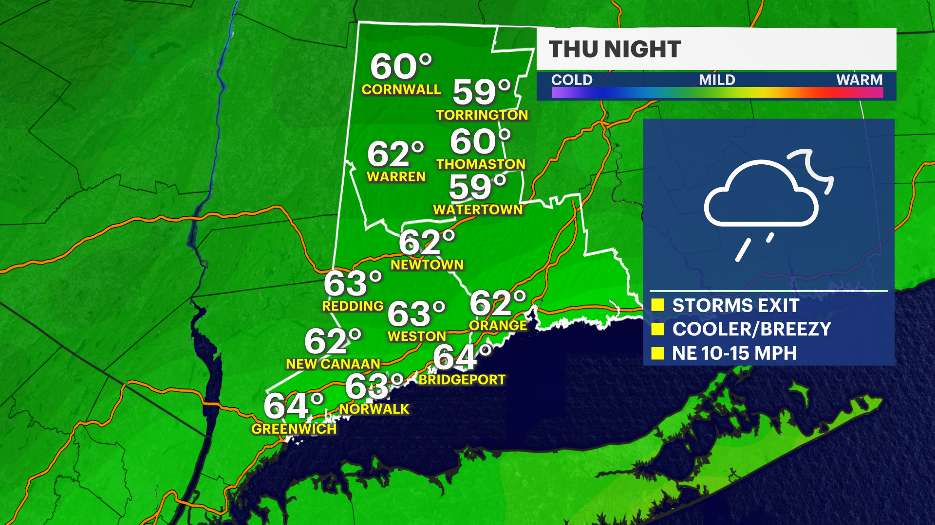
Overnight, more rain will move through but it won't be as heavy and flooding is no longer a concern.
Most of the rain fell north of I-84 and part of Litchfield County has already seen 2 to 3 inches of rain. Another half inch to 1 inch is possible. Farther south, about a half inch of rain is possible.
Use caution driving as roads will be wet overnight.

The winds will pick up out of the Northeast 10-15 mph, with gusts up to 25 mph.
Temperatures will cool back into the 60s.

Lighter showers will linger for Friday morning, then clearing will take shape during the afternoon. Temperatures will be a lot cooler with highs in the middle 70s. The northeast winds will also keep it cooler.


The weekend will be nice, dry, and comfortable for the start of August.
Warmer days next week. No more heat wave.

TONIGHT: Rain tapers to showers overnight. Breezy and cooler. Low of 64.
FRIDAY: Clouds and showers. Sunshine and cooler temperatures. High of 75.
SATURDAY: Sunny. High of 80.
SUNDAY: Sunny. High of 83.
MONDAY: Mostly sunny and warmer. High of 86.
TUESDAY: Mostly sunny. High of 85.
WEDNESDAY: Partly cloudy. High of 82.
THURSDAY: Sun and clouds. Showers. High of 81.

More from News 12
2:10

BITTER BLAST: Another arctic air mass on the way to Connecticut
2:07

Morning showers exit before sunny and breezy Monday afternoon in Connecticut
2:15

Bridgeport’s Jamaican community reacts to Hurricane Melissa heading to their homeland
2:10

Warm weather lingers in Connecticut; cooler air arrives midweek

News 12 weather blog
2:10
