Weather turns humid, a bit unsettled through the end of the week ahead of mainly dry weekend
A steady warming trend continues through the end of the week. Isolated thunderstorms are possible Thursday evening, with a better chance for showers and thunderstorms Friday afternoon and evening before drier weather returns for the weekend.
More Stories


What to expect
Dry and pleasant weather continues through Thursday afternoon.
Temperatures steadily warm, with Friday expected to be the warmest day of the week.
Isolated showers and thunderstorms are possible Thursday evening.
A better chance for showers and thunderstorms arrives Friday afternoon and evening.
Any thunderstorm could produce brief heavy downpours, although widespread flooding is not expected.
Mainly dry, seasonably warm weather returns for the weekend into early next week.
Weather alerts
No watches, warnings, or advisories are currently in effect.
Forecast
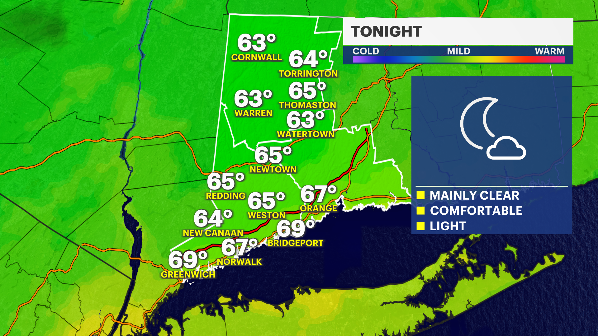
Tonight: Mostly clear and comfortable. Overnight lows will be in the mid-60s.
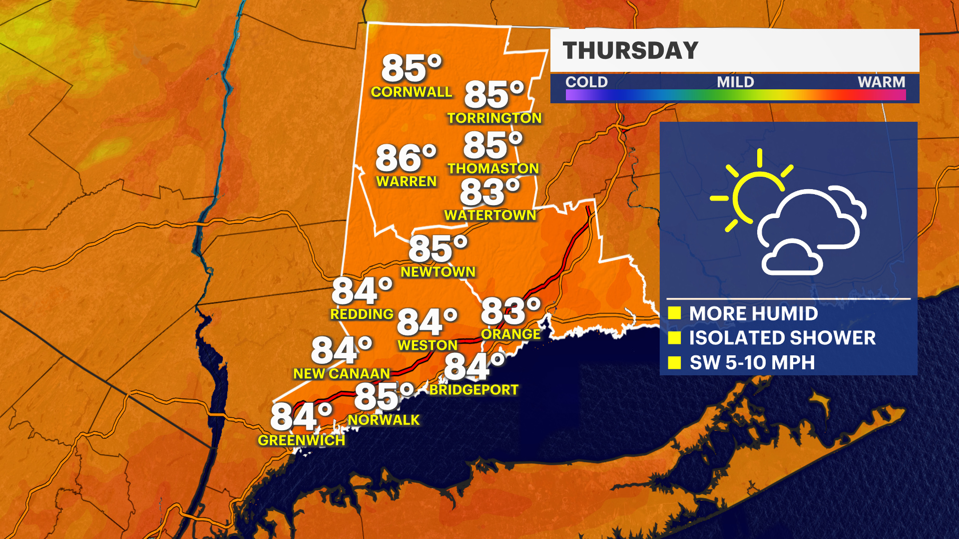
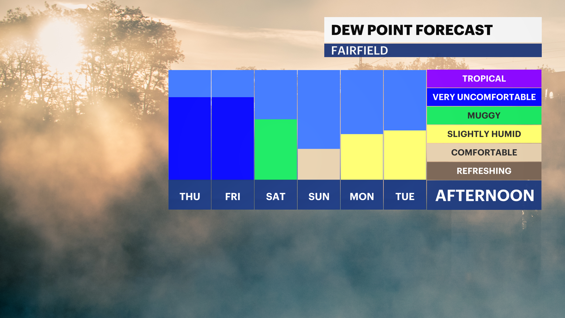
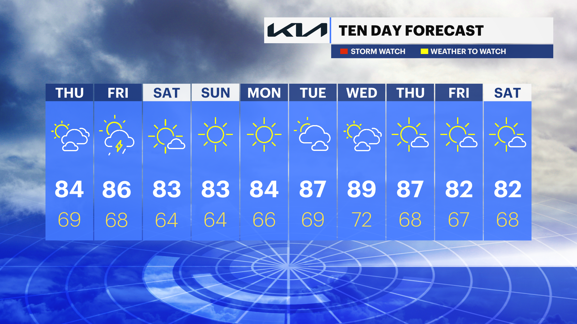
Thursday: Mostly sunny and warmer with increasing humidity. An isolated shower or thunderstorm is possible late in the day and during the evening. Highs will be in the mid-80s.
Thursday night: A few isolated evening showers or thunderstorms are possible before skies gradually clear overnight. Lows will be in the upper 60s.
Friday: Partly sunny, warm, and more humid with scattered afternoon and evening showers and thunderstorms developing. Some storms may produce brief heavy downpours. Highs will be in the upper 80s.
Saturday: Mostly sunny with lower humidity and comfortable summer weather. Highs will be in the lower to mid-80s.
Sunday: Sunny and seasonably warm. Highs will be in the lower to mid-80s.
Monday: Mostly sunny and pleasant with highs in the mid-80s.
Tuesday: Sunny and warmer. Highs will range from the upper 80s to near 90 degrees.