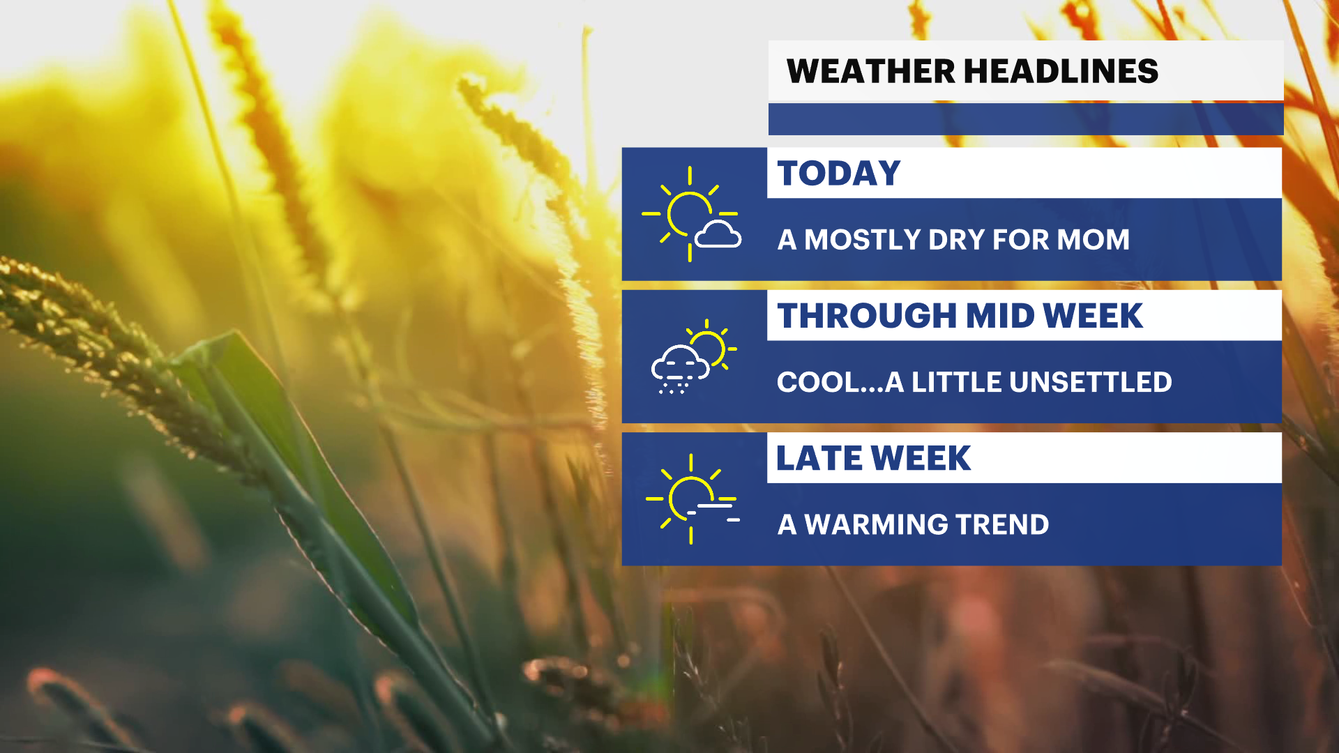
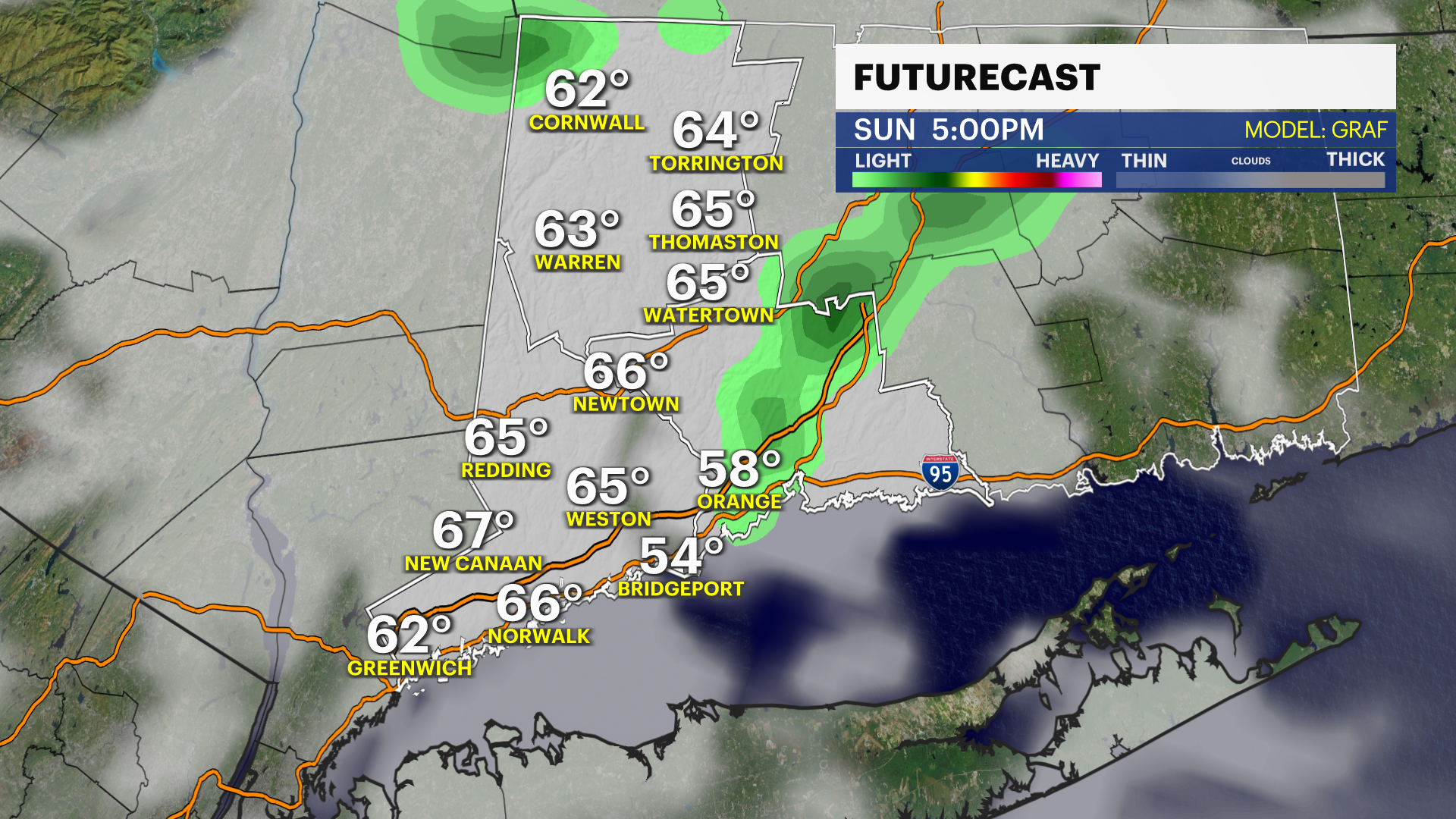
Foggy start to Mother's Day before an unsettled stretch returns later this week for The Bronx
Dense morning fog, scattered showers, and a wetter storm system could bring several rounds of rain to the New York City area through next weekend.
More Stories


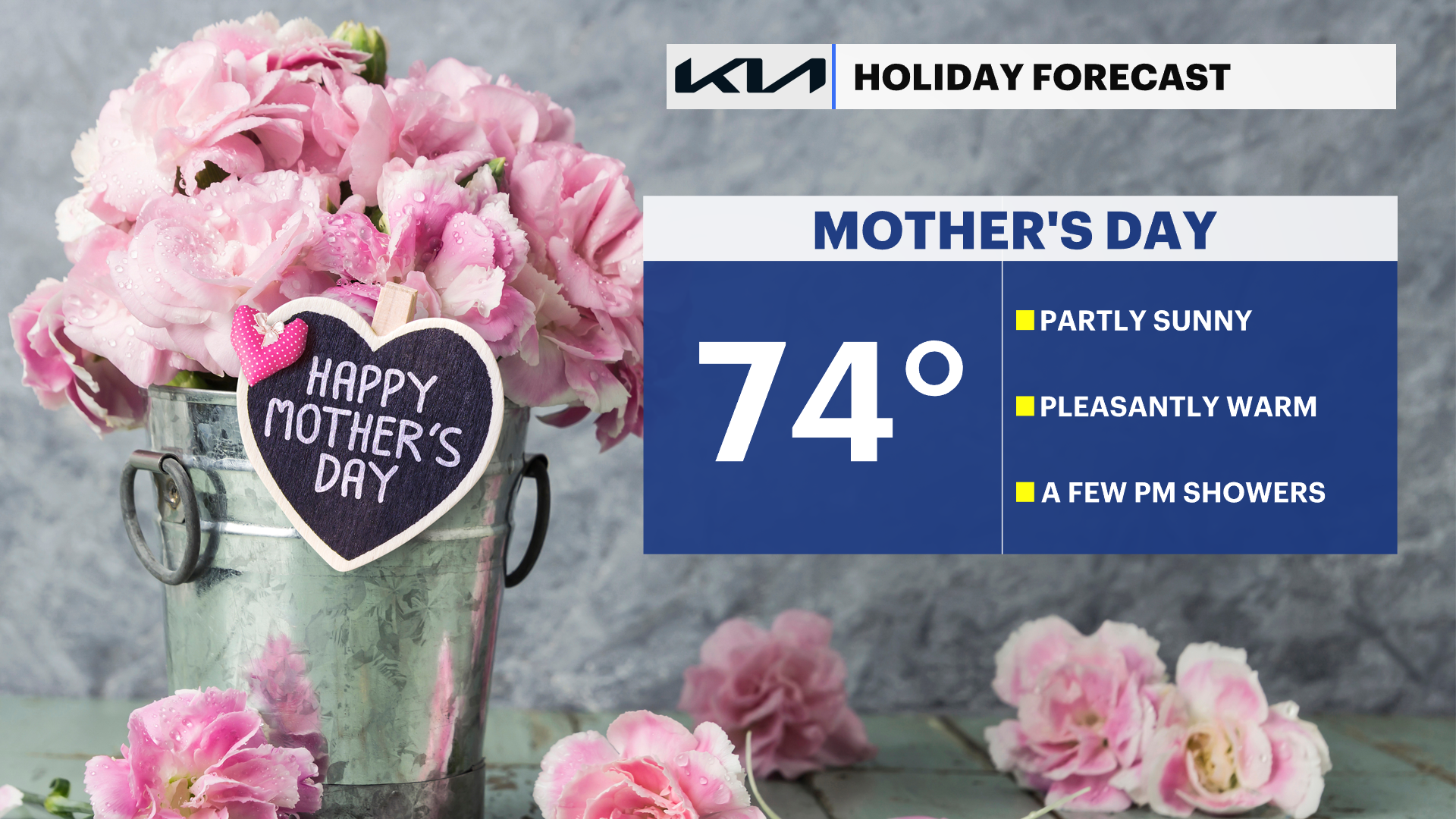
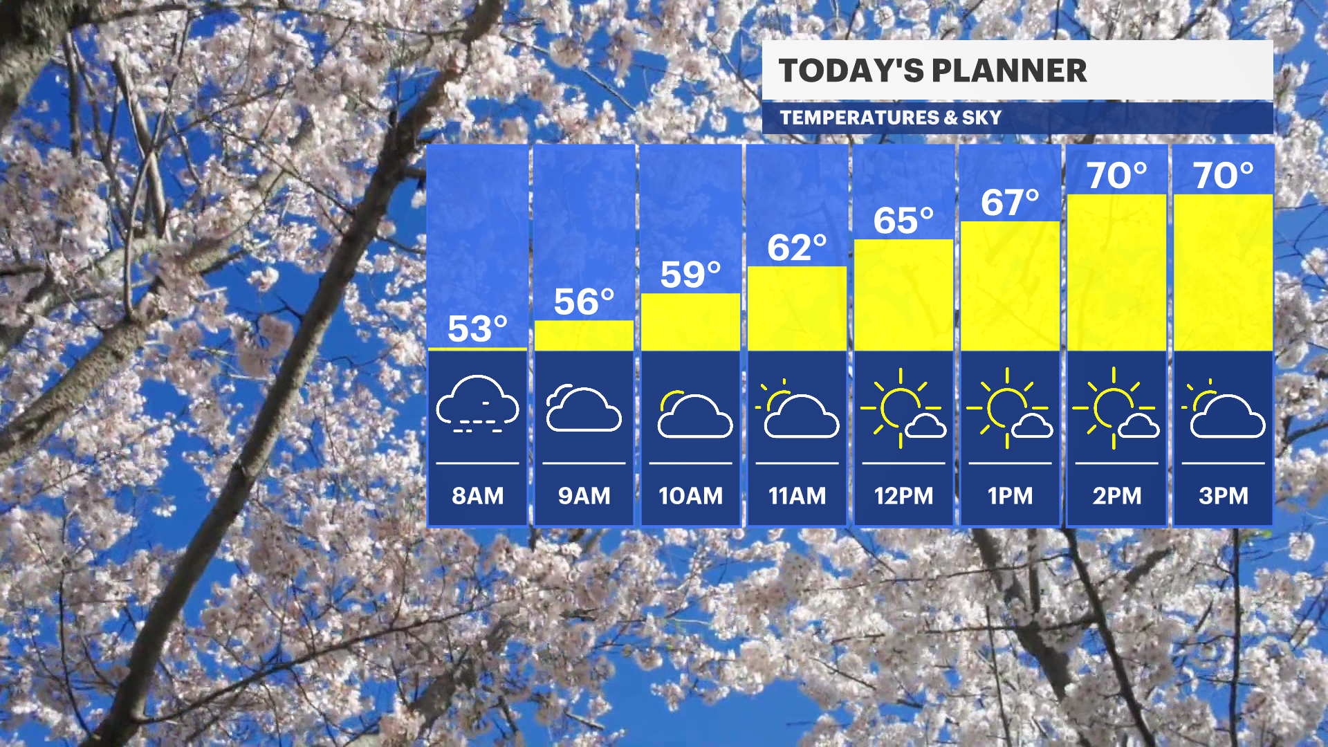
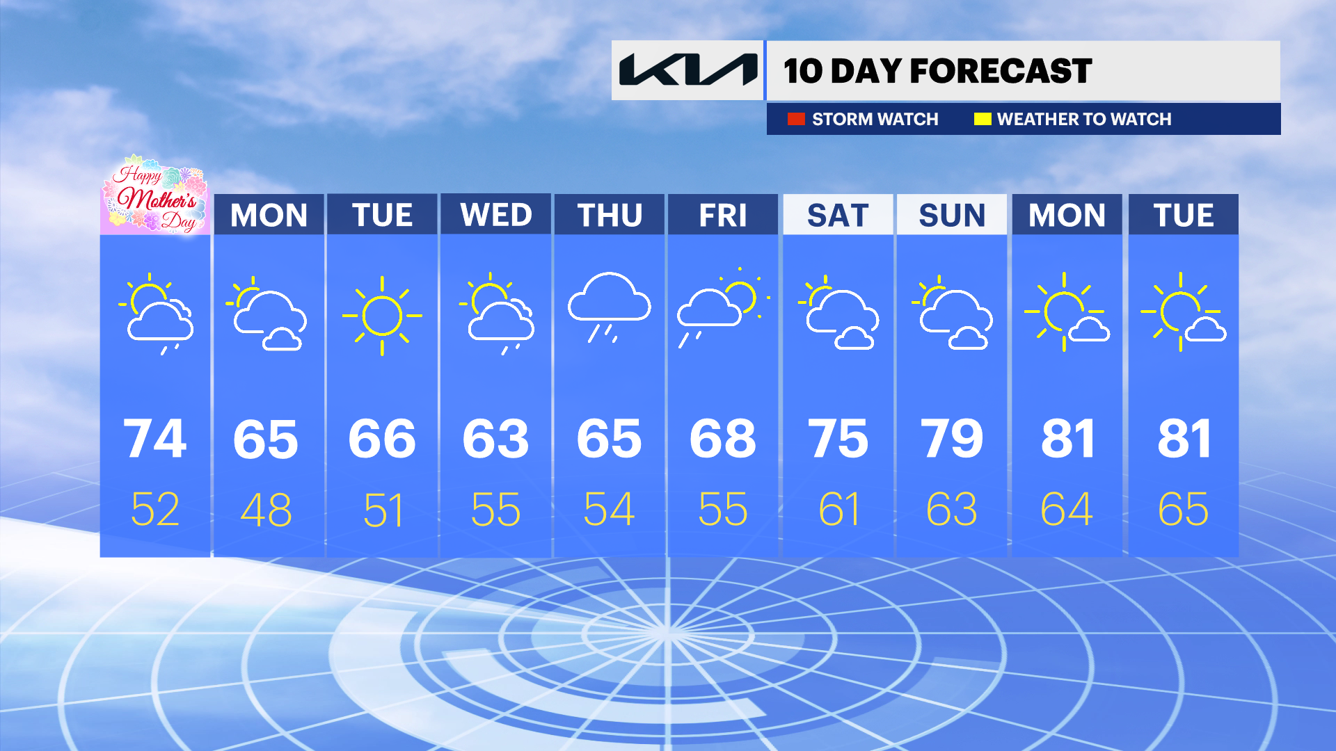
Mother's Day
Areas of dense fog will make for tough early morning travel around New York City, especially on Long Island, Brooklyn, and Queens. In some spots, visibility could drop to just a few hundred feet. The fog should slowly clear by mid to late morning, although some coastal areas may stay hazy longer. By the afternoon, scattered showers — and possibly a thunderstorm — could pop up mainly north and west of the city. Temperatures will still feel warm, with many neighborhoods reaching the 70s.
Monday
Showers become more widespread overnight Sunday into Monday morning, especially for areas south and east of New York City, including Long Island and the Jersey Shore. Rainfall amounts are expected to stay light, but damp conditions and gray skies could slow down the Monday morning commute before things gradually improve later in the day.
Wednesday and Thursday
Another storm system is expected to bring a steadier round of rain to the New York City area beginning Wednesday afternoon. The wettest weather currently looks most likely from Wednesday night through Thursday, with periods of rain and possible downpours at times. Rainfall totals could reach around a half inch to over an inch in isolated spots, depending on how the storm develops.
Friday into next weekend
The storm may be slow to move away, meaning lingering showers and cloudy skies could continue into Friday and possibly part of next weekend. While the exact timing is still uncertain, the overall pattern points toward an unsettled and occasionally wet stretch for the New York City area through the end of the week.
Warmer temperatures are expected to return to the area starting later in the week and lasting into the weekend.