More Stories
WHAT YOU NEED TO KNOW
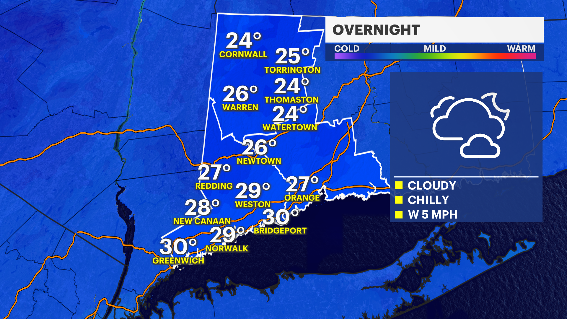
Clouds continue to build for the evening and into the overnight. It will be calm and quiet for the overnight, but cold. Temperatures will be dropping into the 20s. Temperatures on Monday will feature temperatures in the mid-40s. Tuesday through Thursday will see temperatures soaring into the upper-40s and even low-50s. Then there will be a steady cool off into the weekend due to a surge of some colder air from Canada. Low temperatures continue to get less harsh. Lows will be above freezing for the first half of the week.
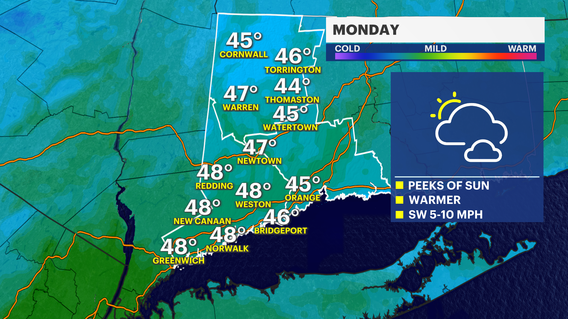
Beyond already mild temperatures, there will be less winds for a while. This will allow temperatures to feel mild.
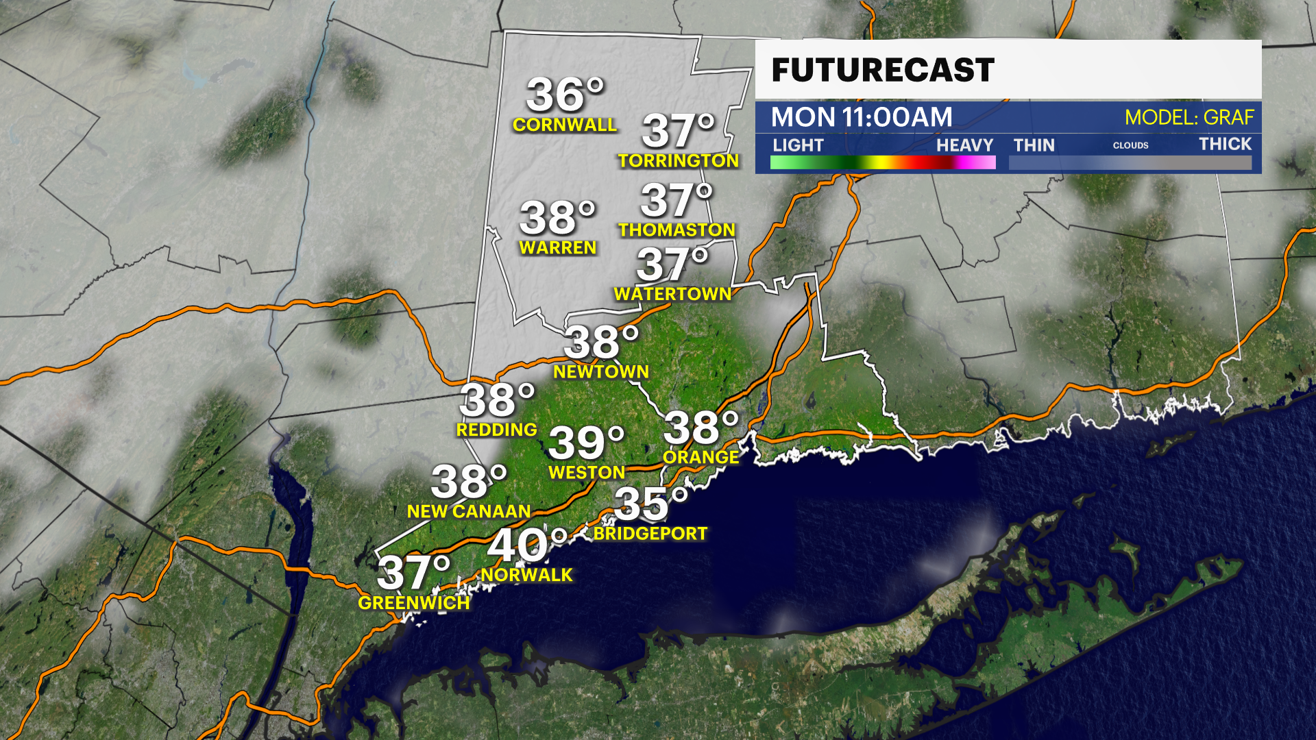
As far as rain, Connecticut will remain dry throughout the rest of the weekend and into Monday. A brief period of light sprinkles is possible for Tuesday. It will be very minor. Plenty will have a completely dry Tuesday. Wednesday is dry as well with the next opportunity for showers moving through during Thursday. Depending on exact timing and speed, this could linger into earliest parts of Friday.


More from News 12
2:54

STORM WATCH: Overnight snow showers followed by frigid air in Connecticut
2:33

Sadly, we will miss the peak of the Geminid meteor shower this year, but we'll get snow instead!
2:07

Morning showers exit before sunny and breezy Monday afternoon in Connecticut
2:15

Bridgeport’s Jamaican community reacts to Hurricane Melissa heading to their homeland
2:54

Warm weather lingers in Connecticut; cooler air arrives midweek
