STORM WATCH: Tracking next round of storms this week in Connecticut
The sunshine and warmup in temperatures return to start the week in Connecticut.
More Stories


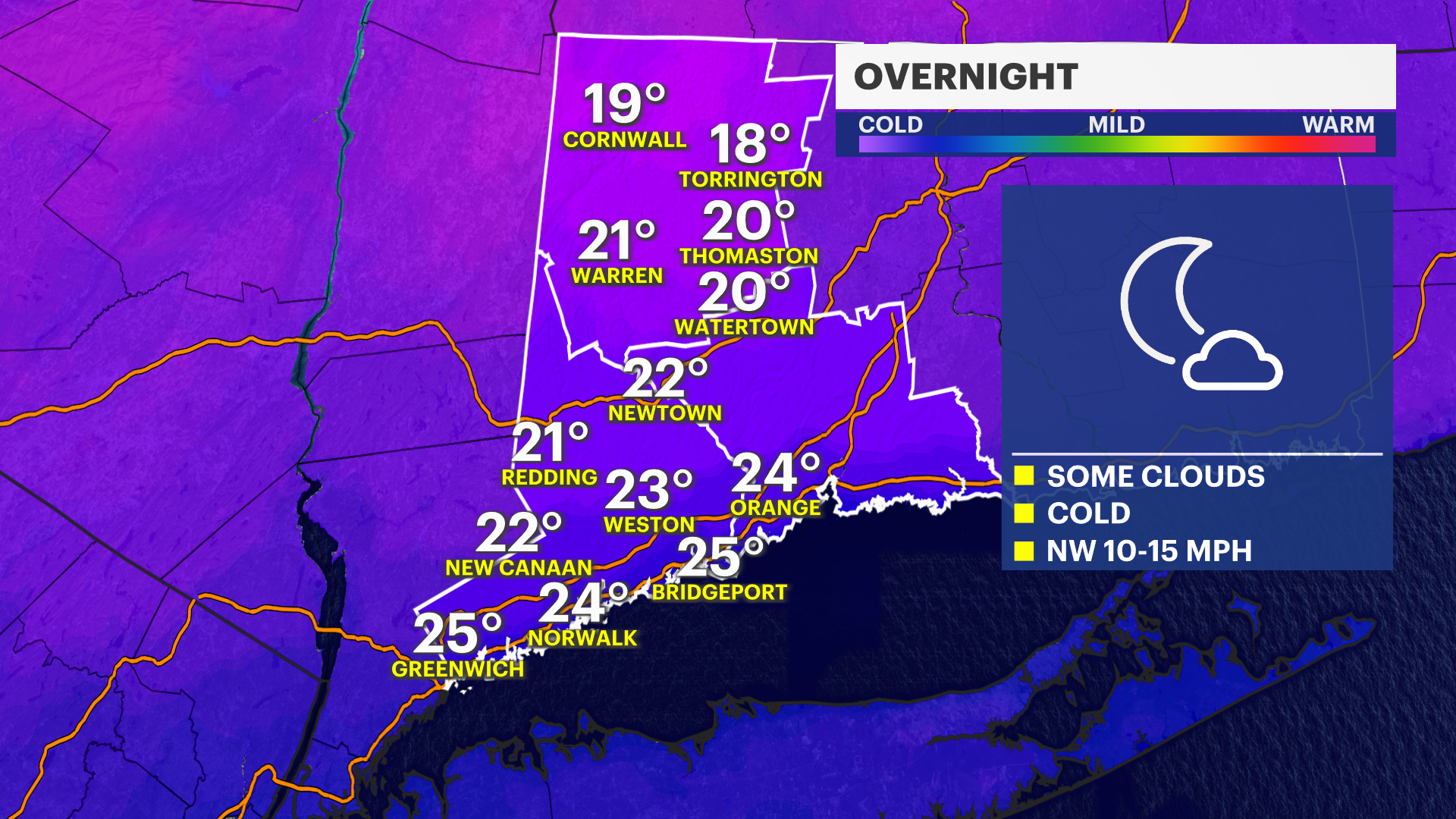
OVERNIGHT: Temperatures will be cold but closer to what we anticipate for overnight lows during this time of February.
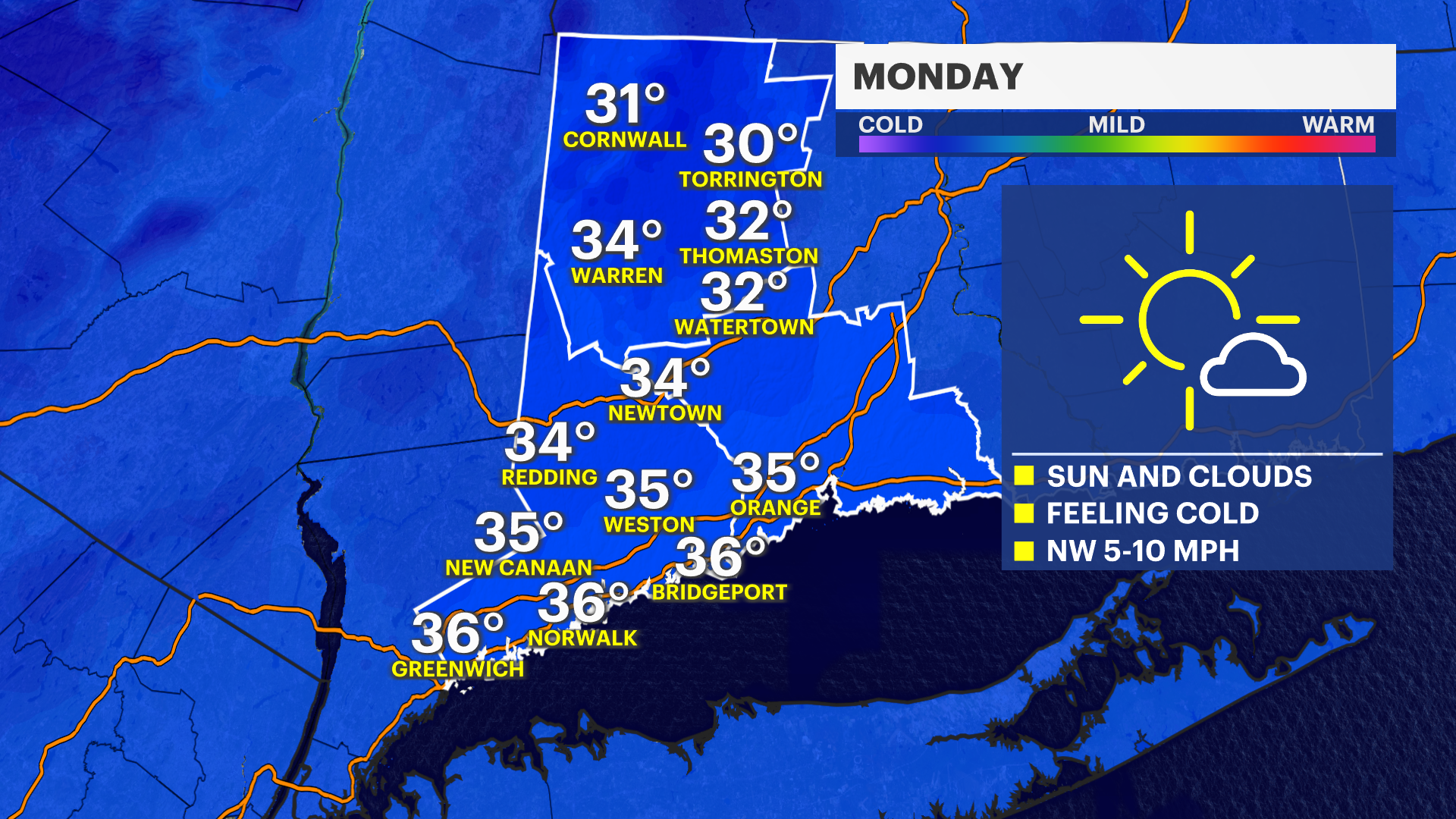
MONDAY: Monday has more sunshine and temperatures are manageable. Not a whole lot of melting is expected beyond spots that are in the sun. The beginning of the week is calmer vs. the middle and end of the week.
TUESDAY: Most of Western Connecticut will be dry on Tuesday, but coastal pasts of Fairfield and New Haven have the chance for some very light snow.
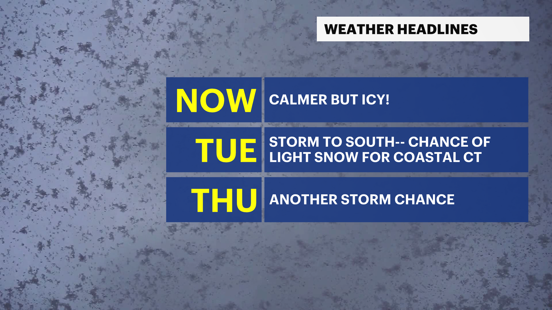
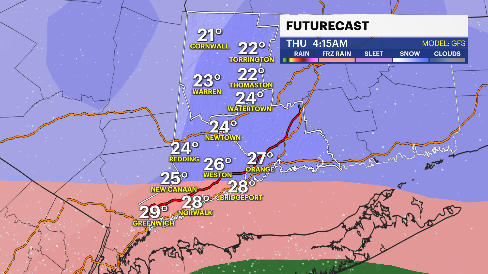
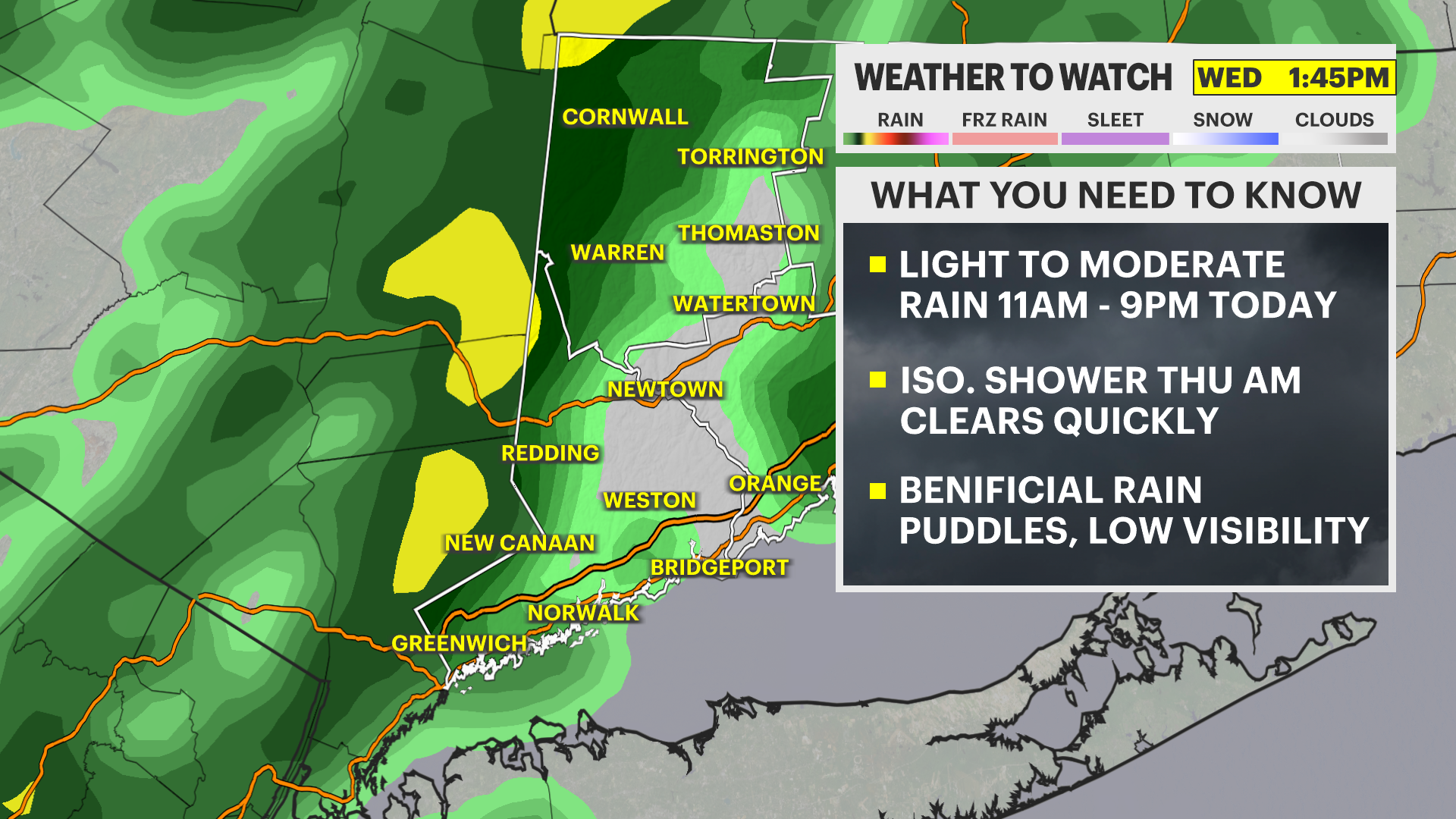
WEDNESDAY: Wednesday is drier until the evening then the next round of storms is possible into Thursday, bringing snow as well as some wintry mix and rain.
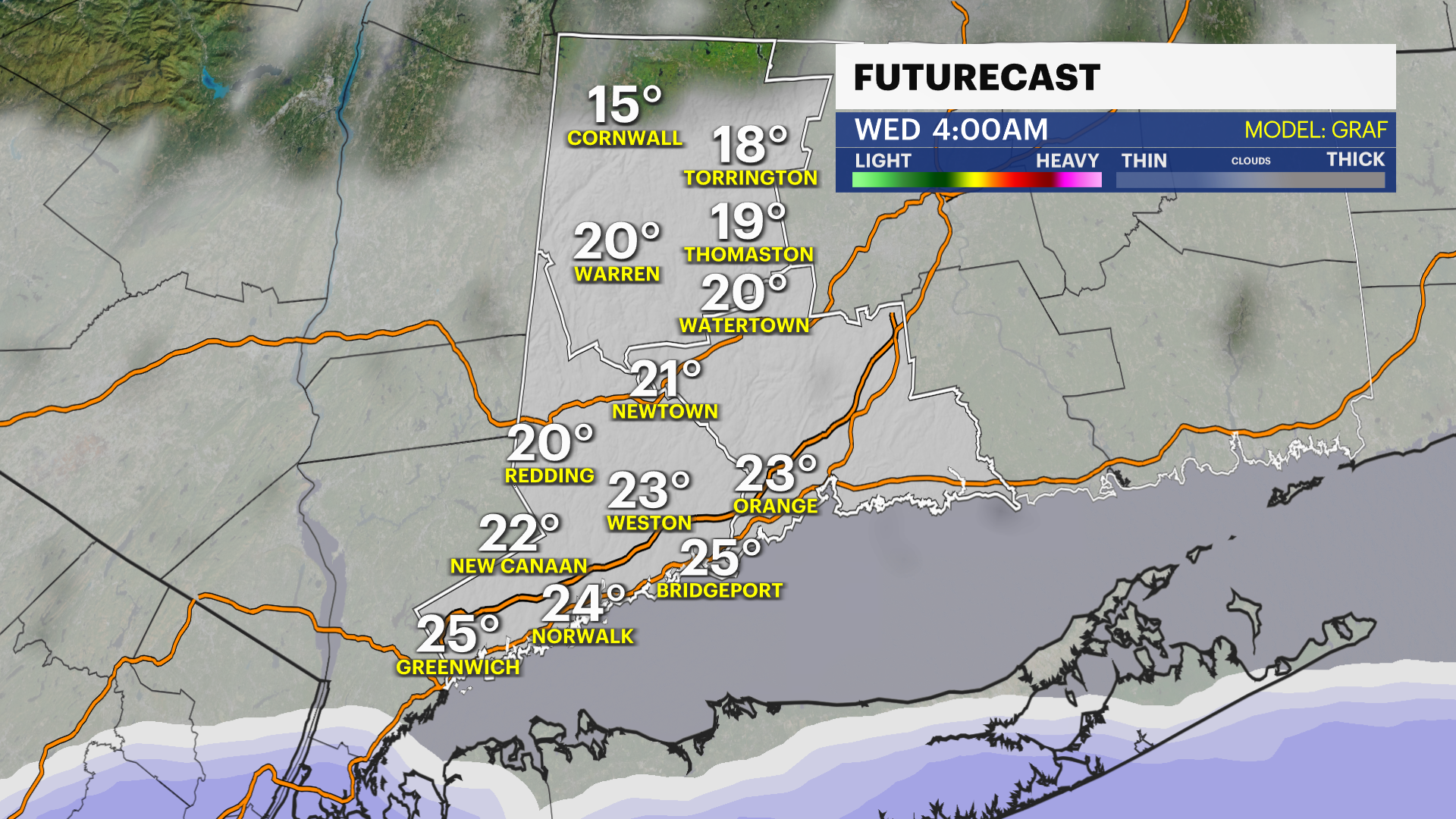
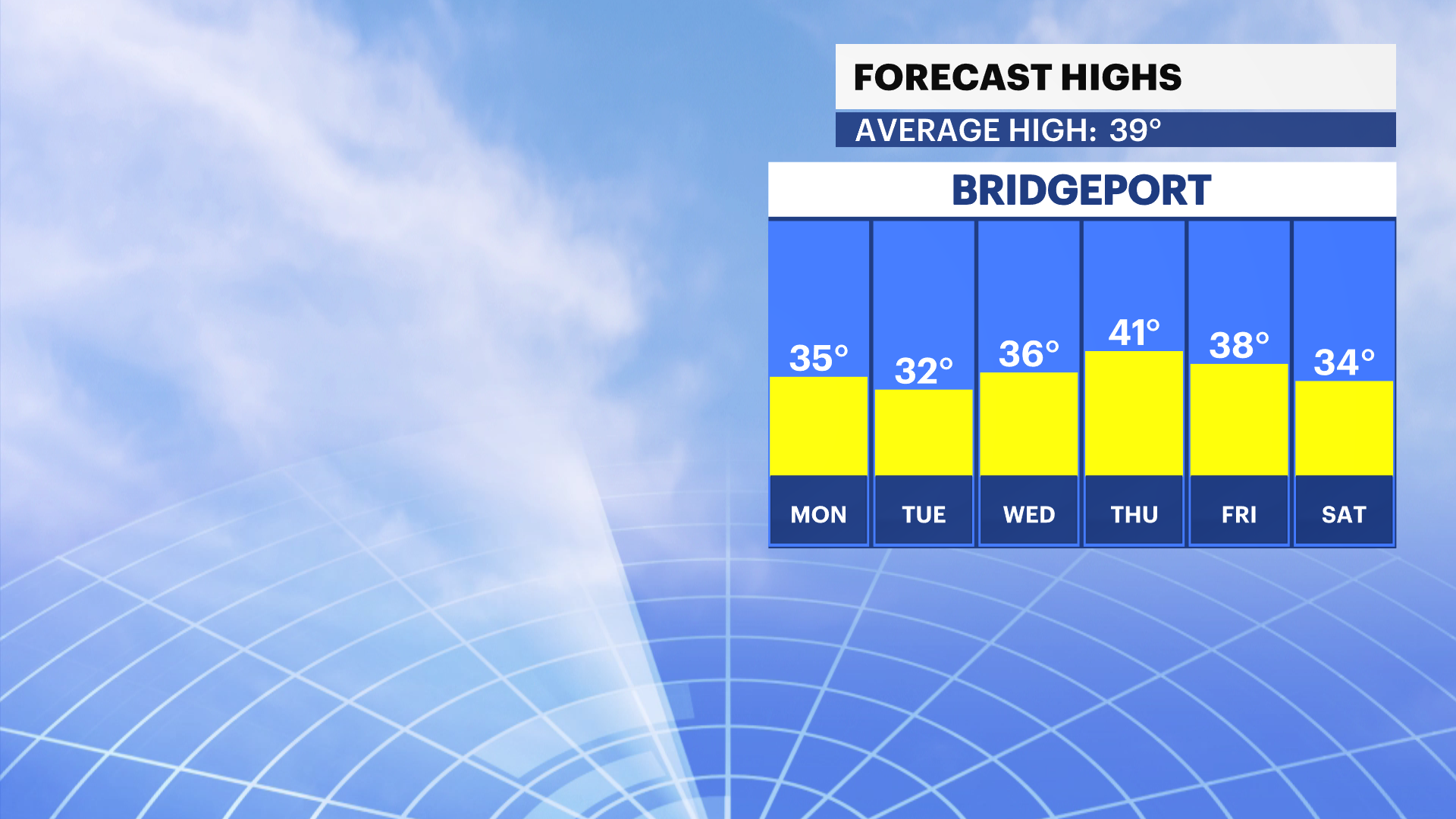
ICY CONDITIONS: Lows are below freezing for the near future. Make sure you are careful of icy spots on surfaces throughout the next few days. Monday through Wednesday we have temperatures in the low and mid-30s. Thursday is the warmest of the workweek with temperatures climbing into the low 40s. We return to the 30s for the rest of the workweek and into the weekend as well.