STORM WATCH: Soggy Saturday with risk of flooding
Umbrellas will be needed during the first half of the weekend.
Oct 6, 2023, 4:57 AM
•
Updated
More Stories
NOW & NEW: Storm Watch Team Meteorologist Michelle Powers says it will be a soggy Saturday with a risk for flooding. The rainfall totals and rates may be increasing for us. The axis of heaviest rain has now shifted closer to our area. It can still hit slightly east or west, but it's best to be prepared for up to 3-4 inches of rain.
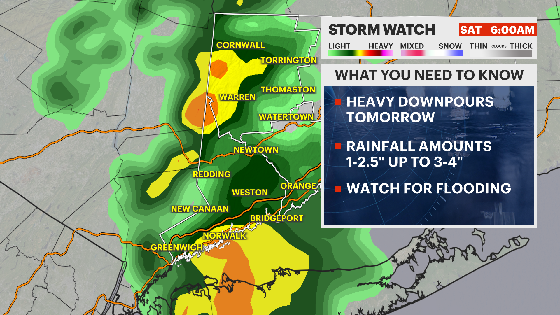
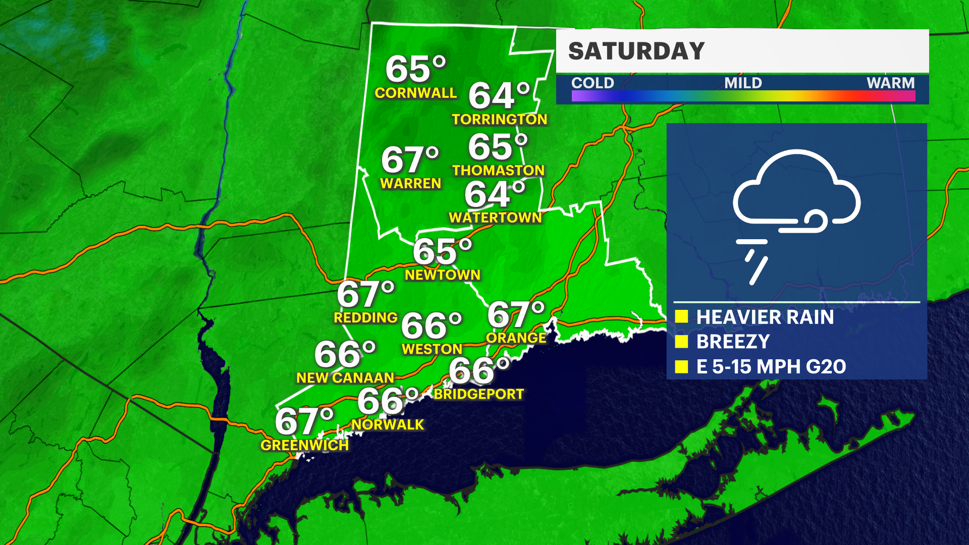
NEXT: A cold front with a tropical connection interacts over the area starting tonight. Phillippe is now post tropical, but that really doesn't matter. It's the moisture that counts. The center of circulation will continue to head north and toward Maine on Sunday. The weather improves Sunday, and it will be breezy and chilly with that fall feel through next week. Slight risk of showers Tuesday with a more substantial rain for the end of the week. Temperatures will be running below average through about Tuesday, then average the rest of the week.
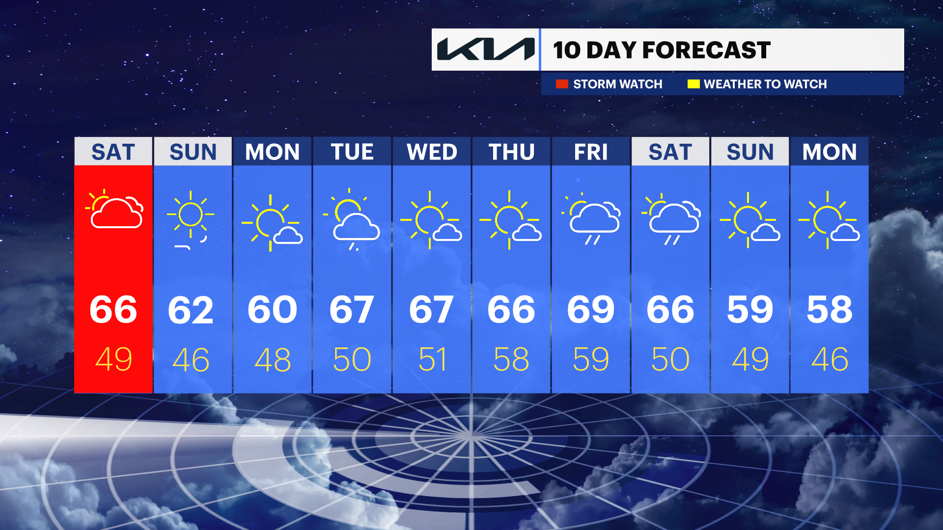
SATURDAY: Mostly cloudy, showers. High of 69.
SUNDAY: Much cooler. Sunny. Breezy. High of 62.
MONDAY: Sun and Clouds. High of 60
TUESDAY: Small shower chance. Cool. High of 65.
