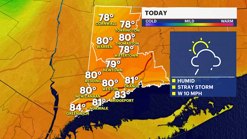
A humid Wednesday with a stray storm in Connecticut
We're timing out a pop up storm chance this afternoon, and then a major change for the rest of the week that many people will love.
More Stories


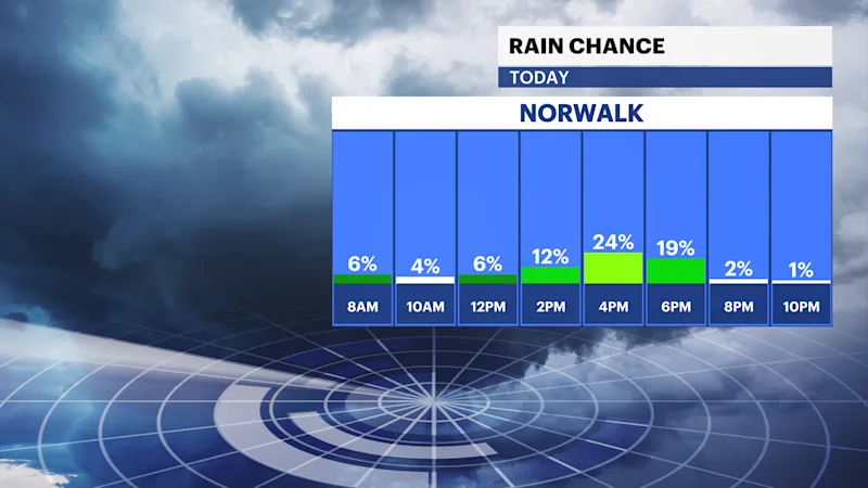
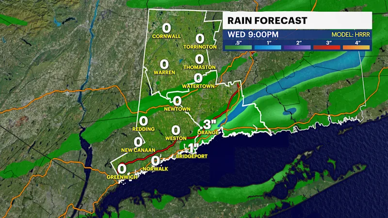
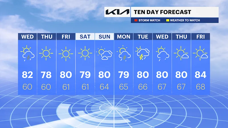
It is a very muggy start to the day with temperatures in the 70s. Afternoon highs are in the low 80s with a mix of sun and clouds and a pop-up thunderstorm. A cold front will push through the area this evening and bring a perfect stretch of weather Thursday, Friday, and through the weekend. However, the front will be slow moving so there could be a pop up thunderstorm on your Wednesday afternoon .
TODAY: Humid with a pop-up storm
High temperatures today are in the low to mid 80s but it will feel like the upper 80s with the humidity.
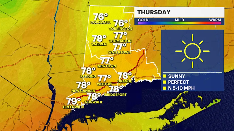
Thursday: Picture Perfect
Plenty of sunshine returns with low humidity. Morning temperatures are refreshing, in the 50s in Litchfield and 60s elsewhere with afternoon highs in the mid to upper 70s.
Friday: Another great day
Friday will be nearly identical with morning temperatures in the 50s up north and 60s along and south of I-95. Afternoon highs are in the upper 70s or near 80.
The weekend: Dry with sunshine
Saturday is the pick out of the weekend with abundant sunshine, but both days look good! Sunday will be partly cloudy. Morning lows are near 60 and afternoon highs are near 80.