HEAT ALERT: Heat advisory in effect through Tuesday; stray storms possible
News 12 Storm Watch Team meteorologist Sam Augeri says hot and humid conditions continue before some rain cools us down.
News 12 Staff
•
Aug 8, 2022, 9:19 AM
•
Updated 632 days ago
Share:
More Stories
2:16
Warm and dry on Thursday; cooler this weekend
9h ago1:03

LIVE BLOG: News 12 weather updates
21h ago
Ready to explore the great outdoors? These 14 tips can help you stay safe while hiking
6ds ago2:16
Cold and sunny for Thursday; frost possible at night
7ds ago2:16
Chilly temperatures overnight in Connecticut, scattered shower returns on Wednesday
8ds ago2:16
Temperatures drop overnight, more sunshine for Connecticut on Tuesday
9ds ago2:16
Warm and dry on Thursday; cooler this weekend
9h ago1:03
LIVE BLOG: News 12 weather updates
21h agoReady to explore the great outdoors? These 14 tips can help you stay safe while hiking
6ds ago2:16
Cold and sunny for Thursday; frost possible at night
7ds ago2:16
Chilly temperatures overnight in Connecticut, scattered shower returns on Wednesday
8ds ago2:16
Temperatures drop overnight, more sunshine for Connecticut on Tuesday
9ds ago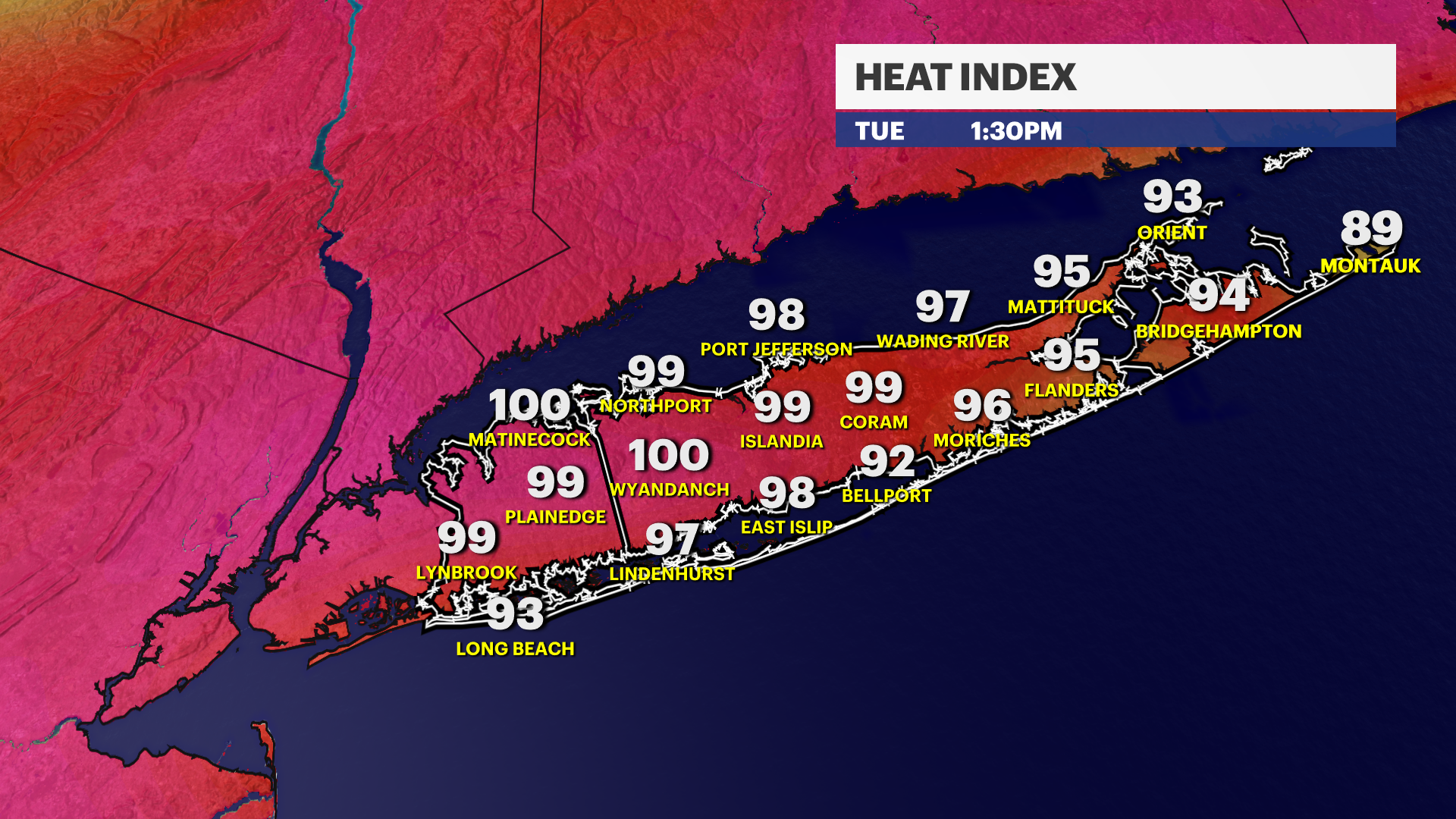
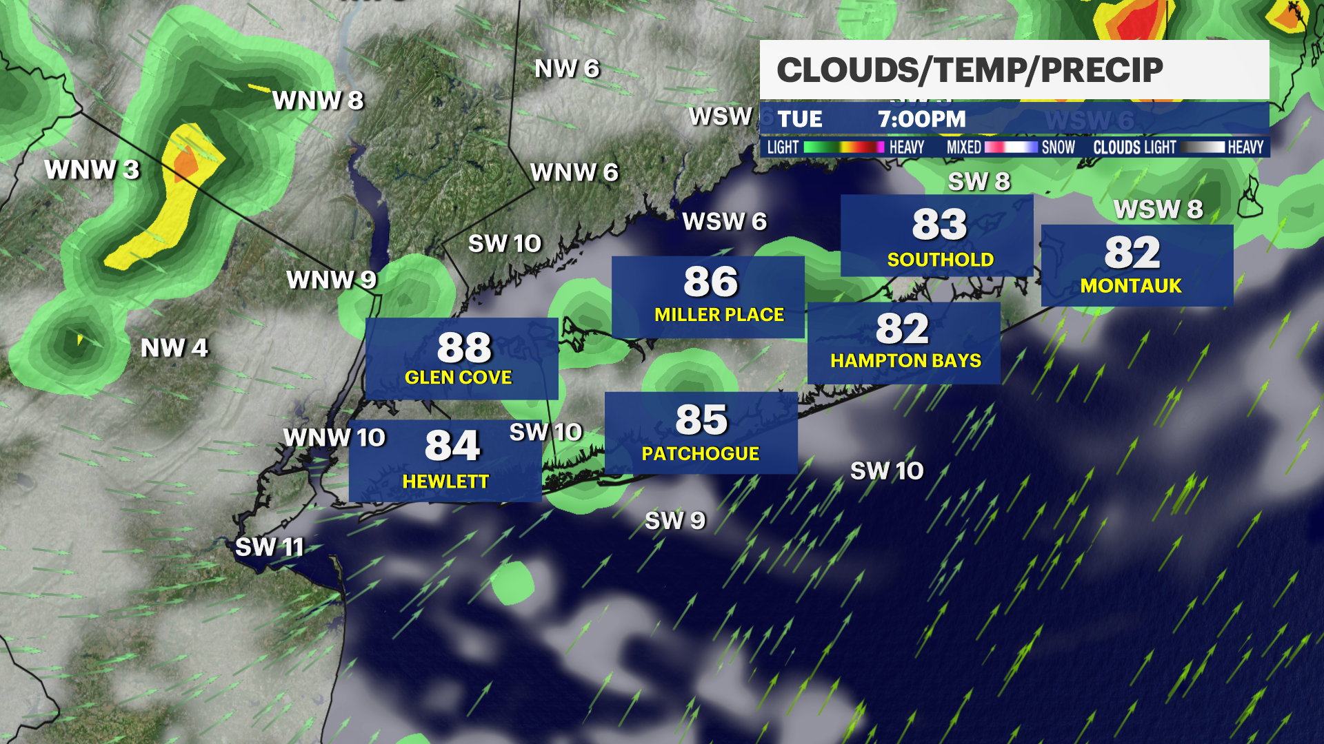
WHAT'S NEW: Today is the hottest
day of the week. Today is the third consecutive morning that the warmest
low temperature record was broken at Islip, as the temperature never dipped
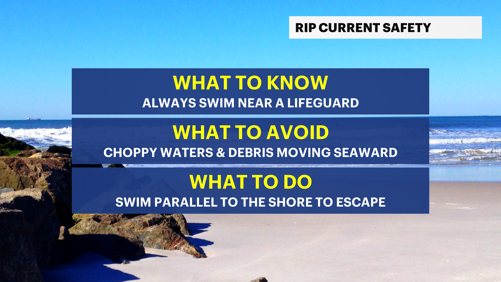
below 76 degrees at night. This breaks the old record from 2013. Heat Advisory
and dangerous rip currents continue through tomorrow. Feels like temperatures
in the upper 90s to low 100s this afternoon.
WHAT'S NEXT: Ragweed allergies
are peaking this week and next. Showers and storms arrive after 4 p.m. today,
lasting through tomorrow with clouds through much of Thursday. There will not
be enough rain to end the drought. Pleasantly less humid weather arrives
heading into the weekend.
News 12 Storm Watch Team meteorologist Sam Augeri says hot and humid conditions continue before some rain cools us down.
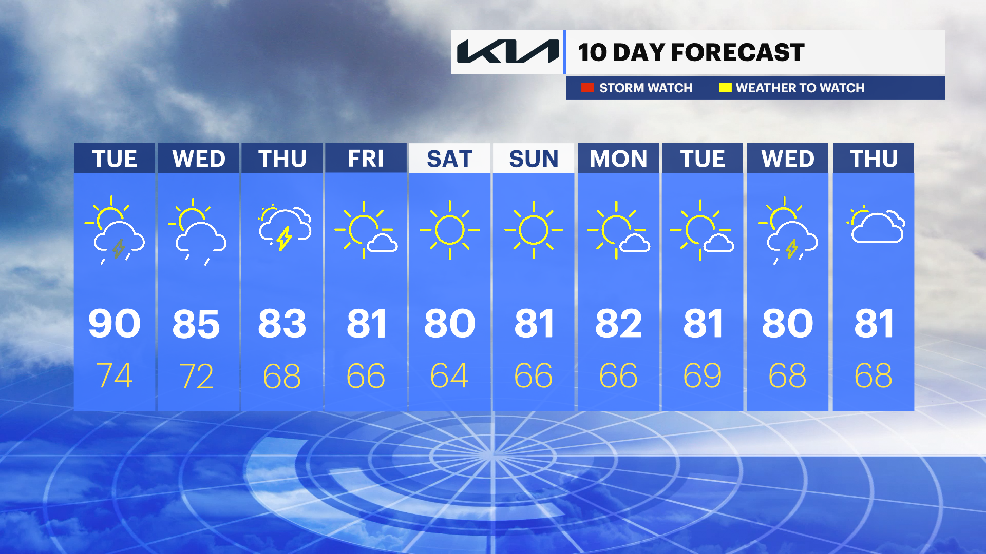
OVERNIGHT: Mostly clear, warm, and muggy. Lows near 75 with southwest winds 5 to 15 mph. Sunrise: 5:57.
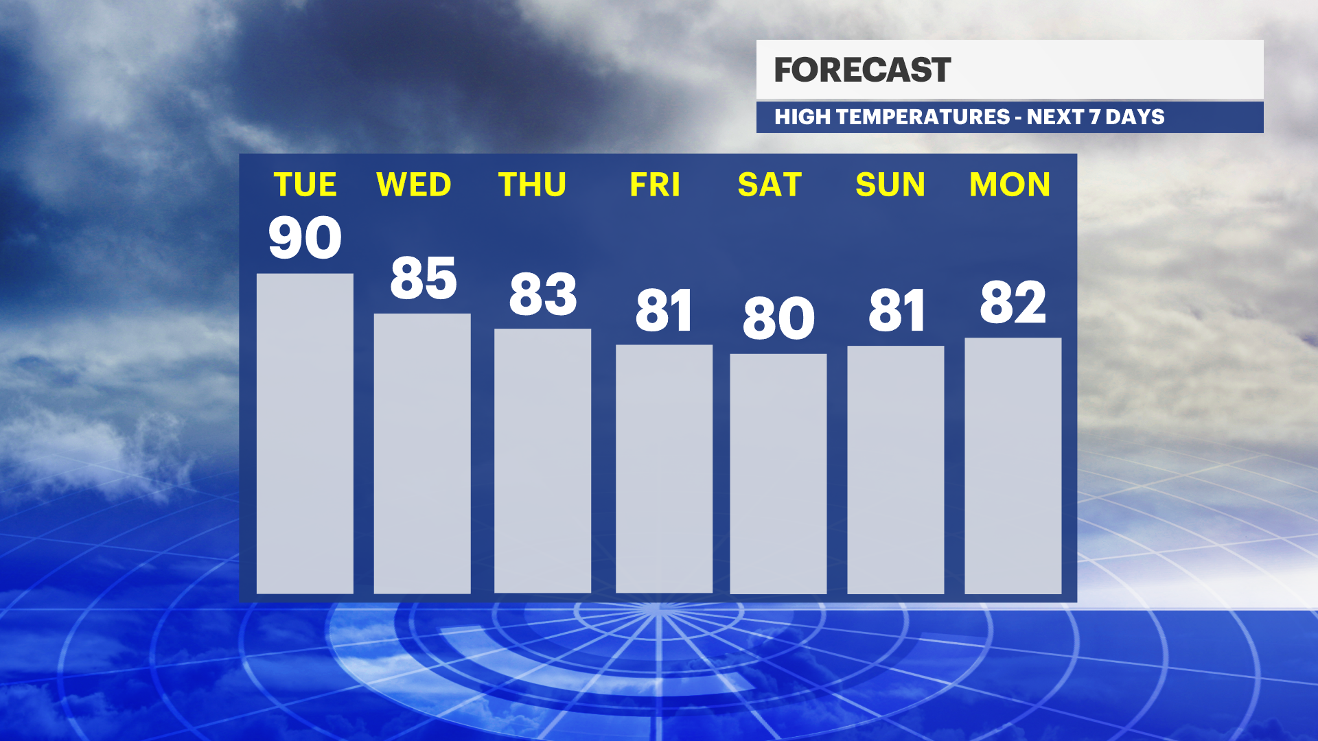
TUESDAY: Mostly sunny, hot, and humid. Chance for a few late day pop up showers and storms. Highs near 90. Lows near 74. Southwest winds 10 to 20 mph. Sunset: 7:58.
GUIDE: Cooling Centers
TUESDAY NIGHT: Chance for an early storm then partly cloudy, warm, and muggy. Lows near 74. West to north wind 5 to 10 mph.
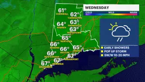
WEDNESDAY: Partly sunny with the chance of a shower or storm, mainly late in the day into Wednesday night. Highs near 85. Lows near 72.
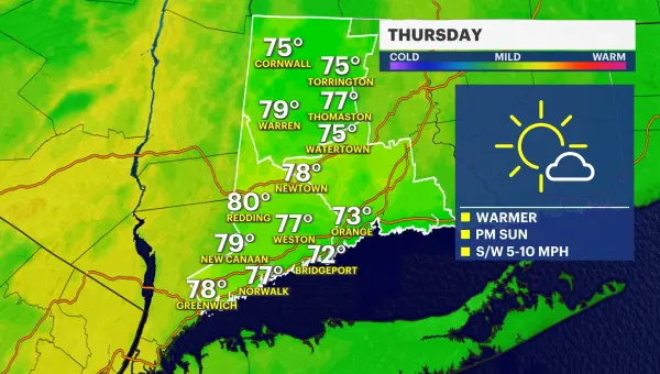
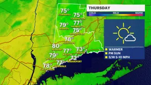
THURSDAY: Partly sunny with the chance of showers and storms. Not as hot or humid with highs near 83. Lows near 68.
FRIDAY: Mostly sunny and nice. Breezy northwest winds. Highs near 81. Lows near 66.