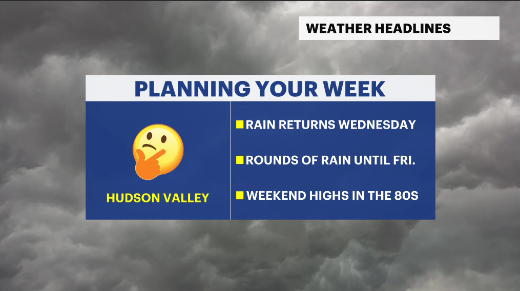
Midweek rain arrives before a warm, sunny weekend for the lower Hudson Valley
Rounds of showers and a few thunderstorms could bring up to an inch of rainfall through Friday morning before sunshine and 80s return this weekend
More Stories


Weather Alerts: Westchester and the Hudson Valley
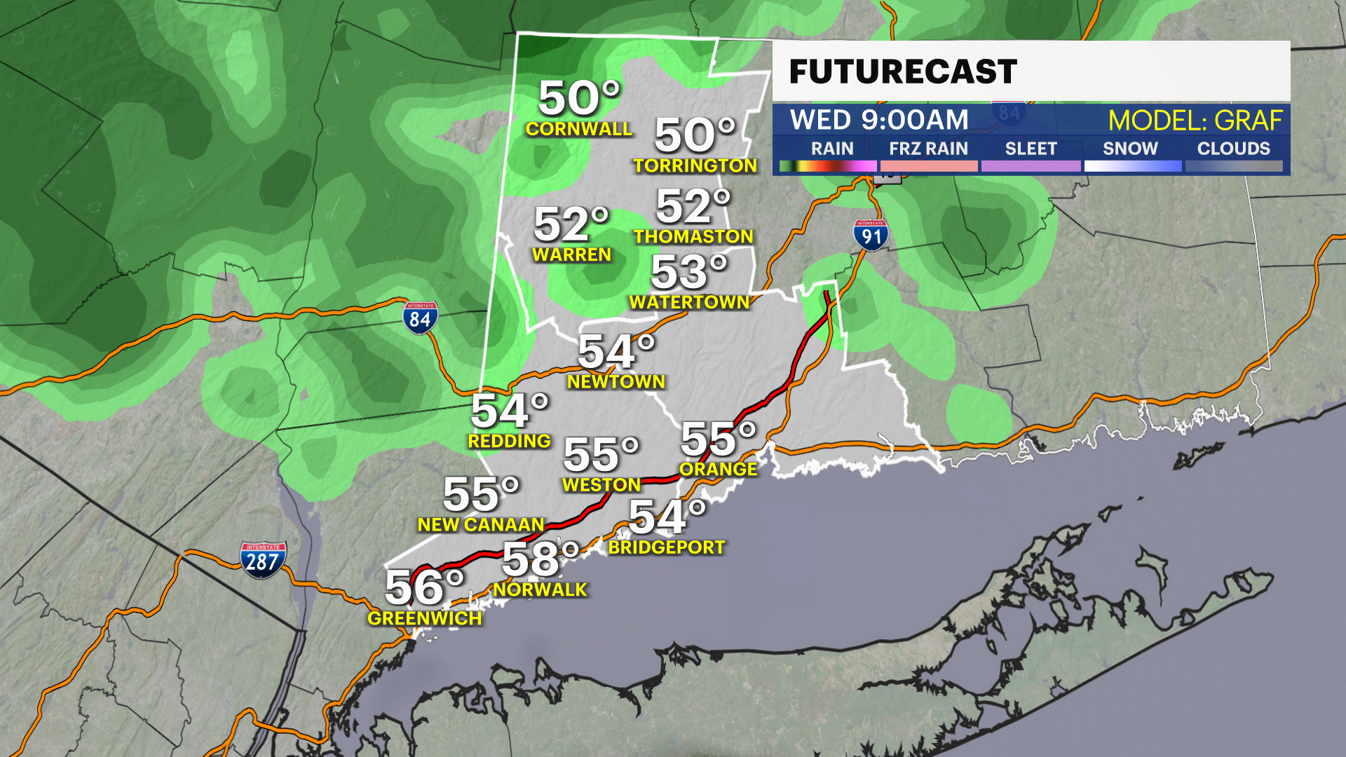
Clouds will begin increasing tonight ahead of a wetter and more unsettled stretch of weather arriving Wednesday morning. Several rounds of rain are expected from Wednesday through late Friday morning, although there will still be dry periods mixed in at times. Wednesday will feature scattered, gusty showers during the morning and evening hours, while some spots could remain dry in between rounds of rain.
The rain becomes more organized Wednesday night into Thursday, when steadier rainfall and a few isolated, non-severe thunderstorms could develop overnight into early Thursday morning. Areas of fog may also develop on Wednesday night as moisture increases across the region. Thursday will remain unsettled with scattered showers and possible downpours, though rainfall coverage will vary from town to town.
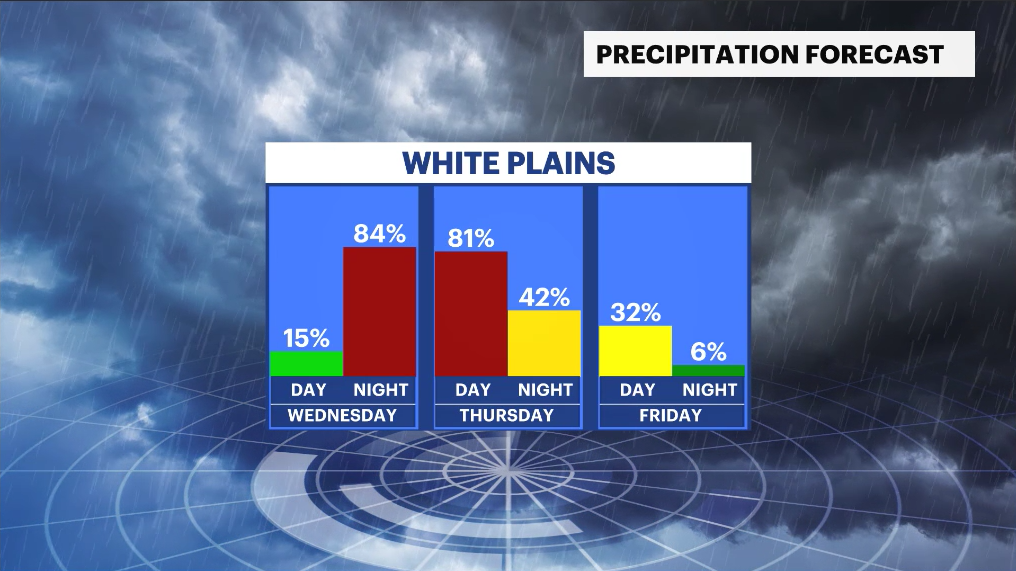
You can see the timing of the wet weather here:
By the time the system exits Friday morning, some locations could pick up close to an inch of rainfall in total. The rain will be beneficial, as portions of the region continue to experience drought conditions.
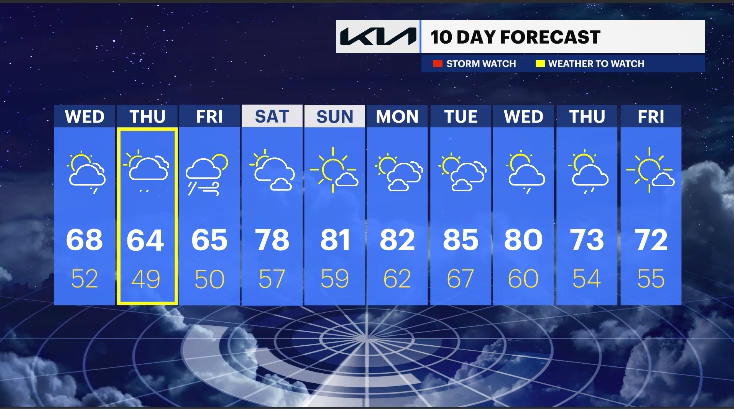
Temperatures through the midweek stretch will remain seasonable before drier air returns by Friday afternoon. From there, the forecast turns much brighter heading into the weekend.
Saturday looks fantastic with a mix of sunshine and a few clouds, along with highs climbing into the mid to upper 70s. Even warmer weather arrives Sunday as temperatures return to the 80s under mostly sunny skies. The warming trend is expected to continue into early next week, with even warmer temperatures potentially arriving by Tuesday.