Showers and thunderstorms roll through Western Connecticut before sunrise
Warm and humid Friday with a chance of showers or isolated storms heading into early Saturday
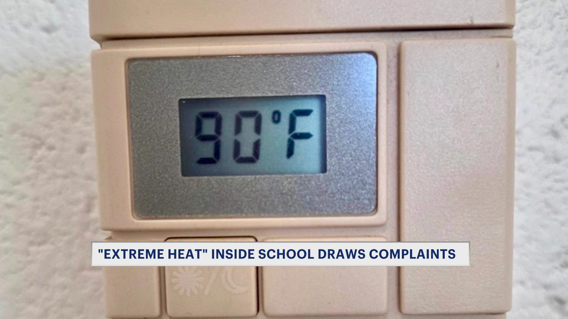
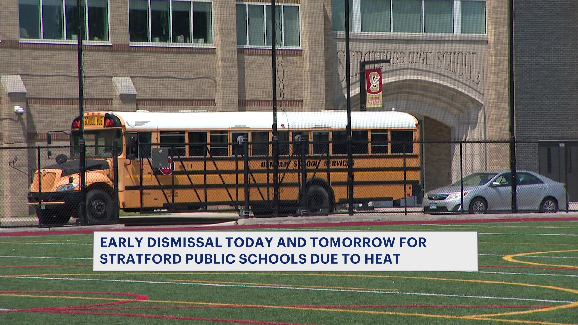
More Stories


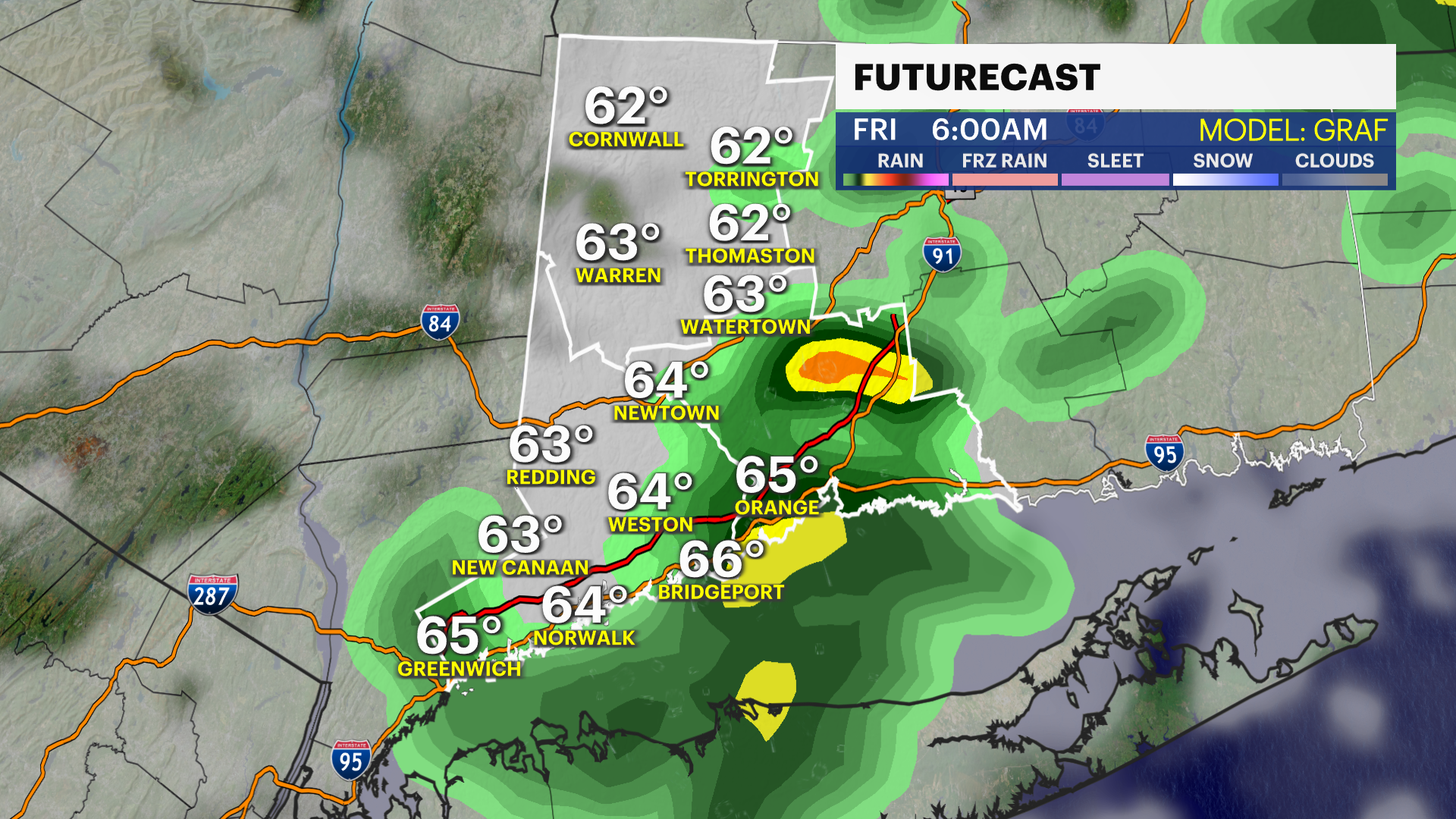
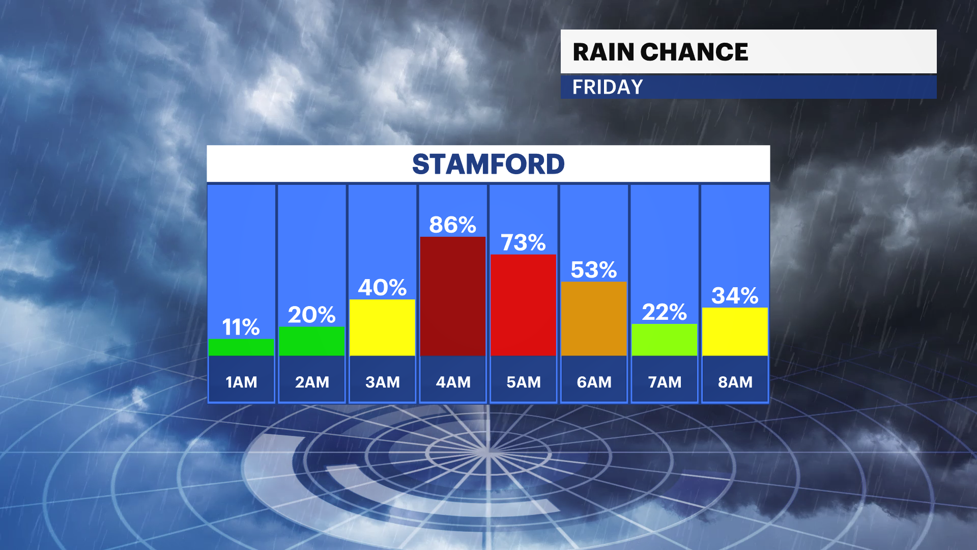
The weather turns cloudier and rainier over the next 24-36 hours. There is a risk of some showers and thunderstorms with pockets of heavy rain into the pre-dawn hours on Friday. Most should clear before the morning commute, but count on wet and muggy conditions. Temperatures will be warmer and in the mid-60s for the early morning.
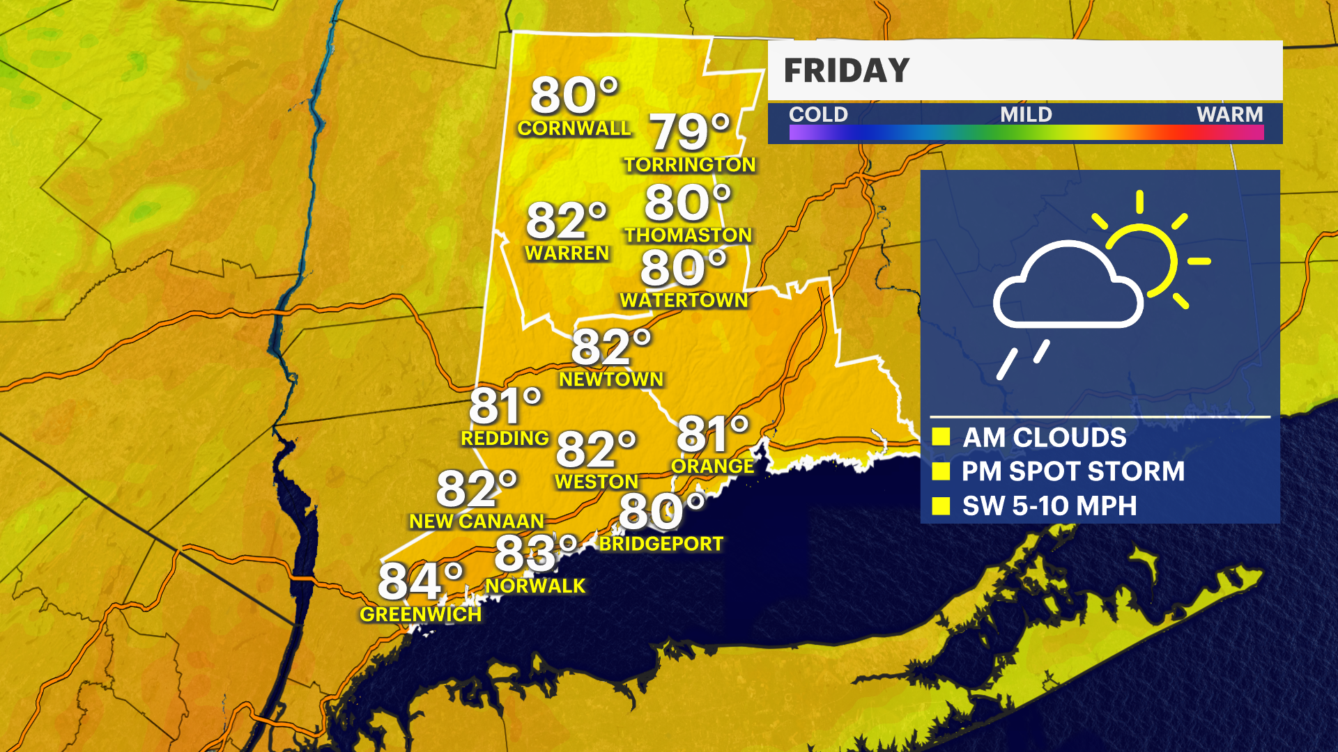
There is a chance to see an isolated shower or storm during the day on Friday and possibly into early Saturday morning. Temperatures on Friday will range from about 80 to 84 degrees. Winds will be southwest at first and then turn northwest with the passage of the cold front Friday night.
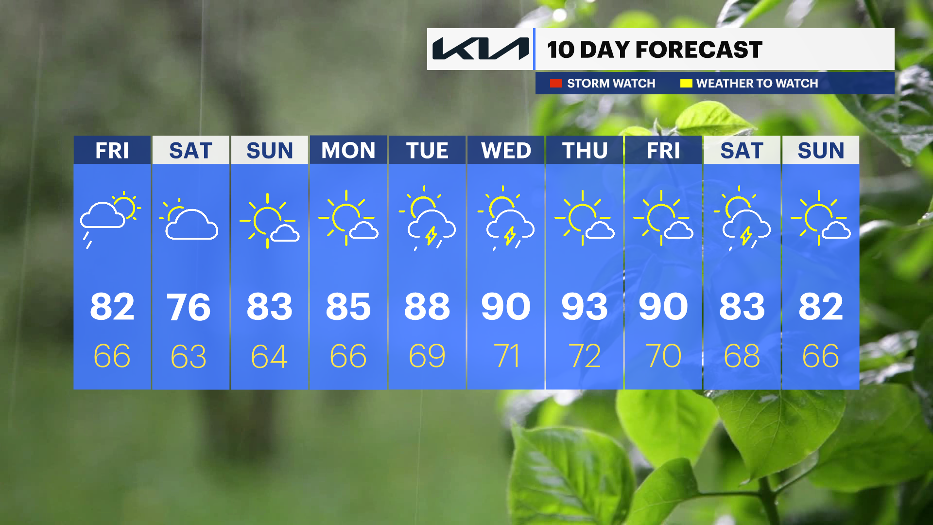
The overall weekend weather pattern looks very good. Sunday is by far the drier of the two weekend days, with mid-80s temperatures under a mix of sun and clouds.
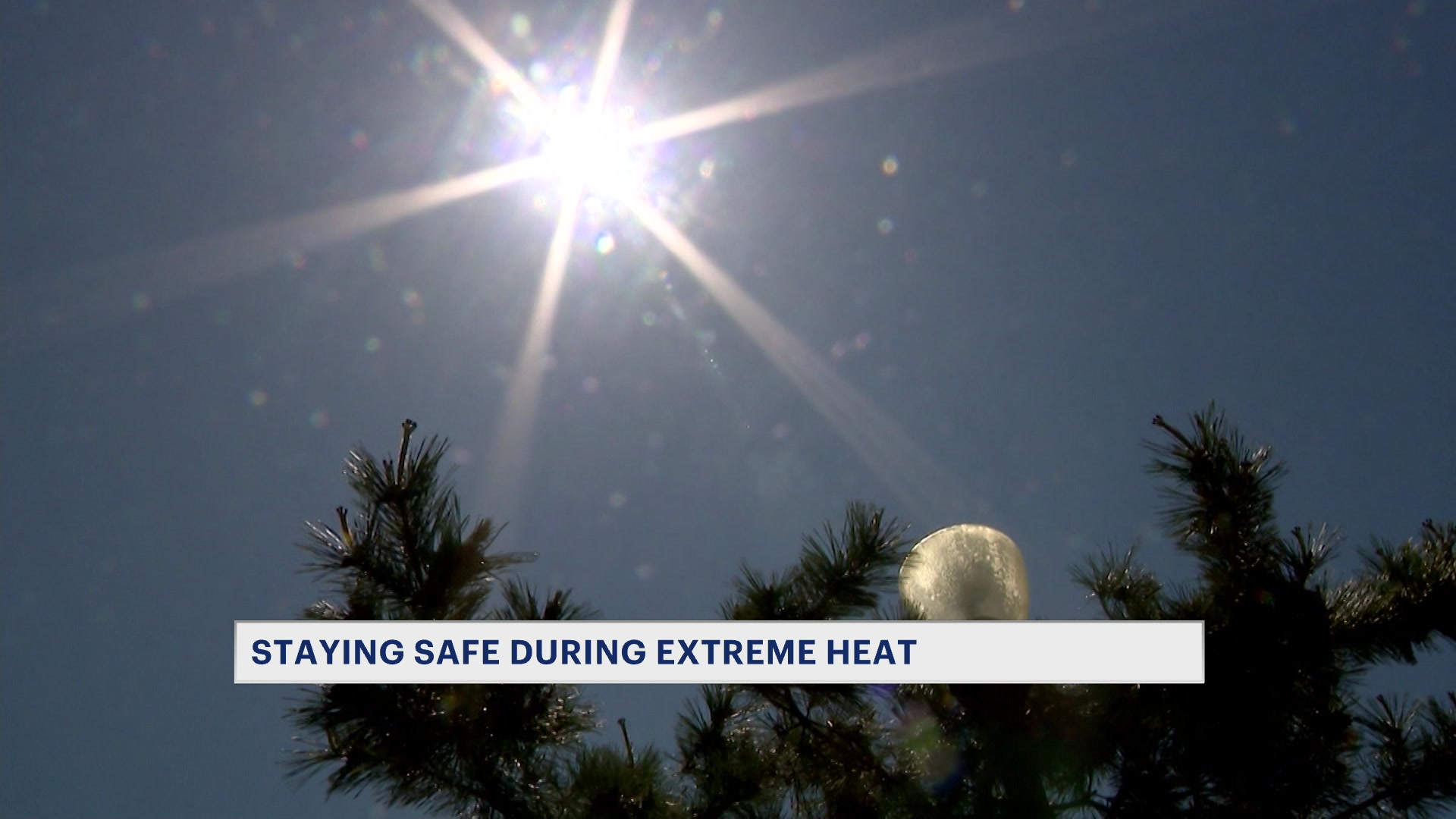
Temperatures really heat up next week. Look for some 90-degree days ahead.