STORM WATCH: A stray strong thunderstorm possible on this hot Saturday afternoon
Temperatures will feel like near 100-degrees this weekend. A few thunderstorms are possible today. Here's the latest on the potential timing.
More Stories


Isolated strong storm possible today
The Storm Prediction Center has placed the Hudson Valley under a level 2 out of 5 risk for severe thunderstorms. Storms will be capable of damaging wind and frequent lighting between 3 p.m. and 8 p.m. Although severe weather is possible, the overall coverage of storms is isolated and many areas will remain dry.
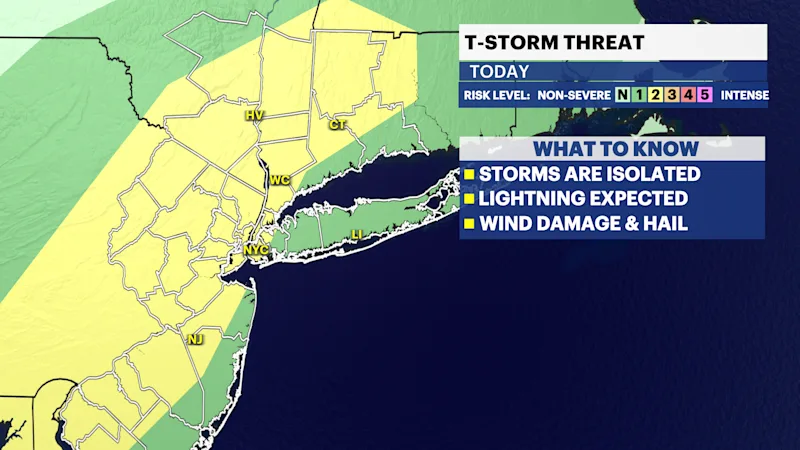
A heat advisory remains in effect through 8 p.m. Saturday for Rockland, Westchester, and Putnam counties, with heat index values, or feels-like temperatures, climbing into the 90s to around 100.
Steamy Saturday, a stray storm
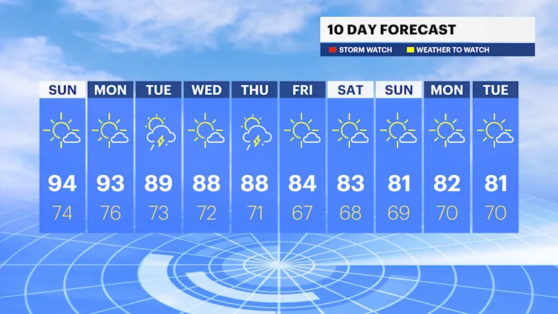
Today is hot and humid under sunny skies, with high temperatures near 90 inland and in the 80s along the coast. With the humidity, it will feel like 100. A pop-up shower and storm is expected today, mainly west. However, the risk for storms is much lower than Friday and storms are not expected to be severe today.
Sunny Sunday, likely dry
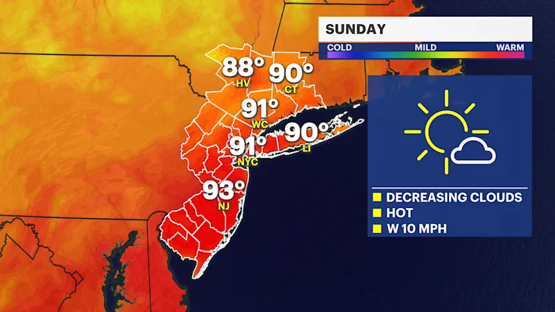
Sunday starts very humid, with some patchy fog and a few clouds, but the humidity levels will lower throughout the day. With mostly sunny skies, it will easily approach 90 during the afternoon and it will feel like near 100. However, storms are not expected.
Boat and Beach Forecast
It's a great stretch for boaters or beach goers. The wind will generally be west to southwest this weekend at 5 to 10 mph. Wave heights are generally a foot or less on the Long Island Sound. The lakes and Hudson River have no weather related hazards over the next few days.