STORM WATCH: Tracking drenching thunderstorms today in the Hudson Valley
Soaking rain is expected today, but improvements arrive just in time for the weekend.
More Stories


Bridgeport Information
WHAT TO KNOW
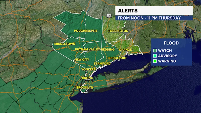
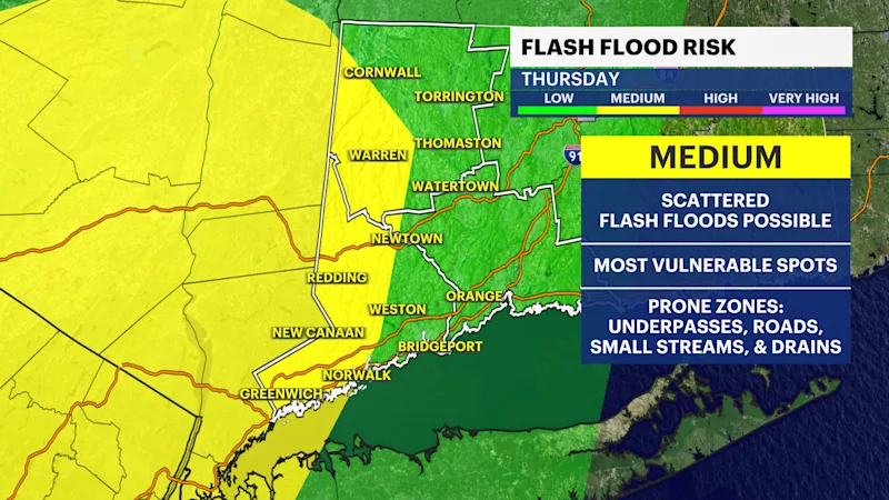
A Flood Watch is in effect today for Fairfield County where the greatest risk for flooding is expected to develop this afternoon; however, scattered slow moving storms are expected in later today with 1" of rain expected, but locally 3"+ of rain in the heaviest downpours.
While the primary risk is flooding, a few storms today could also turn strong to severe, mainly with damaging wind gusts.
THE MORNING COMMUTE
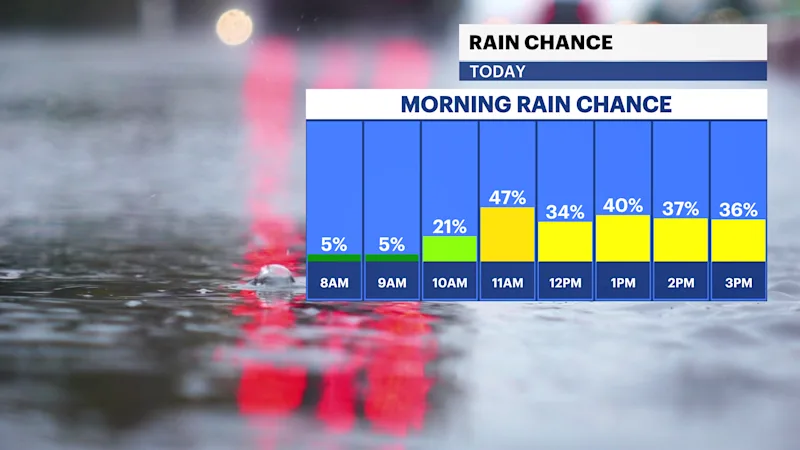
The radar is dry early this morning, but scattered showers are expected by lunchtime..The bigger concern for timing is midday into the evening when storms are expected to become more numerous and any flooding or stronger storms are most likely. Give yourself extra time and expect ponding on roadways.
TODAY: HEAVY AFTERNOON STORMS
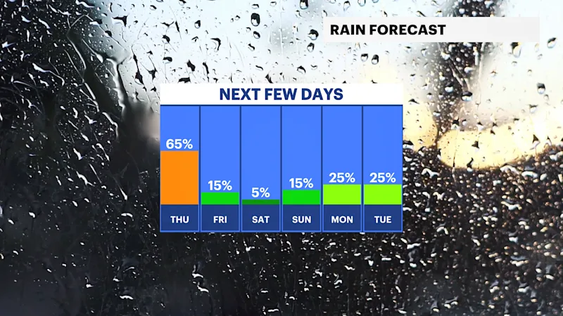
Showers and storms will become more numerous this afternoon with a few storms capable of damaging wind. The primary risk is heavy rain. Flooding is possible on roadways especially for commuters. The greatest risk will be late afternoon into the early evening.
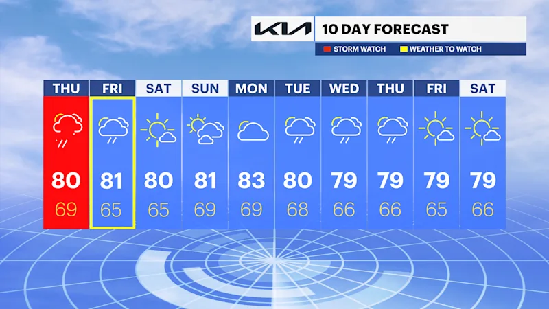
Storms gradually taper off tonight, mainly before 2am, leaving just a slight chance of lingering showers. Clouds hang around, with lows near 70.
FRIDAY: LESS NUMEROUS STORMS
A stray shower is possible in the morning, then a few showers and thunderstorms move in during the afternoon as a cold front passes through. Coverage looks more isolated than today, but a strong storm can't be ruled out. Highs reach the low-80s, with shower chances lingering into Friday evening.
BEAUTIFUL FOR THE WEEKEND
Skies clear out behind the front. Saturday is mostly sunny with highs in the low-80s, and Sunday stays mostly sunny as well with highs in the mid-80s.
BOATERS AND BEACHGOERS: ROUGH SEAS
Southerly winds of 15 to 20 mph are expected this afternoon bringing choppy conditions for boaters this afternoon, but at this time no advisories have been posted by the National Weather Service. Boaters and beach goers should remain weather aware because storms can bring rapidly deteriorating conditions this afternoon and on Friday.