More showers & thunderstorms expected for western Connecticut overnight
Storms will continue to come in waves through early Friday before sunshine returns for the holiday weekend.
More Stories


Bridgeport Information
Another wave of rain and thunderstorms will move through the area overnight. A large cluster of storms will be heading our way out of the northwest again and arrive after midnight through about 5-6 a.m. They will be running into more stable air, so some of them should start to weaken, but there is a risk that some storms could bring some gusty winds, pockets of heavy rain and some thunder.
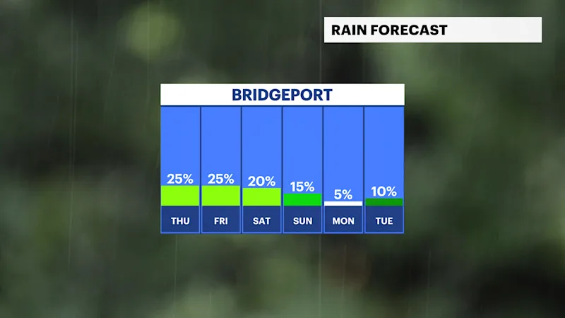
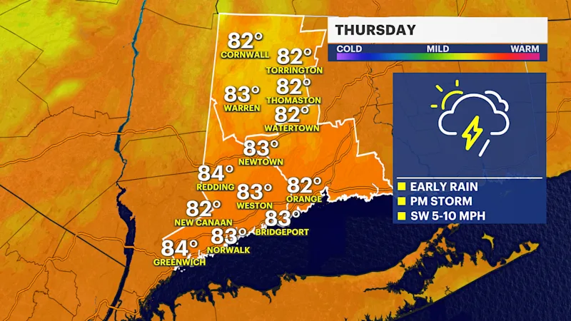
Conditions will improve Thursday morning as the rain clears out, giving way to some afternoon sunshine. It will become hotter and more humid as a warm front lifts through with highs in the lower to mid-80s. There is the potential for a few hit-or-miss storms during the day, but they look very isolated.
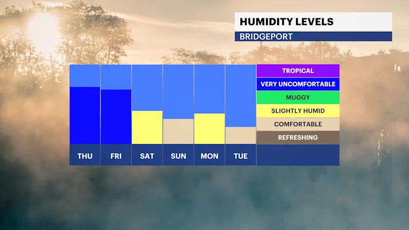
Another round of storms may slide through from the northwest again late into early Friday. By Friday afternoon and evening, the weather should clear and feel less humid.
Heading into Labor Day weekend, weather conditions look ideal for outdoor plans. Highs will hover comfortably in the 70s, with overnight lows dipping into the 50s and 60s, amid low humidity.
Outside of a possible isolated afternoon shower on Saturday, the remainder of the holiday weekend through Labor Day itself looks dry, sunny and pleasant.