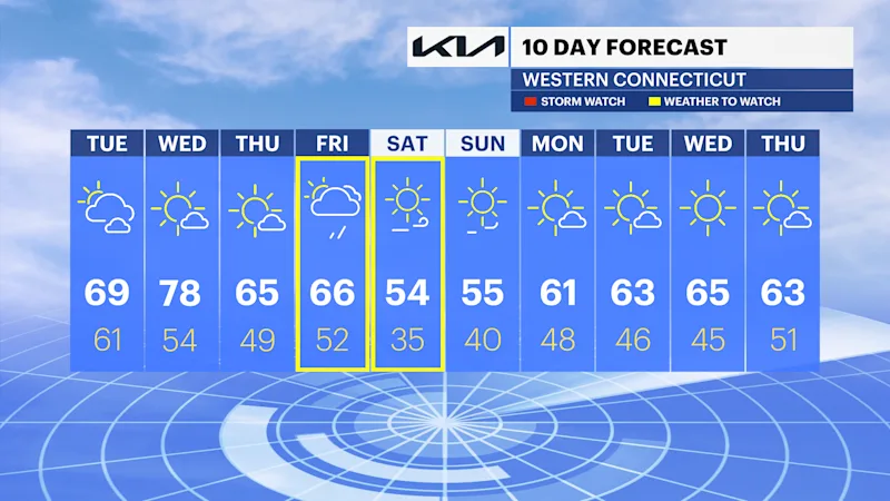
Mild and pleasant today before rain and a big cool down returns late this week in Connecticut
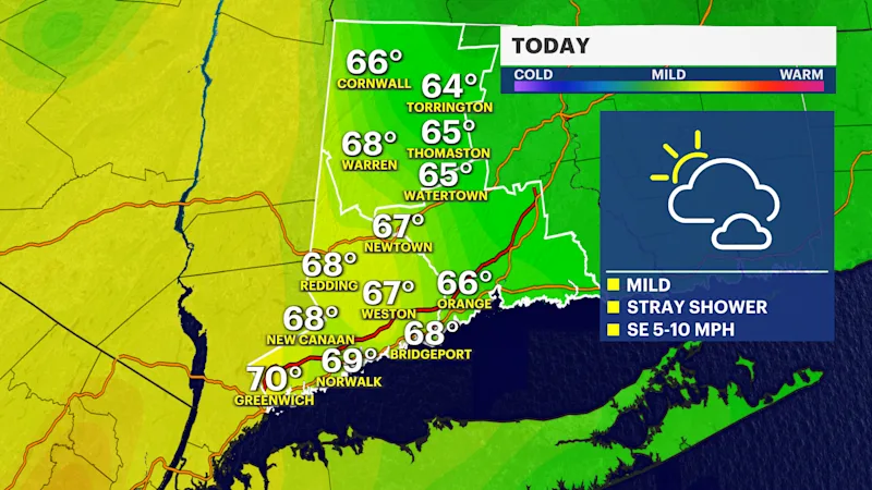
It's another nice and comfortably mild day with highs in the upper 60s to low 70s. Summer-like warmth returns tomorrow before rain and big a cool down late this week.
More Stories




Bridgeport Information
FORECAST
Today's another pleasantly mild day with plenty of sunshine and highs in the upper 60s to low 70s. A frontal system to the north will bring clouds this evening and a few isolated showers. We have a wonderful treat of summer-like warmth with highs soaring into the upper 70s to low 80s tomorrow afternoon.
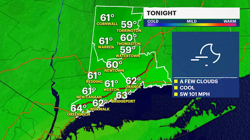
Another frontal system moves through the city Wednesday evening bringing a chance of a stray shower and cooler air. Thursday will be close to seasonable with comfortable fall temperatures in the mid to upper 60s.
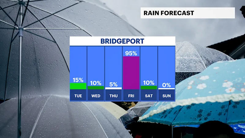
Our next storm system arrives Thursday night into Friday with a chance for afternoon showers and gusty thunderstorms. As of now, there's confidence that widespread rain will impact the region on Friday, but the exact rain totals can still vary with any thunderstorms.
Gusty winds from 30-40 mph are possible on Friday and Saturday. Rain totals could range from half an inch to one inch of rainfall through Friday evening.
Behind this storm system, the coolest air of the season so far is heading our way. A cool, crisp and refreshing air mass sweeps in for a classic Fall weekend with highs in the 50s and chilly lows in the 30s. Stay tuned for updates.