Sunshine first, then rain makes a return for Connecticut
A mostly sunny Wednesday leads into a wetter end to the week, with showers developing Thursday and into Friday.
More Stories



Bridgeport Information
WHAT TO KNOW:
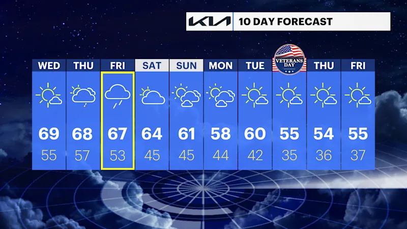
Patchy fog is possible overnight and into early Wednesday morning, but sunshine takes over during the day. Temperatures climb into the upper 60s to around 70, making Wednesday the last dry day before a wetter stretch arrives.
Clouds increase Thursday, with a few showers possible during the day before steadier rain develops Thursday night. Friday is the main weather story, as periods of rain and possible thunderstorms move through. Some areas could pick up a healthy amount of rain, leading to wet roads and the potential for localized flooding.
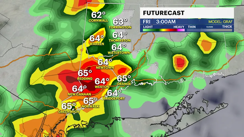
The rain gradually tapers off Friday night into Saturday, although a few showers could linger into Saturday morning. Cooler air settles in behind the system, bringing temperatures back into the 60s for the weekend and early next week. Sunshine returns for much of Sunday and the beginning of the week.
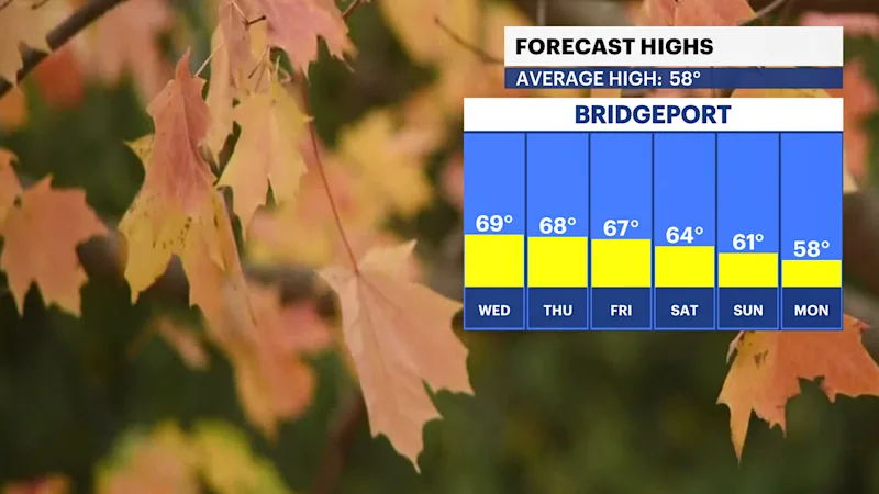
FORECAST:
Wednesday: Patchy morning fog gives way to sunny skies. Highs in the upper 60s to around 70.
Thursday: Mostly cloudy with a chance of showers. Highs in the upper 60s.
Friday: Periods of rain with a chance of afternoon thunderstorms. Heavy rainfall is possible, with highs in the mid-to-upper 60s.
Saturday: A few lingering morning showers are possible, followed by some sunshine. Highs in the low to mid-60s.
Sunday: Mostly sunny and cooler. Highs in the upper 50s to around 60.
Monday: Mostly sunny. Highs in the upper 50s to around 60.
Tuesday: Sunny and seasonably cool. Highs around 60.