Sunshine returns today, but a soaking storm looms later this week
A brief morning shower gives way to sunshine before eyes turn to Friday's rainmaker
More Stories


White Plains Information
FORECAST:
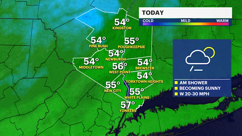
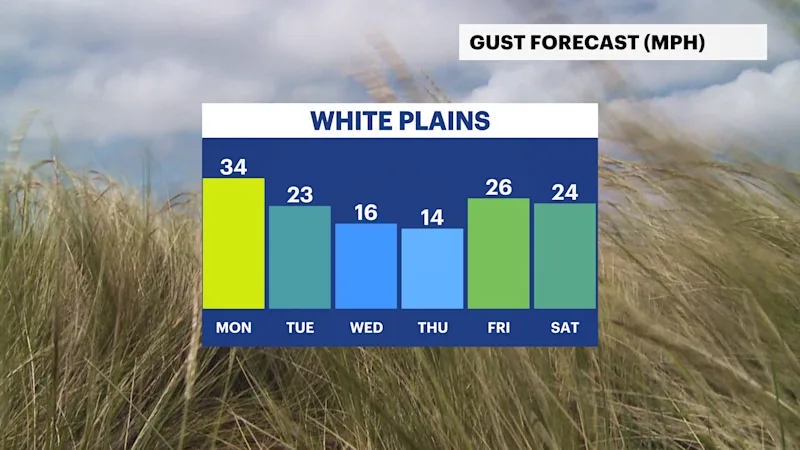
A weak frontal system is bringing a few clouds and a passing shower to the Hudson Valley this morning, along with breezy conditions. Wind gusts of 20 to 30 mph are expected through the early part of the day before gradually easing.
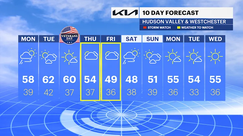
Skies will clear quickly by late morning, leading to a pleasant afternoon with temperatures reaching the upper 50s.
Tonight will be mostly clear and calmer, with overnight lows falling into the upper 30s and near 40 degrees.The remainder of the week stays relatively quiet with seasonable temperatures near 60 degrees.
LATE WEEK STORM:
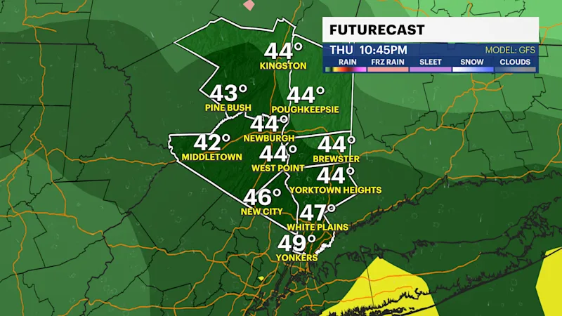
Attention then turns to a developing storm system expected to arrive Thursday afternoon.
Rain will become likely Thursday afternoon and continue through Friday and early Saturday. Friday currently appears to be the wettest day, with periods of heavier rainfall possible.
As the storm moves east, it is expected to interact with a developing coastal low, prolonging rain and increasing winds into Saturday.
Gusts could reach 30 mph as the system exits.While most of the Hudson Valley is expected to see a soaking rainfall, some northern and higher-elevation locations could see minor snow impacts on the backside of the storm.
Rainfall amounts and storm details will become clearer over the next several days.