Anatomy of a nor’easter and how it could impact New Jersey
What to watch ahead of another potential storm this weekend.
More Stories


Did you know that nor’easters originate from two primary tracks? Their origins occur from two primary patterns of the jet stream and how it carries moisture to the East Coast. With a new storm expected to develop this weekend, all eyes are on this track.
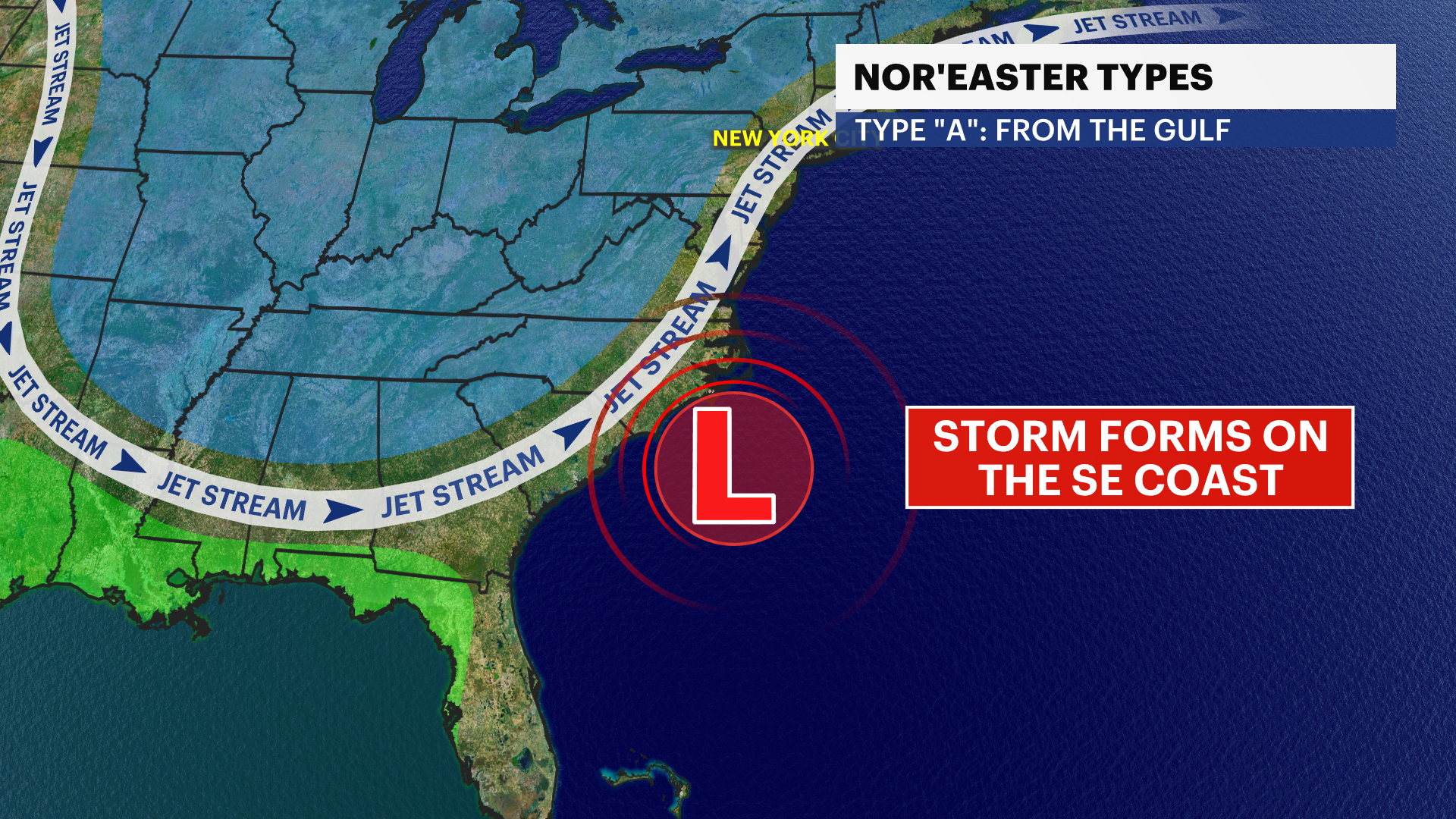
TYPE “A” NOR’EASTER
These storms originate along the Gulf coast where an arctic black through the continental US forces the jet stream south. The jet stream grabs moisture from the gulf and spits out a storm along the southeast coast. From here, the nor’easter strengthens and tracks northward along the eastern seaboard.
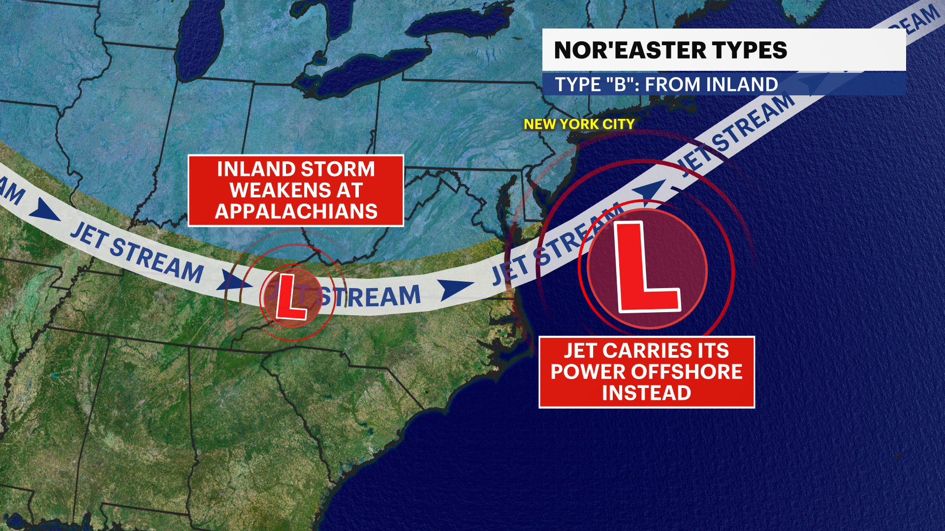
TYPE “B” NOR’EASTER
These storms originate in the Great Plains, tracking eastward across the Mississippi Valley. The stormy energy collides with the Appalachian Mountains where it weakens, but it picked up and dropped offshore with the jet stream. The nor’easter then strengthens offshore, near the Virginia/North Carolina coast where it then can track northward or continue its path out to sea. These storms sometimes simply graze our area to our south.
However, regardless of the storm’s formation, the most critical feature of nor’easter forecasting is the 40/70 Benchmark.
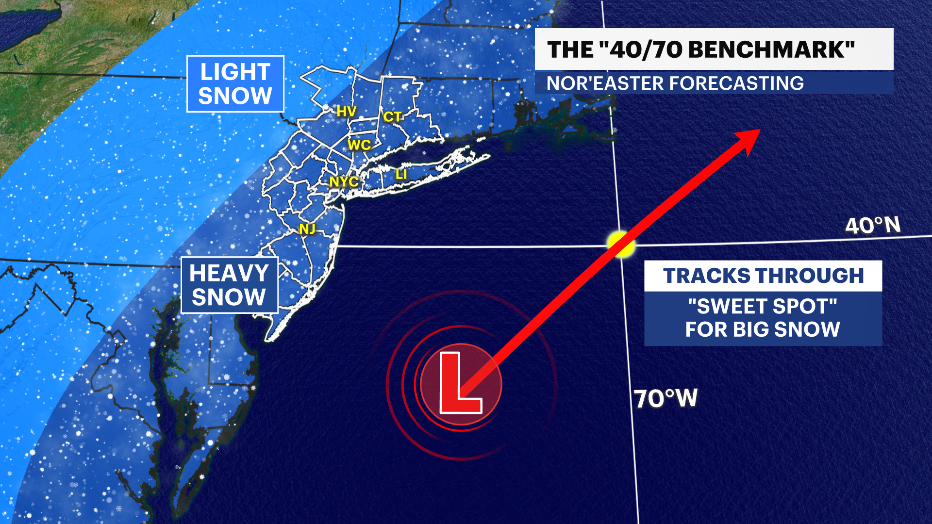
40/70 BENCHMARK
This point is defined as the intersection of 40 degrees North latitude and 70 degrees West longitude. It’s about 215 miles due east of Point Pleasant Beach, NJ.
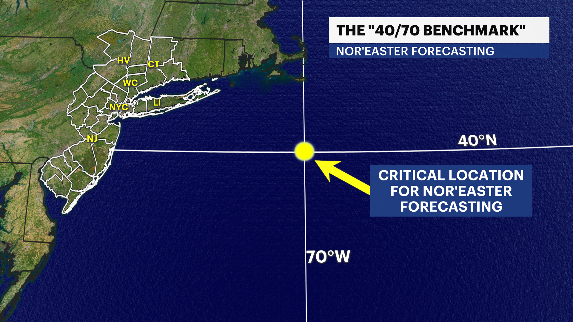
If the center of a nor’easter passes directly over this point, it is known as the “sweet spot” for major impacts along the I-95 corridor from Washington DC through NJ/NYC and New England with heavy snow and strong gusts.
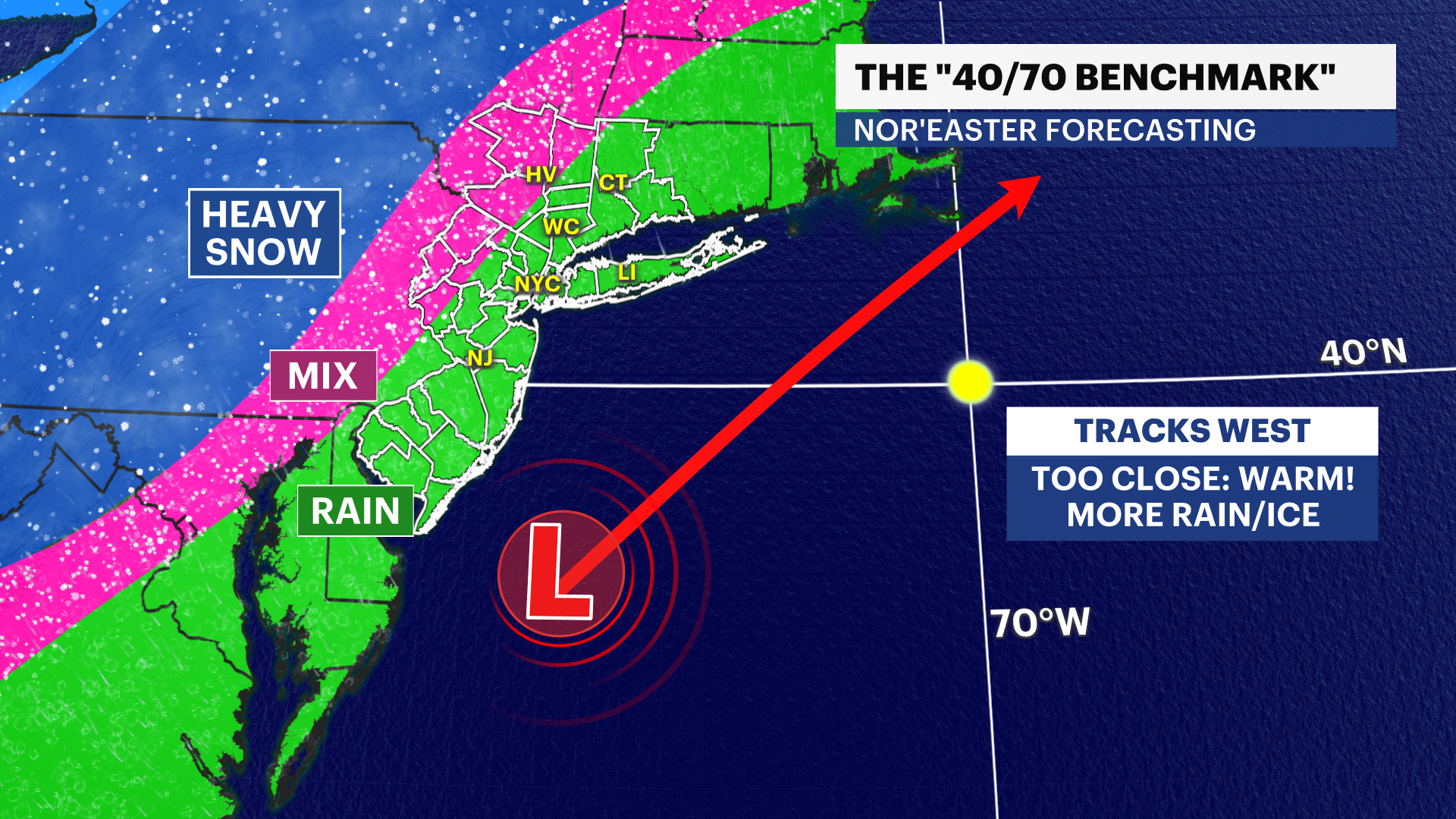
If the nor’easter passes west of benchmark, then the storm is too close to the coast where it may be warmer and produce rain across the coast. This would push snowy impacts far inland.
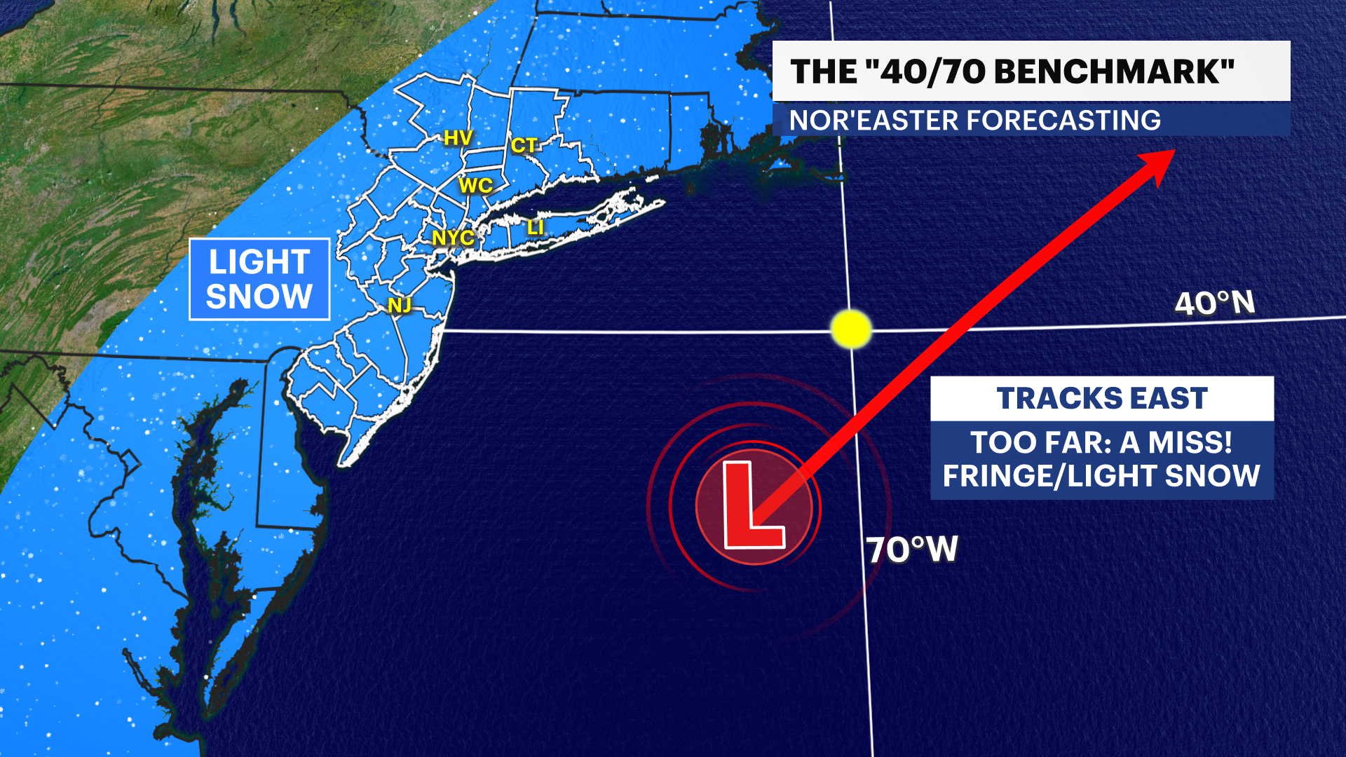
Lastly, if the track is east of benchmark, the storm is then too far away for big impacts. This can mean the storm misses the area by going out to sea or it can be a glancing blow with fringe effects of lighter snow across the I-95 corridor to the coast.
Regardless of the type of nor’easter, the track’s proximity to the 40/70 Benchmark determines the intensity of its impact on our area. It’s too soon to tell right now where exactly it’ll go, but this will come to light later this week.