Cool, damp start with clouds lingering throughout the day for The Bronx
For tonight, expect cloudy and cool conditions and lows near 61 degrees.
Share:
More Stories
2:14

On-and-off rain to hit Connecticut through the rest of the week
1h ago2:04

Sunny weather carries over to Tuesday, but rain looms
2ds ago
News 12 weather blog
13ds ago2:14

Sunny and pleasant Monday in Connecticut; more rain chances this week
17ds ago2:14

STORM WATCH: Overnight rain, more wet weather to start week in Connecticut
24ds ago1:29

Rainy weather expected to impact viewing of Eta Aquarids meteor shower
26ds ago2:14
On-and-off rain to hit Connecticut through the rest of the week
1h ago2:04
Sunny weather carries over to Tuesday, but rain looms
2ds agoNews 12 weather blog
13ds ago2:14
Sunny and pleasant Monday in Connecticut; more rain chances this week
17ds ago2:14
STORM WATCH: Overnight rain, more wet weather to start week in Connecticut
24ds ago1:29
Rainy weather expected to impact viewing of Eta Aquarids meteor shower
26ds agoFor tonight, expect cloudy and cool conditions and lows near 61 degrees.
Here’s what you need to know:
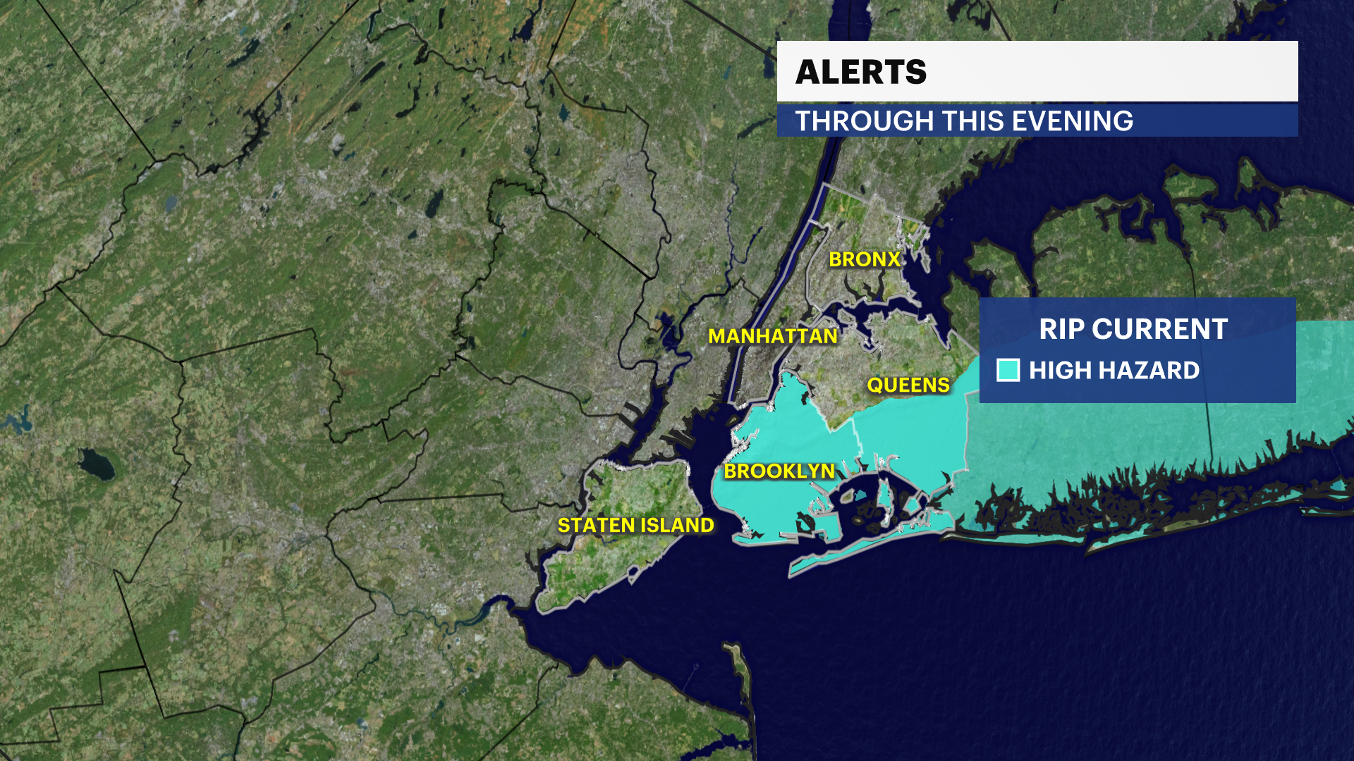
- A high rip current risk is in effect through this evening. Life-threatening rip currents are likely at Brooklyn and Queens ocean-facing beaches.
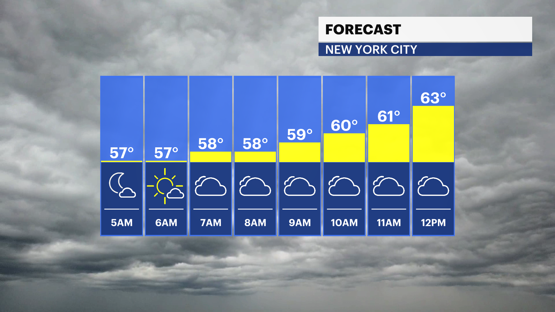
- It's cool and damp this morning. Temperatures are in the mid- to upper-50s.
- Today will be a touch milder, mostly cloudy with a light breeze. Highs will be near 70 degrees.
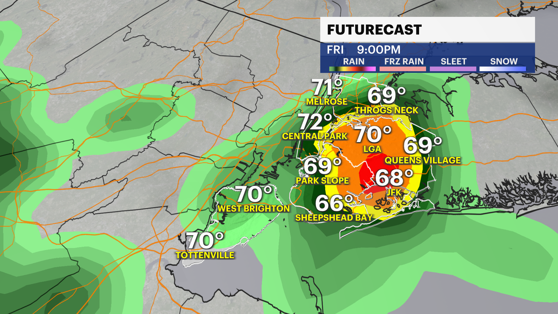
- Another round of rain moves in after 2 p.m. Friday. Expect a few moderate to heavy pockets of rain/storms Friday after 9 p.m. Poor visibility, wet roads and a few puddles are expected with this storm system.
- A cold front moves through the area on Saturday. Scattered showers/thunderstorms are possible on Saturday afternoon, with 1-1.5" of rainfall expected through Saturday evening.
- Sunday will be drier, mild and breezy. Highs will be in the upper-60s to low-70s. Monday will be seasonable before the warmup by midweek.
- Temperatures soar into the 80s next week with tranquil weather conditions. Stay tuned for updates!
Today: Damp start. Mostly cloudy, a bit milder with light winds. Highs near 70.

Tonight: Cloudy and cool. Lows near 61.
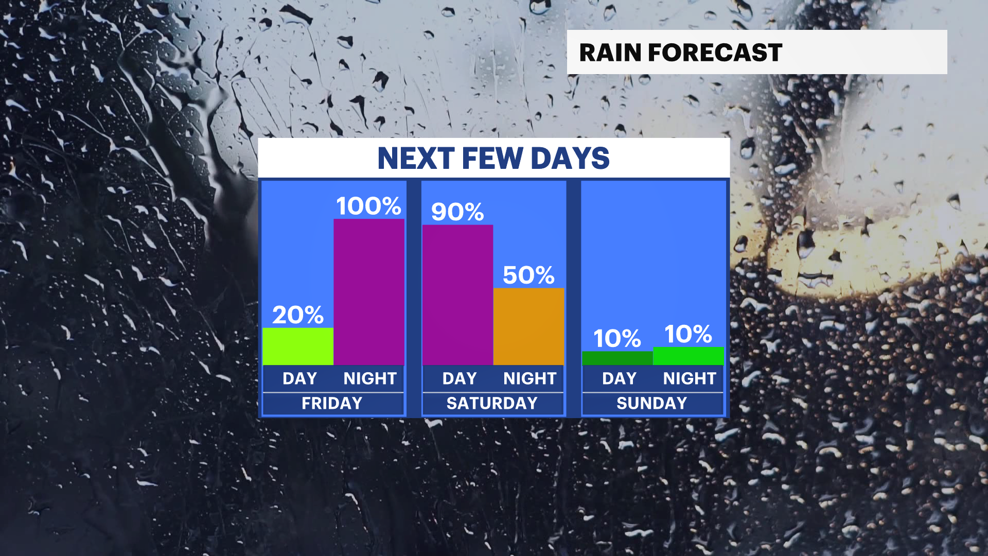
Friday: Partly sunny and near seasonable. A few afternoon showers, pockets of downpours/storms late at night. Highs near 77. Lows near 55.
Saturday: Mostly cloudy and mild. Chance of showers/storms. Highs near 71. Lows near 54.
Sunday: Brighter and still mild. Breezy. Highs near 69. Lows near 56.
Monday: Mostly sunny and mild. Highs near 74. Lows near 61.
More from News 12
2:14
On-and-off rain to hit Connecticut through the rest of the week
2:04
Sunny weather carries over to Tuesday, but rain looms
News 12 weather blog
2:14
Sunny and pleasant Monday in Connecticut; more rain chances this week
2:14
STORM WATCH: Overnight rain, more wet weather to start week in Connecticut
2:14
