Storm to bring snow, gusty winds and rain to Connecticut
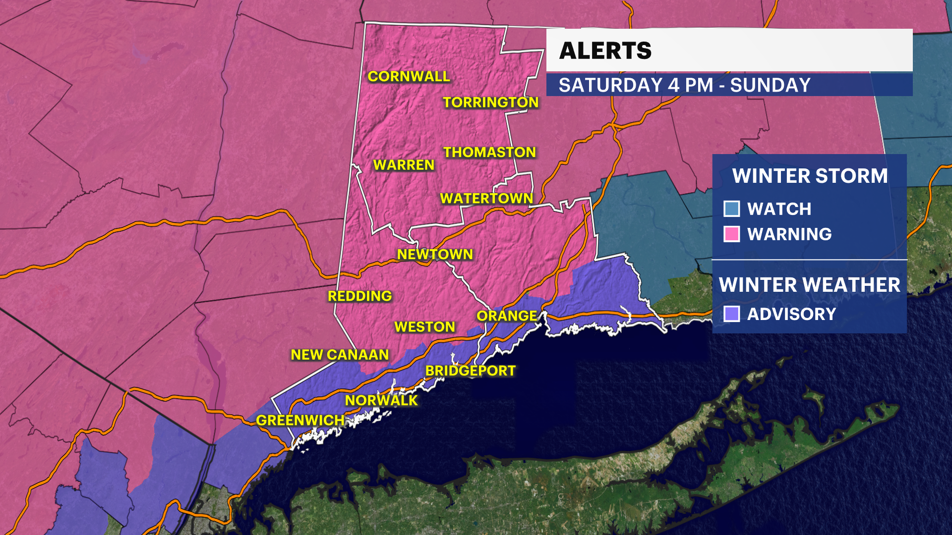
A winter storm warning is in effect from 4 p.m. Saturday to 6 p.m. Sunday for portions of Northern Fairfield and Northern New Haven counties. A winter storm warning is also in effect from 4 p.m. Saturday to 1 a.m. Monday for portions of Hartford, Tolland and Windham counties.
More Stories


Another storm is coming our way and this time it will bring some accumulating snow and even some rain to Western Connecticut this weekend.
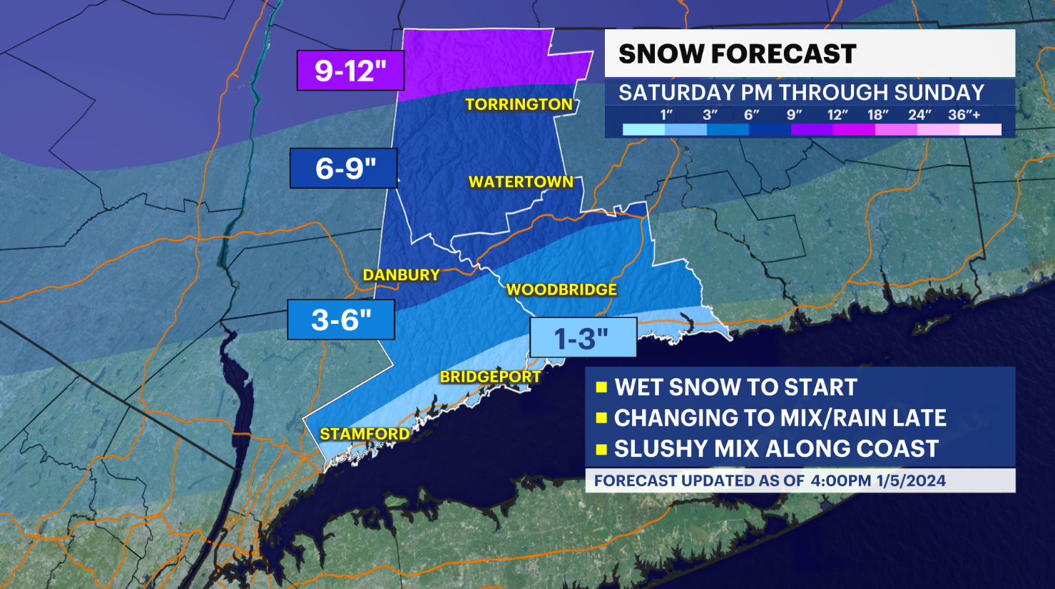
WHAT'S NEW: The National Weather Service has issued Winter Storm Warnings for Northern Fairfield and Northern New Haven Counties starting at 4 p.m. Saturday through 6 p.m. Sunday. Wet snow will accumulate and generally 5-9" could fall. Snowfall rates can be as high as 1" per hour. Roads could become snow covered, slushy and even slick through Saturday evening.
There is also a Winter Storm Warning for Litchfield County starting at 4 p.m. on Saturday through 7 p.m. Sunday. Generally 6-10 inches with a few spots that may go slightly higher.
Winter Weather Advisories are up for Southern Fairfield and Southern New Haven counties starting at 4 p.m. Saturday through 11 a.m. Sunday. Wet snow to start, then changing to mix and rain closer to midnight. Could go back to snow early Sunday. Minor accumulations 1-3", lesser closer to the coastline.
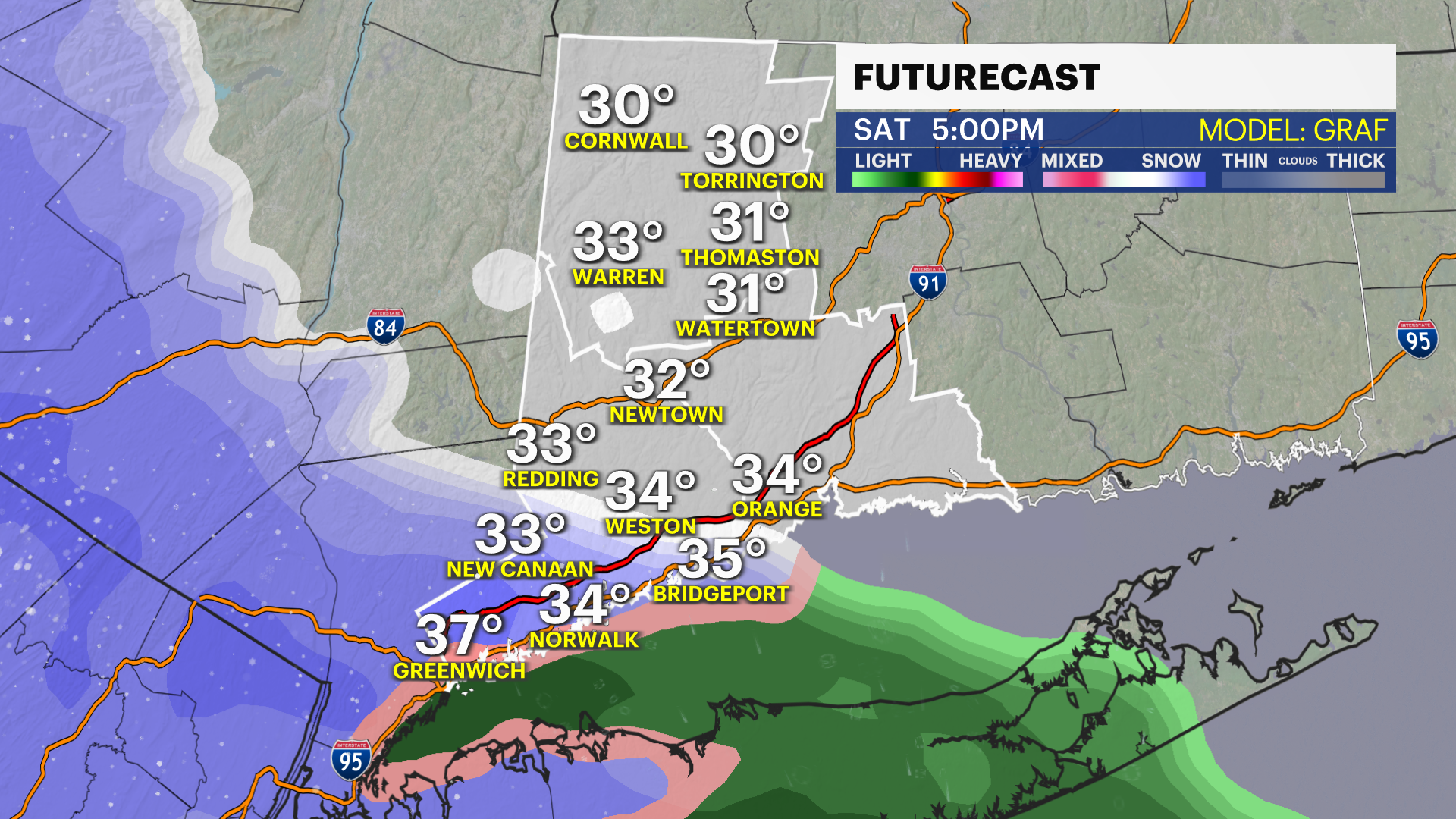
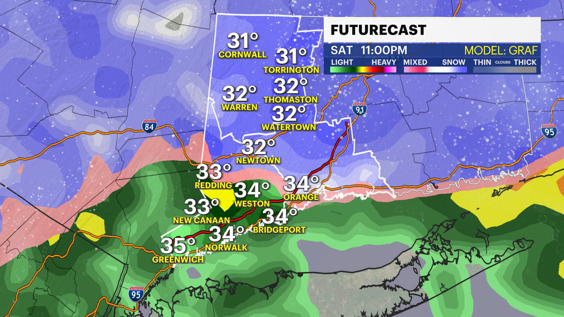
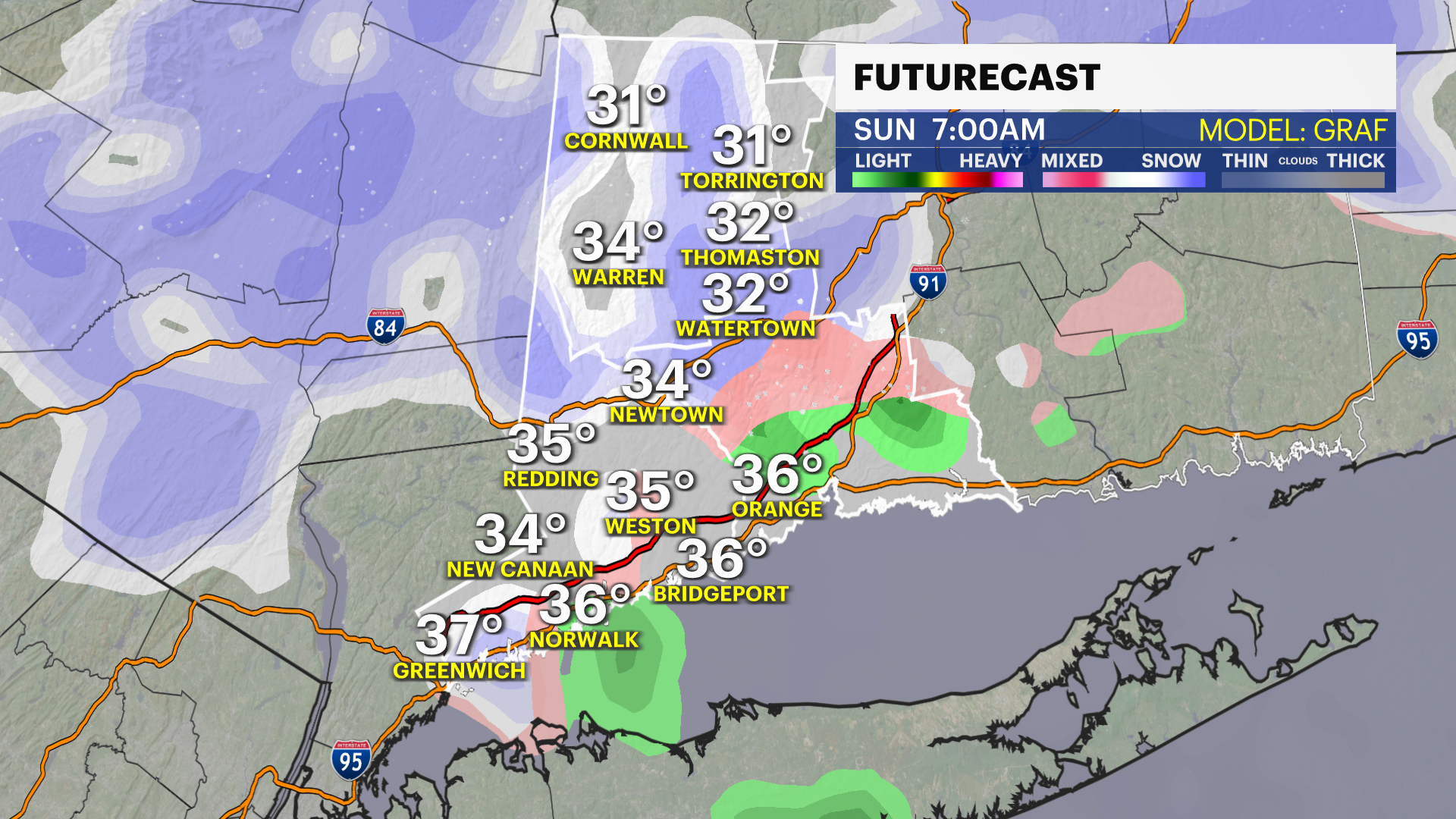
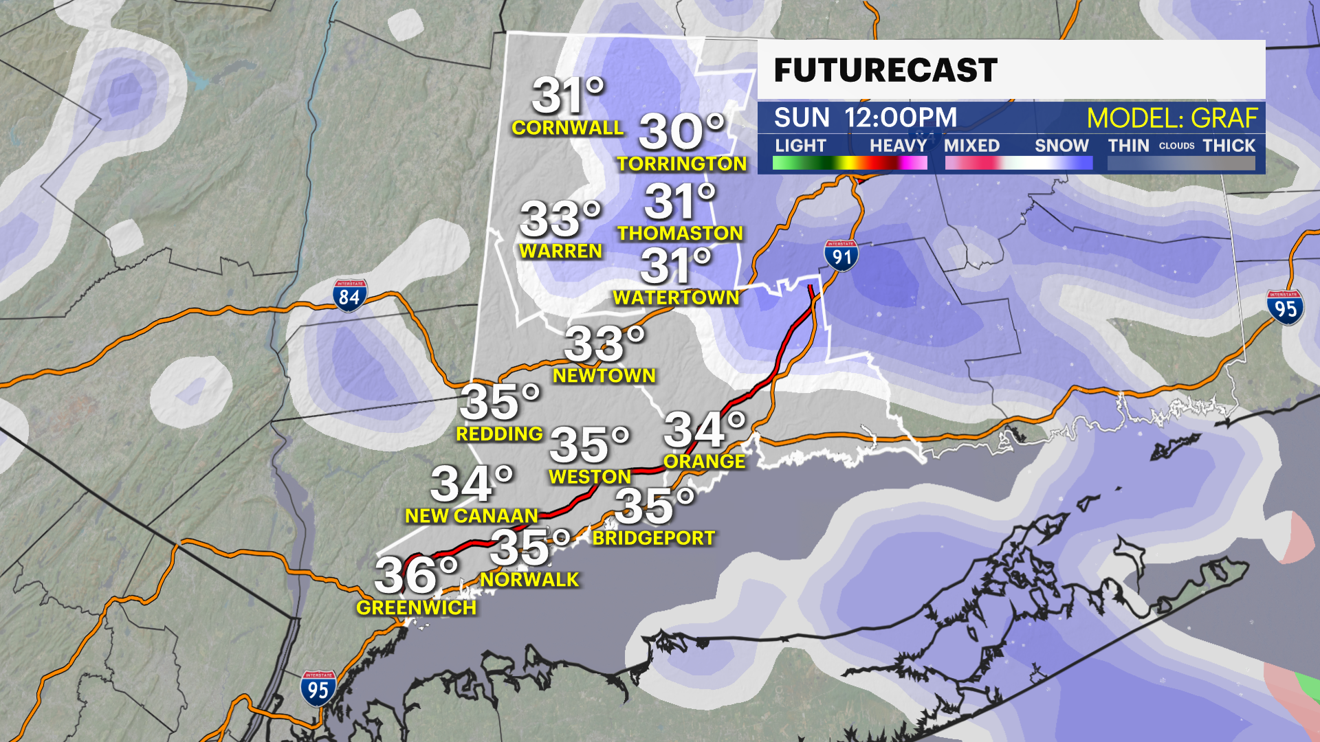
This should all start around 4 p.m. to 5 p.m. Saturday with wet snow. Then between 10 p.m. and midnight, the changeover occurs south. This will go over to sleet and then plain rain.
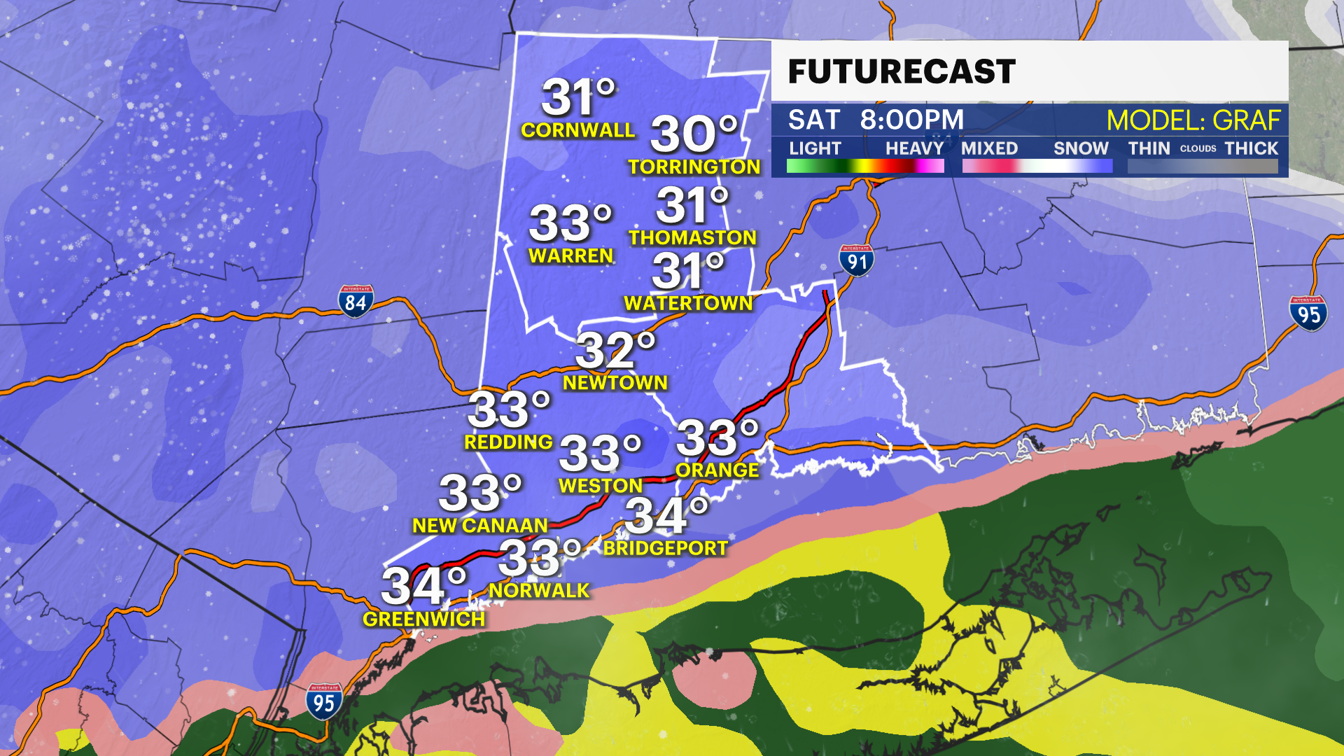
The snowfall map has a very tight gradient, meaning north and south of the Merritt will major differences to looks on Saturday.
Winds will pick up Saturday evening and overnight. Gusts 35-40 mph closer to the coast. Lighter winds 30 and under north.
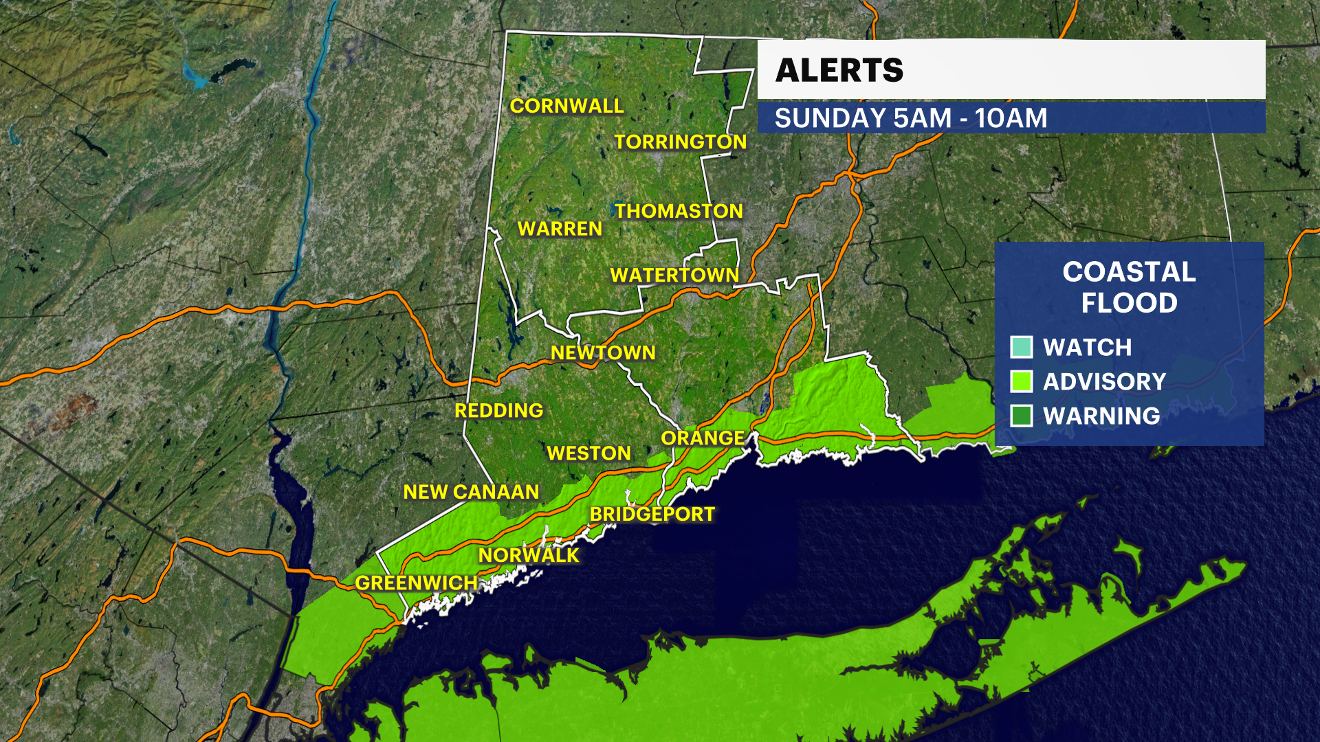
COASTAL FLOODING: Advisories for Sunday between 5 a.m. to 10 a.m. Minor flooding.
WHAT'S NEXT: This isn't the end of the storms. This is a very active weather pattern we are in and more will come every few days. Tuesday and Wednesday will be warmer, so that looks to fall as rain. Could be flooding rain.
Winter Storm Preps: