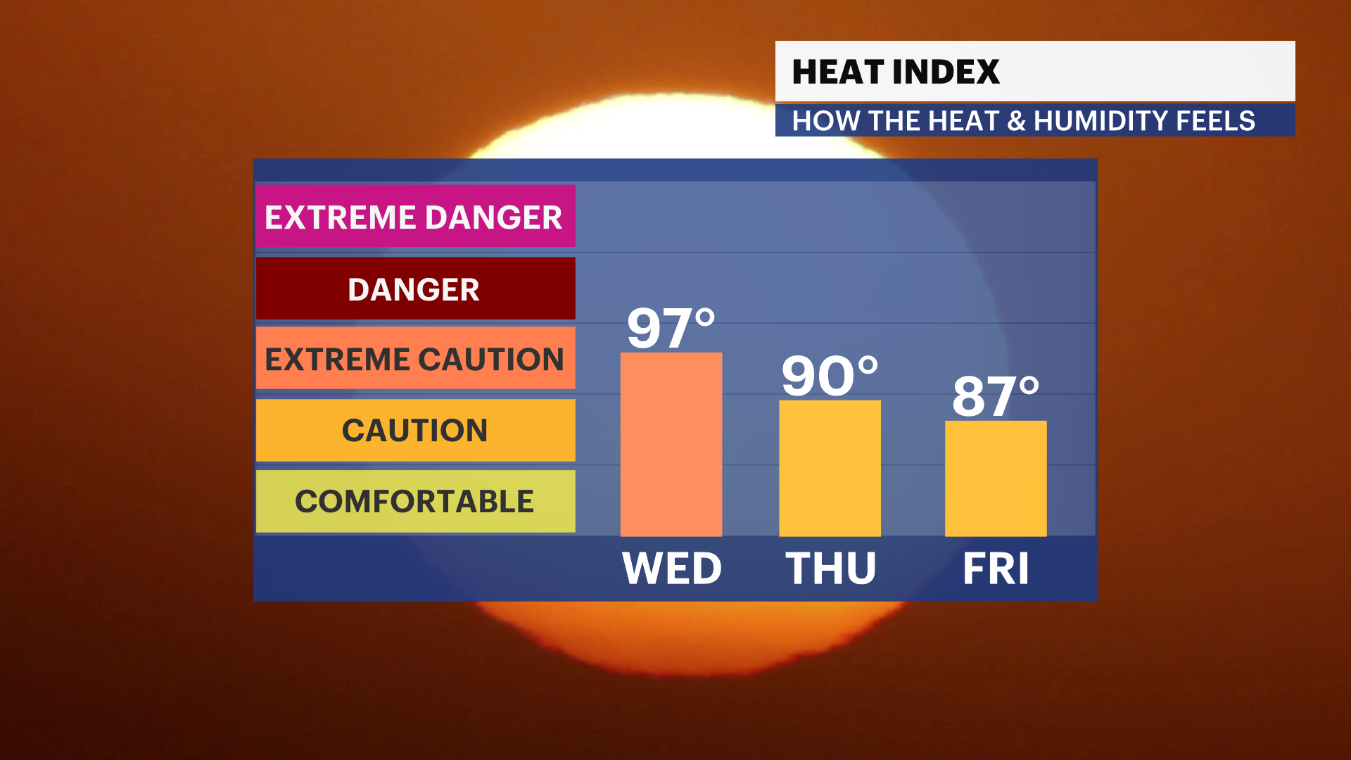
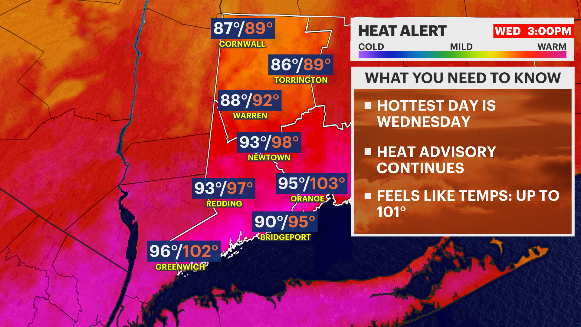
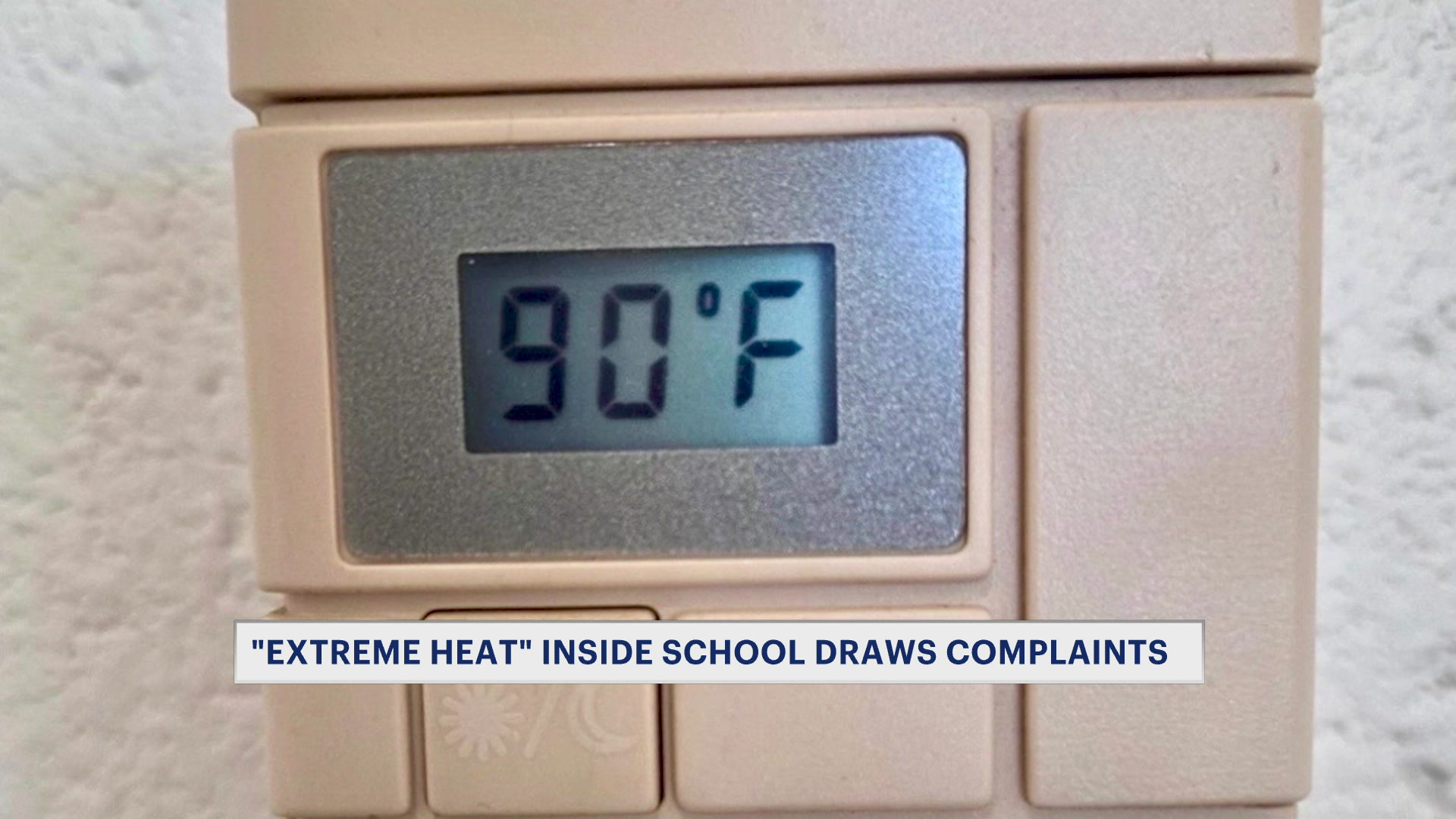
HEAT ALERT: Heat and humidity peak Wednesday
The humidity will increase heading into tomorrow, peak heat indices near 100 degrees
More Stories


ALERTS:
HEAT ADVISORY: Until 9 p.m. on Wednesday.
AIR QUALITY ALERT: Today until 11 p.m.
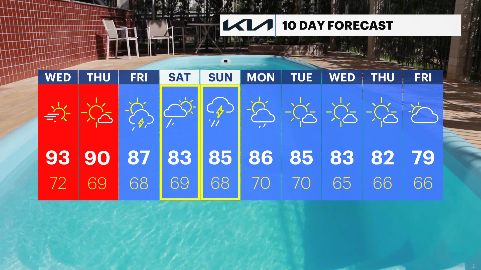
The hottest day of the week is on the way for tomorrow. The heat builds and so does the humidity. The combination of the two will make it feel like it's close to 100 degrees during the day. Actual air temperatures will be higher for Wednesday with highs in the low to mid-90s. A change in wind direction will allow temperatures to heat up a bit more than today.
Expect to see the wildfire smoke linger in our sky too. It may briefly clear up, but the come back for Wednesday.
By Thursday and Friday, there will be drier heat at least. The temperatures ease back into the upper 80s.
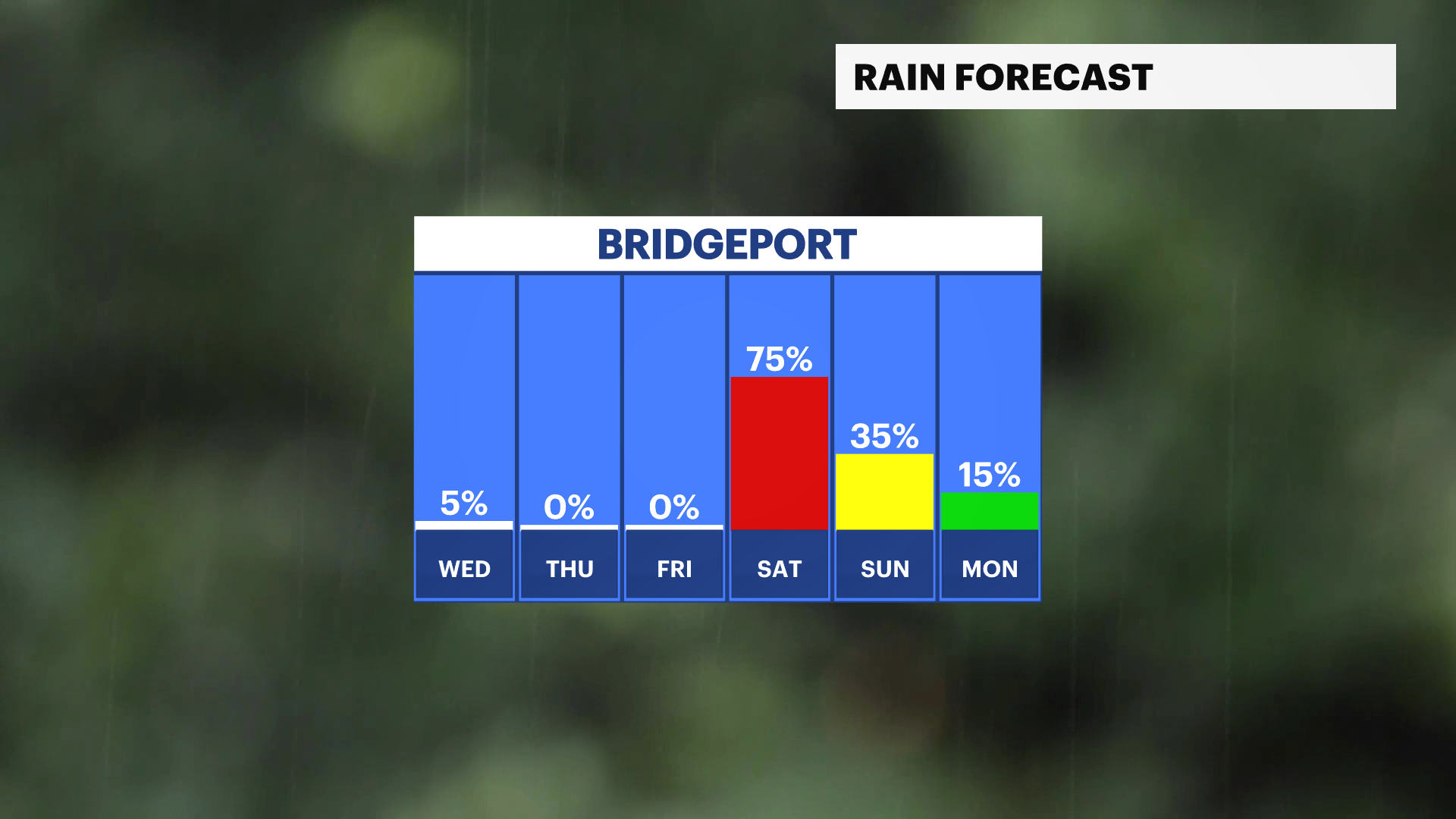
Rain arrives for the weekend, so there is a chance some showers or thunderstorms may disrupt plans. Stay with News 12 for updates throughout this week, as there is some uncertainty with the timing of the systems and storms.