More Stories
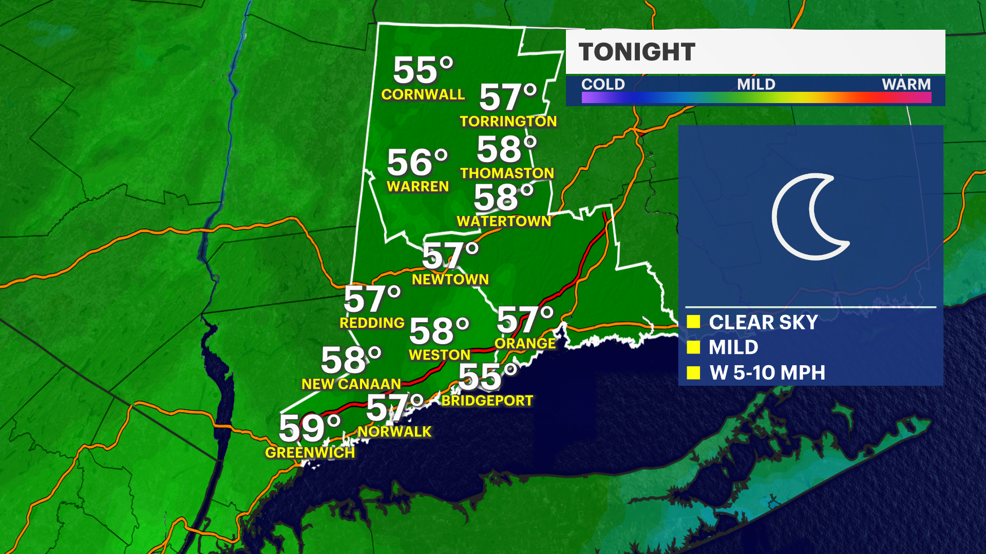
Storm Watch Team Meteorologist Michele Powers says it will stay mild and dry overnight with one more really warm day before the weekend brings some changes, including rain.
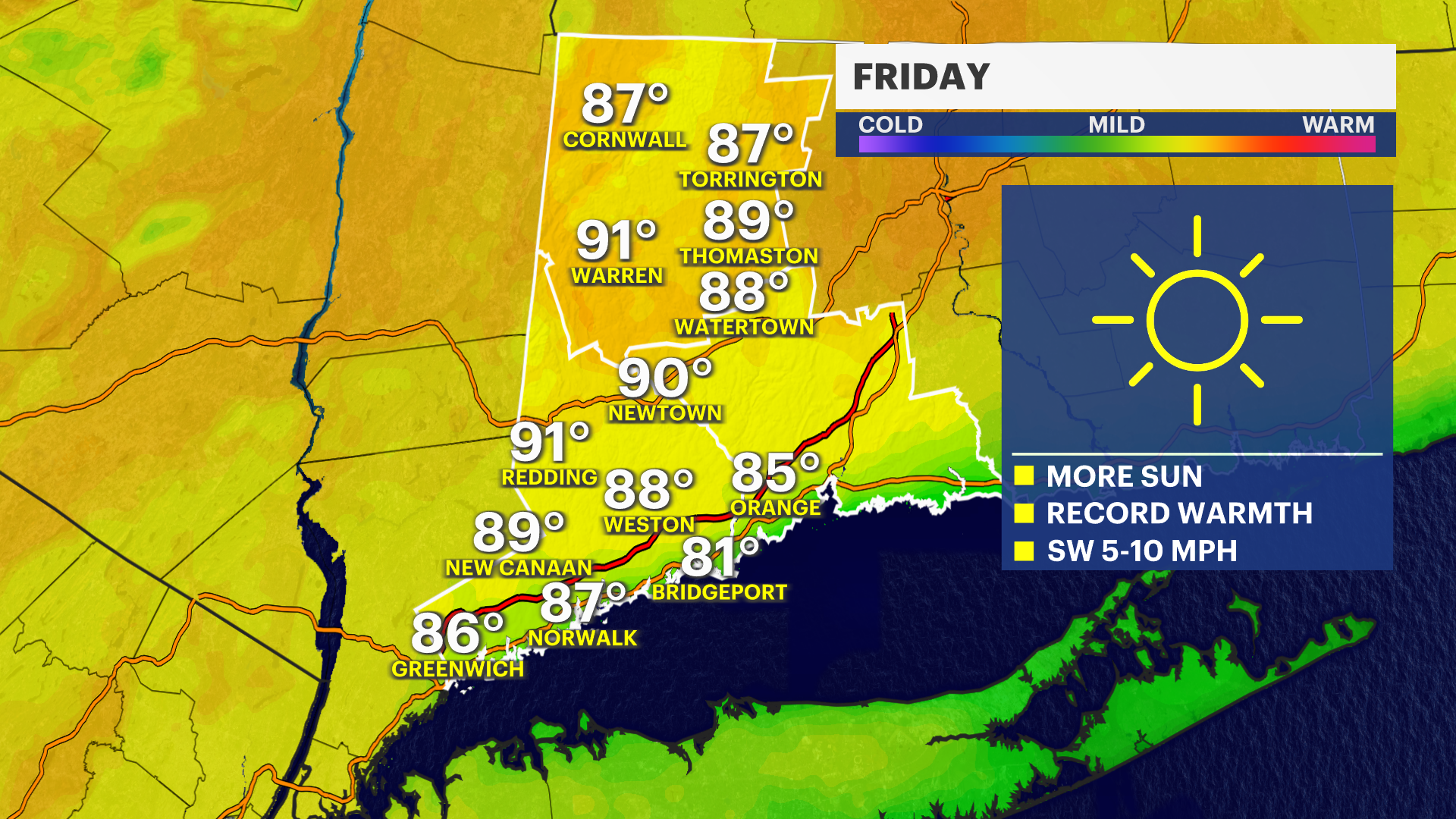
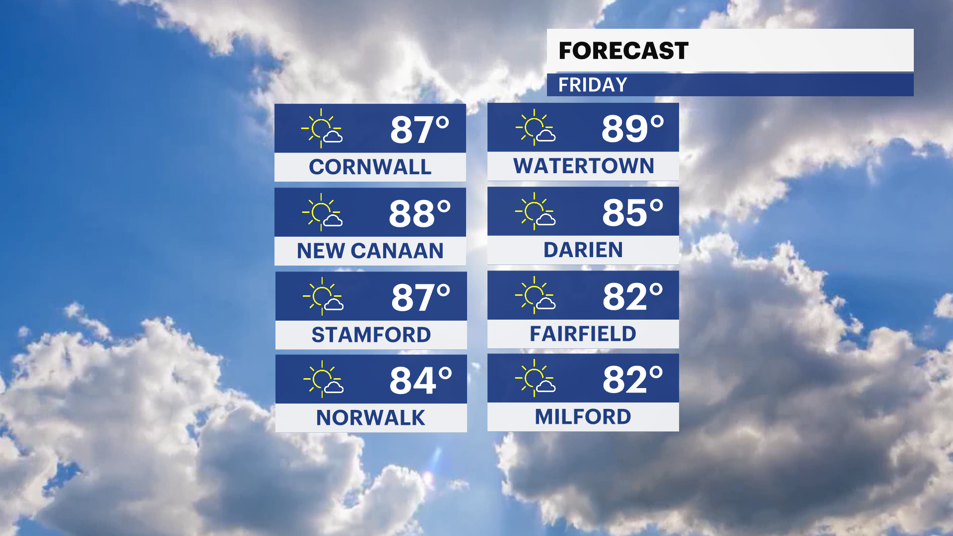
WHAT'S NEW: Temperatures will be in the 80s for all of western Connecticut. The sea breeze along the Sound Shore will likely keep temps down in the lower-80s and then drop. Inland areas will sizzle with highs ranging from 85-90 degrees.
WHAT'S NEXT: No storms or rain are expected until this weekend. This type of weather is also conducive to fire spread. Light, broken showers look likely now later on Saturday. There could be some sprinkles or light showers in the afternoon. Sunday may end up staying mostly cloudy. Rain could return again on Monday. This doesn't look like very much but will end up being stretched out over a few days as a pair of systems slides through the region.
Due to this pattern change, temps will cool into the 60s over the weekend and stay there next week. It will still be above average but not as warm.
FRIDAY: A mix of sun and clouds. Potential record-high temperatures on both sides of 80 degrees. Lows in the 50s.
SATURDAY: Cooler with increasing clouds. Shower chances Saturday night. Highs in the 70s.
SUNDAY: Mostly cloudy and cooler with a few sprinkles possible. Highs in the 60s.
MONDAY: Partly cloudy with a shower chance. Highs in the 60s, 50s north of I-84.
TUESDAY: Sunshine with a shower chance. Highs in the 50s to around 60.
More from News 12
2:12

Ganim issues safety alert amid 'tropical storm-like conditions' in Bridgeport

LIVE RADAR: Tornado Watch in effect for NJ
1:35

Welcome back, spring! Everything you need to know about the upcoming vernal equinox
1:22

Venus and Saturn cozy up in the night sky Sunday - a planetary conjunction
1:19

Clouds may obscure March 3 ‘Blood Moon’ eclipse on East Coast
1:59
