More Stories
NOW: Storm Watch Team Meteorologist Scott Sincoff says areas of dense fog
are out and about along the Merritt, I-95, and toward I-84 with showers and
even some mix up by Litchfield County. Take it slow for your morning commute
and plan ahead!
NEW: Skies will be
clearing as the day goes with some sunshine and highs in the 50s for your
Thursday.
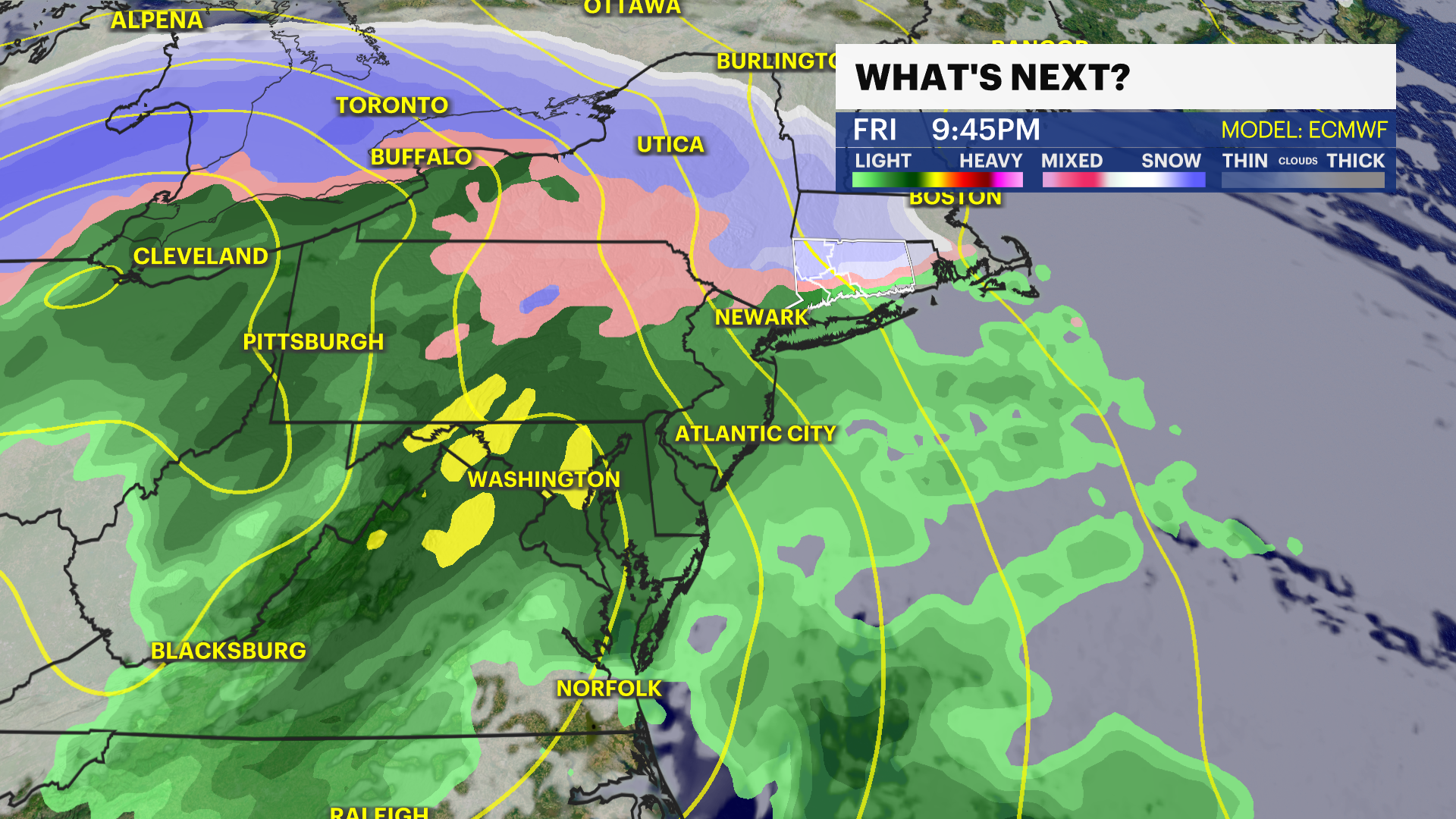
NEXT: Another storm with
snow and rain is in the cards overnight Friday into Saturday as we're looking
at rounds of weather to watch over the next ten days.
THURSDAY: Foggy start
with showers and mix with clearing skies as the day goes on. Highs in the 50s.
Wind: NW 5-15 MPH.
THURSDAY NIGHT: Partly
cloudy to mostly clear with lows in the 20s. Wind: NW 5-15 MPH.
FRIDAY: Sunshine to
start. Snow showers with some ice and sleet mixed in possible overnight. Highs
in the 30s and 40s.
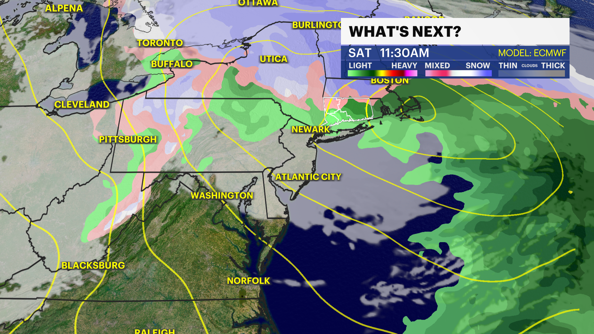
SATURDAY: Snow and mix
fading with skies clearing late. Breezy with gusts up to 25 MPH. Highs in the
40s.
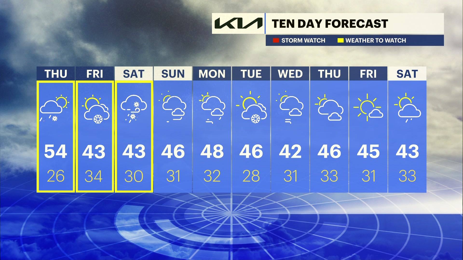
SUNDAY: Mostly sunny and
mild. Highs in the 40s.
MONDAY: Partly cloudy
with a chance of snow and rain showers overnight. Highs in the 40s.
TUESDAY: Partly cloudy
with a chance for snow showers. Highs in the 40s.
WEDNESDAY: Mostly sunny
and breezy. Highs in the 30s and 40s.
More from News 12
0:48

Birthright citizenship battle reaches Supreme Court as Blumenthal speaks out
2:06

Chilly and cloudy today wth passing showers, rain expected for Easter
0:20

SoNo Collection up for sale in Norwalk
0:50

Woman killed in first of 2 fiery crashes that closed northbound Merritt Parkway overnight
2:23

'Amazing.' Artemis II launch wows spectators at Westport Observatory
2:18
