Sunshine and comfortable weather for Connecticut before rain returns
Plenty of sunshine, lower humidity and seasonable temperatures make for a summer day on Monday.
More Stories


WHAT TO KNOW
Expect a comfortable and clear overnight ahead. Some areas will be cool with temperatures dipping into the upper 40s.
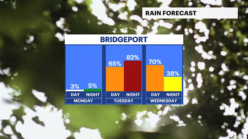
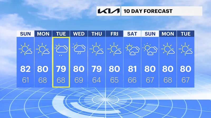
Monday brings another dry and seasonable day before a more active weather pattern returns. Showers and thunderstorms become likely Tuesday afternoon and continue into Wednesday, bringing periods of heavy rain, lightning and locally gusty winds. Drier, more comfortable weather returns by Thursday and lasts into next weekend.
FORECAST
Monday: Sunny, with pleasant summer weather. Temperatures around 80.
Tuesday: Mostly cloudy, with showers and thunderstorms developing during the afternoon. Temperatures in the upper 70s.
Wednesday: Mostly cloudy, with showers and thunderstorms likely. Temperatures around 80.
Thursday: Mostly sunny and comfortable. Temperatures in the upper 70s.
Friday: Sunny and pleasant. Temperatures around 80.
Saturday: Mostly sunny and warm. Temperatures in the low 80s.