More Stories
NOW: Showers pushing in from the west will cause fog and light rain overnight into the Tuesday morning commute.

NEW: Rain chances continue through Thursday so make sure to have the jacket, hat and umbrella at the ready with mild temperatures in the 50s in the cards.
NEXT: The rollercoaster will be running this weekend as colder air pushes in for Friday with some snow and sleet potentially on the way into Friday morning, and even a stray flake or ice pellet Saturday.
OVERNIGHT: Showers pushing in with clouds and fog, especially along the Sound. Lows in the 30s. Calm wind.
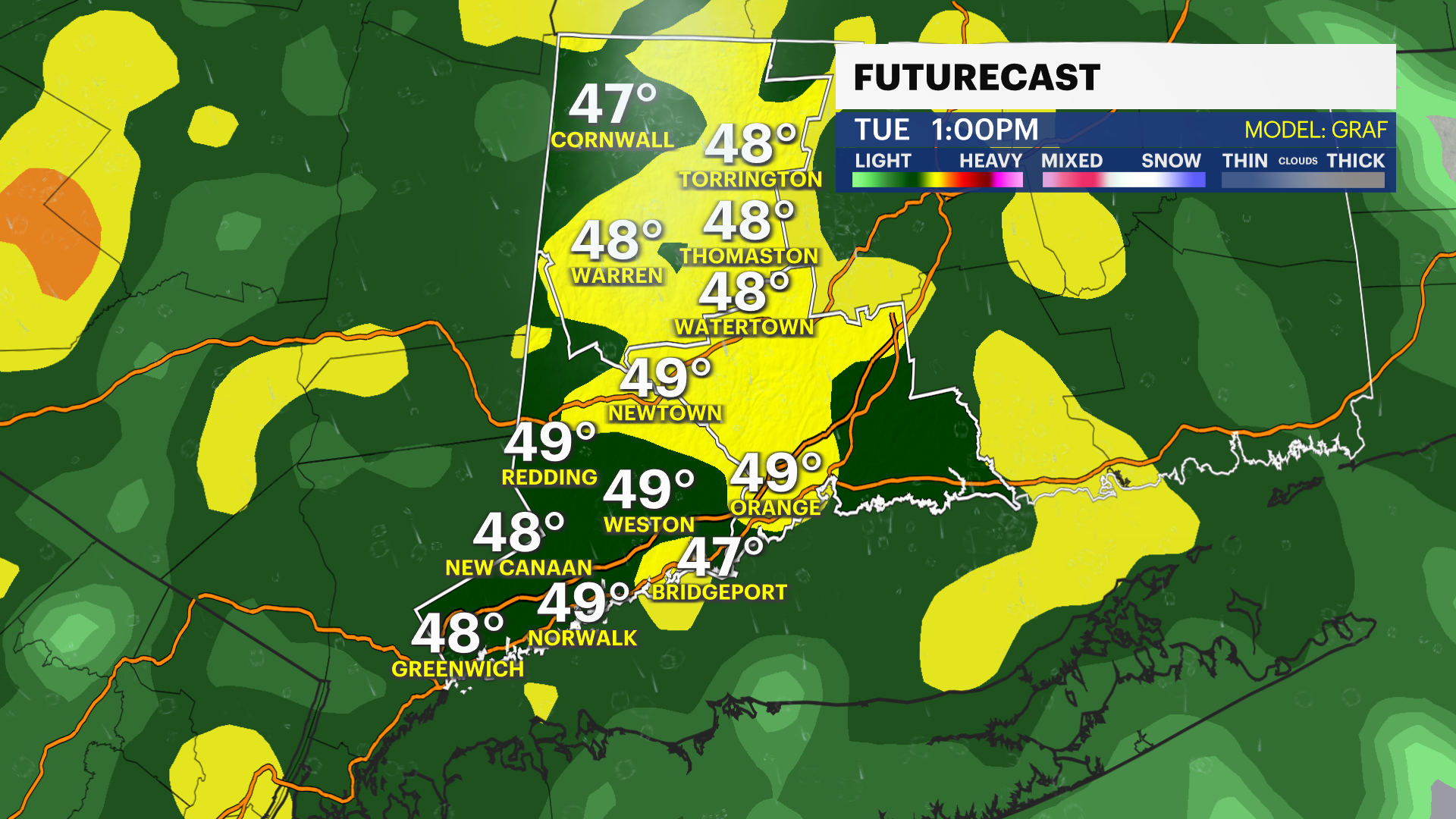
TUESDAY: Cloudy with showers and fog, especially along the Sound. Highs in the 50s, lows in the 40s. Wind: S 0-5 MPH.
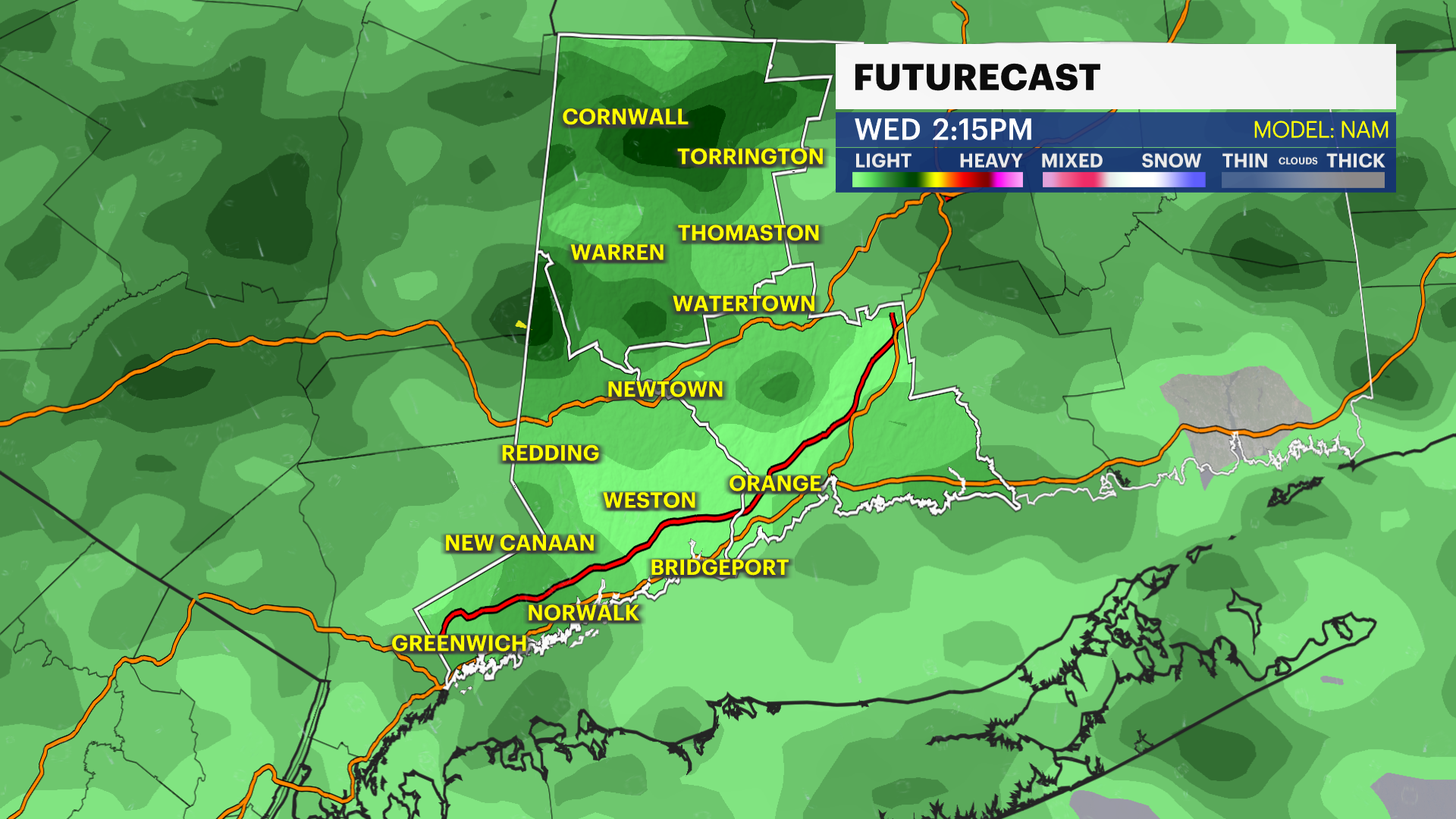
WEDNESDAY: Cloudy with rain, mainly in the afternoon and evening. Highs in the 50s, lows in the 30s and 40s.
THURSDAY: Mostly cloudy with showers transitioning to wintry mix or snowflakes overnight into Friday. Highs in the 50s and lows in the 30s.
FRIDAY: Rain/snow mix to rain showers possible and cooler. Highs in the 30s and 40s and lows near freezing.
SATURDAY: Clouds and sun, with a stray rain/snow shower possible. Highs in the 40s and lows near 30.
SUNDAY: Mostly sunny and seasonable. Highs around 40 and lows in the 20s.
MONDAY: Mostly sunny. Highs in the 30s and lows in the 20s.
More from News 12

PURA approves sale of Aquarion to the Regional Water Authority
1:58

Highs approach 50s today, showers and downpours are possible Thursday evening into Friday
0:36

Peekskill police arrest CT man for luring incident, say he attempted a second one
3:45

Conversation Connecticut: Golf Channel's Rich Lerner shares what to look out for ahead of this year's Masters Tournament
2:59

Jersey Mike's celebrates its annual Month of Giving to send Special Olympics athletes to USA Summer Games
2:41
