STORM WATCH: Severe storms may bring relief from the heat in Connecticut
Connecticut will see a stormy, steamy finish to the weekend.
More Stories


WEATHER ALERT
A severe thunderstorm warning is in effect for Danbury, Naugatuck and Waterbury until 8:30 p.m. The National Weather Service urges to take shelter in a sturdy building, away from windows. Winds of 80 mph can cause flying debris that could be deadly to those caught without shelter.
SEVERE THUNDERSTORM WATCH UNTIL 11 PM

Tonight: Western Connecticut faces the risk of strong to severe thunderstorms, with storms expected to develop along a cold front moving through the region. Similar to Friday's event, some storms could produce damaging wind gusts, frequent lightning and torrential downpours. Wind gusts may reach 60 mph in the strongest cells, bringing the risk of downed tree limbs, isolated power outages and hazardous travel conditions. If you hear thunder, move indoors immediately as lightning can strike well away from the storm itself. The threat should gradually diminish after 9 p.m., although some evening events and fireworks displays could experience weather-related interruptions.
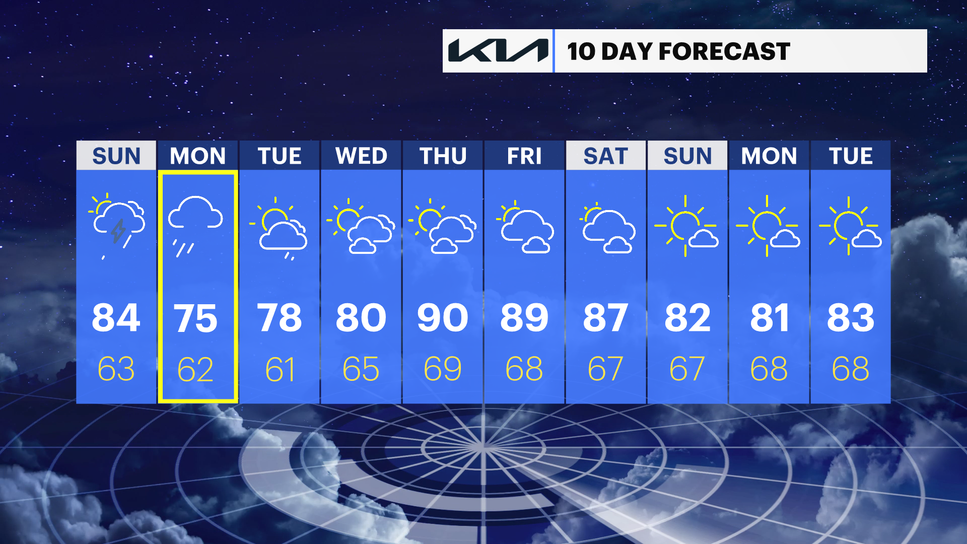
Sunday: The extreme heat eases as temperatures fall back into the mid- to upper 80s. It will still feel summer-like and somewhat humid, but much more manageable than Saturday. A few scattered thunderstorms may redevelop during the afternoon and evening hours.
Monday and Beyond: A wetter weather pattern takes hold to start the new week. Showers and periods of heavy rain are possible on Monday, with additional chances for rain continuing into the first half of the week. While the rainfall may impact outdoor plans and commutes, it will provide much-needed moisture to the region. Stay with News 12 for the latest forecast updates and any watches or warnings that may be issued.