Forecast: Colder temps this week; tracking potential for more snow Thursday night
Temperatures across New Jersey will be falling for the next few days, and there is more potential for snow.
•
Dec 12, 2022, 12:25 PM
•
Updated 786 days ago
Share:
More Stories
1:51

'We'll be ready.' Norwalk crews prepare for early morning storm
2h ago1:58

Thunderbolt 12: Overnight snow makes for slippery morning commute
2ds ago0:53

Bridgeport official calls on state to keep warming centers open during cold weather
10ds ago0:36

'Taylor Drift,' 'Snowtorious B.I.G.' among winners of CTDOT snowplow naming contest
11ds ago1:50

Planets continue to parade across the night sky
13ds ago0:39

Storm Watch Team Meteorologist Jonathan Cubit educates Greenwich Country Day students
13ds ago1:51
'We'll be ready.' Norwalk crews prepare for early morning storm
2h ago1:58
Thunderbolt 12: Overnight snow makes for slippery morning commute
2ds ago0:53
Bridgeport official calls on state to keep warming centers open during cold weather
10ds ago0:36
'Taylor Drift,' 'Snowtorious B.I.G.' among winners of CTDOT snowplow naming contest
11ds ago1:50
Planets continue to parade across the night sky
13ds ago0:39
Storm Watch Team Meteorologist Jonathan Cubit educates Greenwich Country Day students
13ds agoTemperatures across New Jersey will be falling for the next few days, and there is more potential for snow.
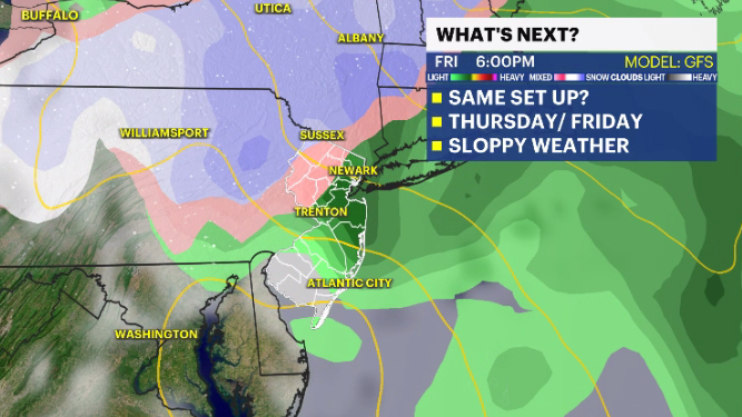
Storm Watch Team Meteorologist Dave Curren is tracking the potential for more snow Thursday night into Friday morning.
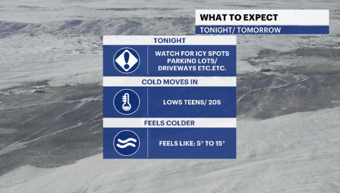
WHAT’S NEXT: Temperatures that are slightly below average. Wind chill make conditions feel colder. Most of New Jersey is expected to see rain Thursday night into Friday. But there is potential for snow in the northwestern sections of the state.
OVERNIGHT: Mostly clear skies with temperatures cooling into the 20s.
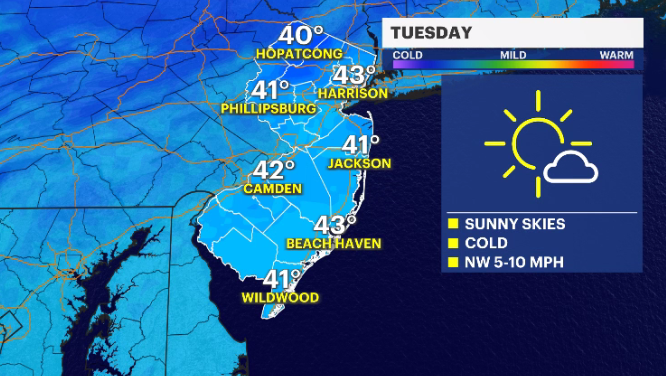
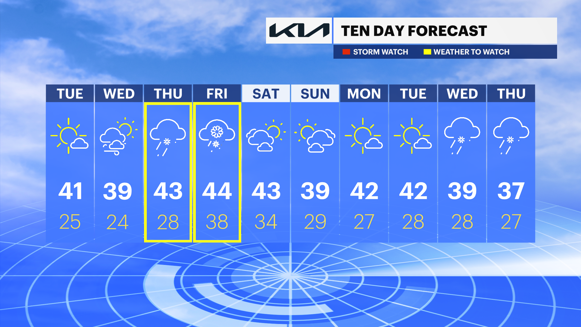
TUESDAY: Plenty of sunshine, but temperatures do not reflect it. Wake-up temperatures could feel as if they are in the single digits due to the wind. Daytime highs in the low-40s. Overnight lows in the mid-20s.
WEDNESDAY: Mix of sun and clouds. Daytime highs around 39 degrees. Overnight lows around 24.
THURSDAY: Cloudy with rain and wintry weather developing by the evening. Daytime highs around 43, with overnight lows around 28.
FRIDAY: Rain and wintry weather in the morning. Daytime highs around 44 degrees. Overnight lows around 38.
WEEKEND: Mix of sun and clouds. Daytime highs in the low-40s and upper-30s. Overnight lows in the low-30s and upper-20s.
More from News 12
2:40

STORM WATCH: Snow, sleet and rain will make for a tricky Thursday morning commute
2:40

SCHOOL CLOSINGS: Closings, delays and schedule changes in Connecticut
1:51
'We'll be ready.' Norwalk crews prepare for early morning storm
2:01

Officials: Bridgeport Police Academy instructor under investigation for alleged 'inappropriate relationship with female recruit'
2:22

Gov. Lamont proposes universal pre-school and tax cuts, but also higher train fares
2:32
