More Stories
NOW & NEXT: No rain tonight, unlike last night where we did see a few rogue showers form very late along this "backdoor front".
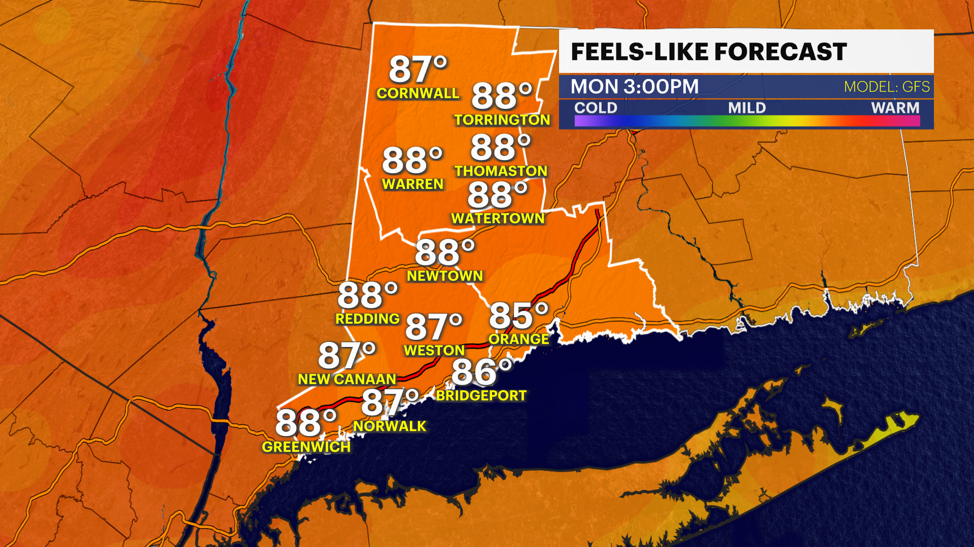
Storm Watch Team Meteorologist Michele Powers says Connecticut will see heat and humidity will build up for Monday before a chance of showers or storms late Tuesday.
Warm and humid and then it heats up as clouds part on Monday.
Risk of storms for Tuesday. They look scattered and broken along the front. Should clear enough for Wednesday to see more sun and temps to stay hot. Less humid and cooler rest of week. Think "fall preview" as we kick off September for a few days.
Much nicer for second half of week. Cooler and comfortable.
TROPICS: One area of concern is highlighted just east of the Windward/Leeward Islands. Moderate risk of development within next couple of days but HIGH risk now by day 7. Models try to develop something as we start September, so we may be tracking a trop system soon in the Atlantic.
Today: Sun and clouds, slight chance of a shower in a few spots this afternoon. Highs 81-87.
Tonight: Mostly cloudy, warm and muggy. Lows around 70.
Monday: Early clouds break for sun. Highs 85-90.
Tuesday: Mostly sunny, late day strong to severe storms possible. Highs 85-90.
Wednesday: Mostly sunny warm and dry. Highs 85-90.
Thursday and Friday: Mostly sunny, cooler and less humid. Highs 80-85.
Saturday and Sunday: Mostly sunny and milder. Highs middle-80s.
More from News 12
0:44

NBC Universal cancels Stamford-based Steve Wilkos and Karamo shows
1:18

Bright & windy day with stormy weather on the horizon
1:35

Welcome back, spring! Everything you need to know about the upcoming vernal equinox
0:57

Annual Team Teddy St. Baldrick’s event raises money and awareness for pediatric cancer research
0:49

Annual Tiny Tots Spring & Summer Consignment Sale returns to Stamford
2:01
