More Stories
News 12 Storm Watch Team Meteorologist Michele Powers says snow showers will wrap in the overnight hours with a chance of one last blast of snow mix before the morning commute.
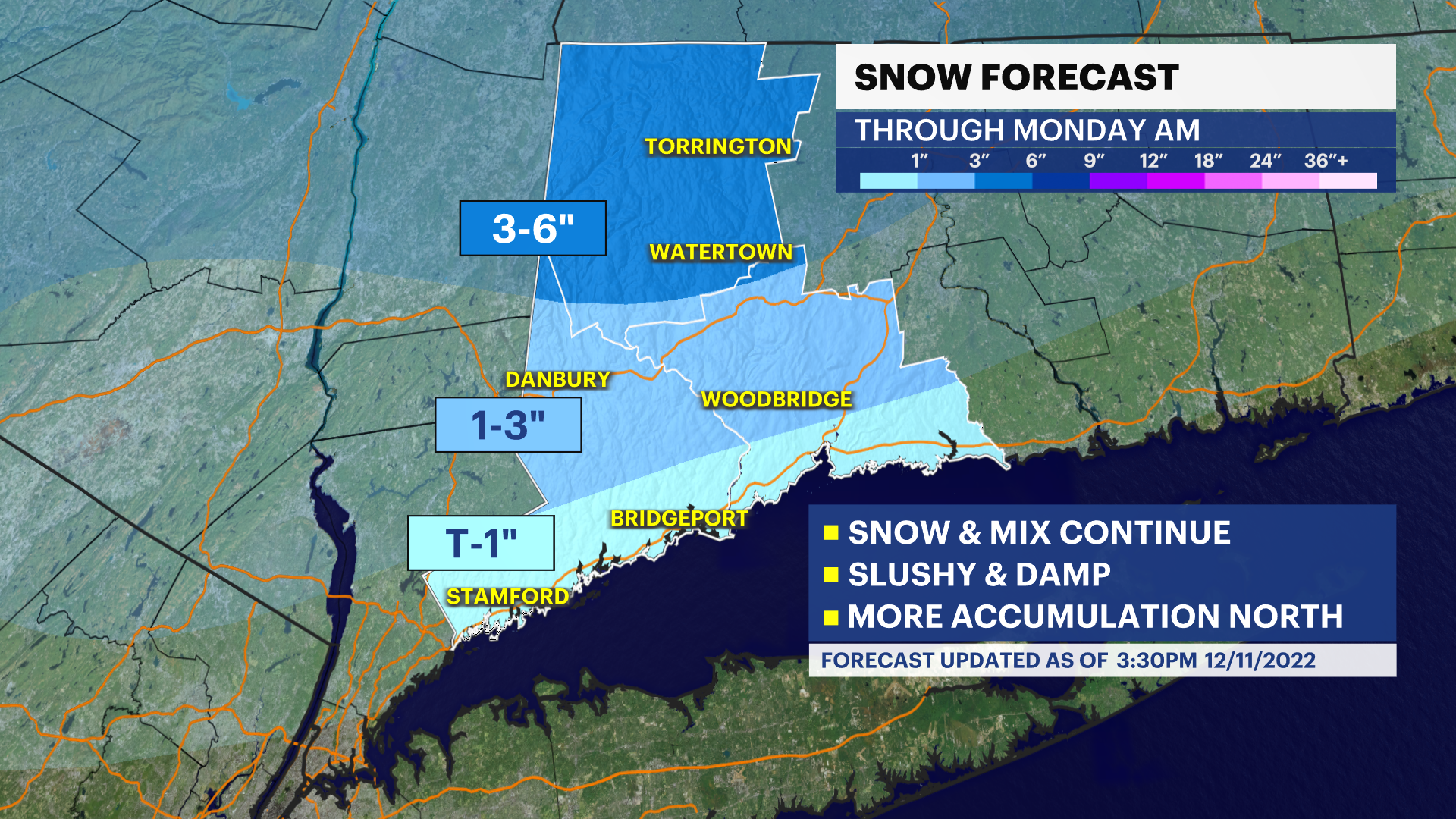
WHAT'S NEW: Tracking snow showers into the evening hours. The showers will fill in more than what we've seen so far over the next few hours. North of the Merritt will see more accumulation. South of the Merritt through the 95 corridor, temperatures are warm enough for the snow to melt and just give us some wet roads. Temperatures will need to be watched overnight as this system wraps up. Anything wet could become icy.
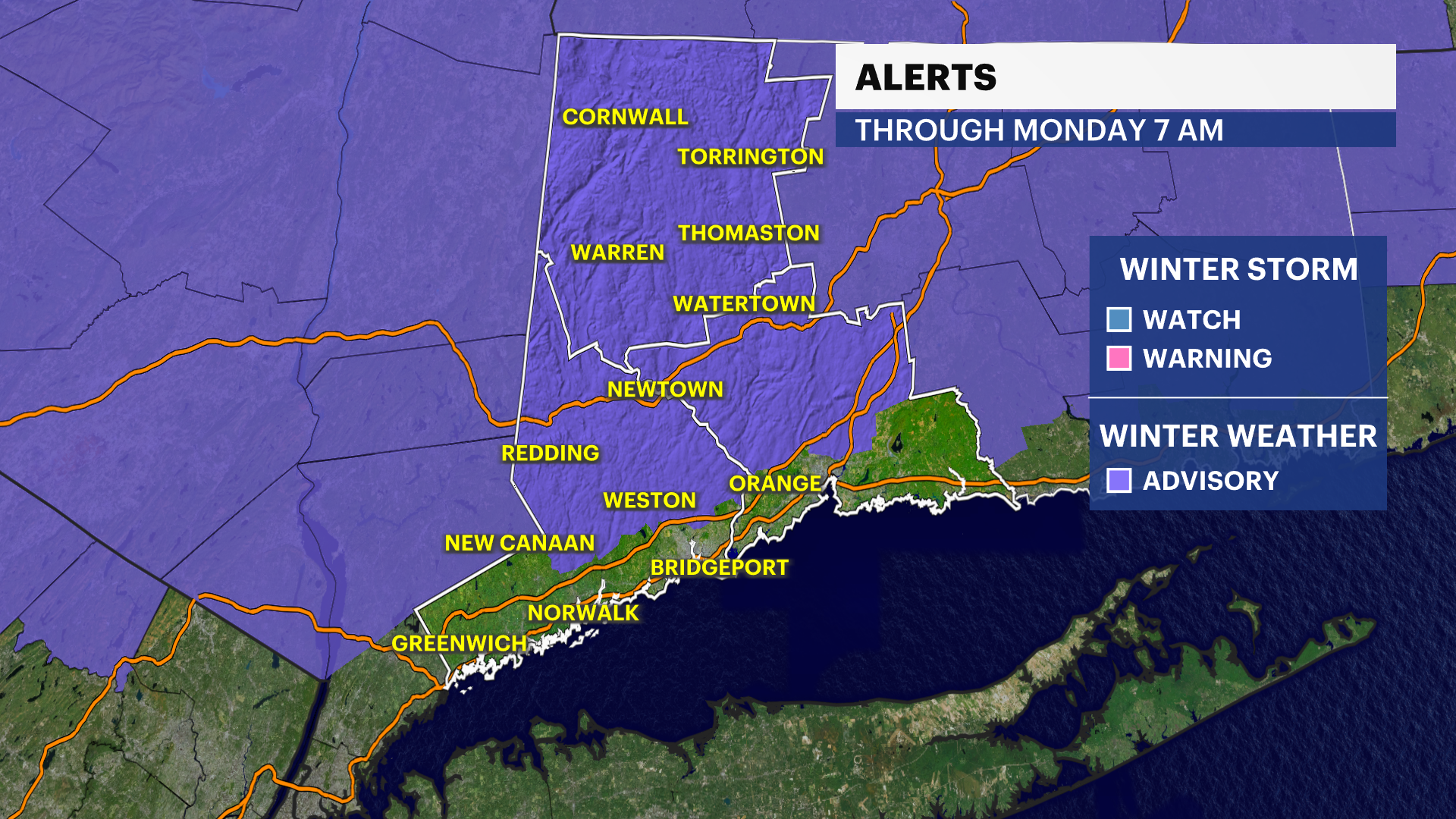
Winter Weather Advisories are in place for Litchfield, North Fairfield and North New Haven counties through 7 a.m. Monday.
About 1 to 2 inches are possible north of the Merritt through about I-84. North of I-84, 3 to 6 inches are possible. Highest totals will occur north and up in elevation.
One last blast of snow and mix may occur in the pre-dawn hours up through the early Monday morning commute before everything winds down. The News 12 Storm Watch Team will monitor this situation closely. At this time, temperatures will fall to near freezing or below.
WHAT'S NEXT: Another storm system comes to the region by the end of the week. This one will be much larger and pack more moisture. Precipitation type is highly dependent on the track, so right now it's too early to say but there could be some snow and mixing involved. It should wrap as Saturday approaches for a dry, cold and windy weekend.
FORECAST
OVERNIGHT: Showers wrap early overnight. Lows 27 to 32.
MONDAY: Early clouds, maybe a few showers in the AM (snow and mix), then clearing. Much colder at night. High of 41, low of 23.
TUESDAY: Mostly sunny. High of 39, low at 20.
WEDNESDAY: Mostly sunny. High of 38, low of 26.
THURSDAY: Mostly cloudy with showers. High of 43, low of 35.
FRIDAY: Mostly cloudy with rain or snow showers. High of 43, low of 30.
SATURDAY: Partly sunny and breezy. High of 41, low of 28.
SUNDAY: Partly sunny and cool. High of 39, low of 28.
More from News 12
2:52

Family of Bridgeport man fatally struck by SUV says beloved grandfather had 'endlessly giving spirit'
2:24

Rain showers to finish first spring weekend for Connecticut
0:13

Police: 19-year-old injured in Waterbury shooting

ICE officers soon will help with airport security unless Democrats end shutdown, Trump says
0:24

Police: 42-year-old Derby man injured after SUV struck bicycle in Waterbury
