More Stories
December is the official first month of winter and it couldn't be a more festive start. Temperatures this week have been running well below average and many neighborhoods have even seen some snowflakes. We are on Storm Watch for Thursday morning. A weak Canadian storm system will bring rain tonight followed by a risk for some mix for the Thursday morning commute, and a stiff wind in the afternoon. Power outages are possible with wind gusts reaching 30-40 mph on Thursday afternoon.

But this is just the start of several storm systems that will approach our area. Another storm will pass over our area early next week, and there's a signal for a larger storm system to follow in the heels of that one. Snow lovers, sit tight! Next week the polar vortex will retreat into Asia which will allow for higher temperatures, in the 50s, to return. The risk for winter precipitation next week is very low.

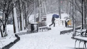
Snow on Christmas?
Historically, the risk for snow on Christmas is low. The last time most of us saw snow on Christmas was 15 years ago, in 2009. Bridgeport did have a trace on the ground in 2021 and Islip had snow on the ground for Christmas 2013.

The best chance for snow on the ground for Christmas is historically in northwest New Jersey, areas north and west of I-287 in the Hudson Valley, and north of I-95 in CT. This year might be challenging for even these spots to have snow on the ground because the days leading up to Christmas are too warm for a snowpack to form. The trend is for slightly above average temperatures through Christmas, but there is also a better than usual chance for precipitation, so stay tuned because the pattern is favorable for a storm in the days leading up to Christmas week.

More from News 12
2:00

Bright and chilly weather will give way to spring showers
1:22

Blizzard of 2026 is now a "bomb cyclone"
2:06

Bridgeport's emergency parking ban in effect ahead of winter storm

25 tips to keep you safe during a winter storm
4:12

What you need to know about the snowstorm heading toward the tri-state Sunday into Monday
1:37
