More Stories
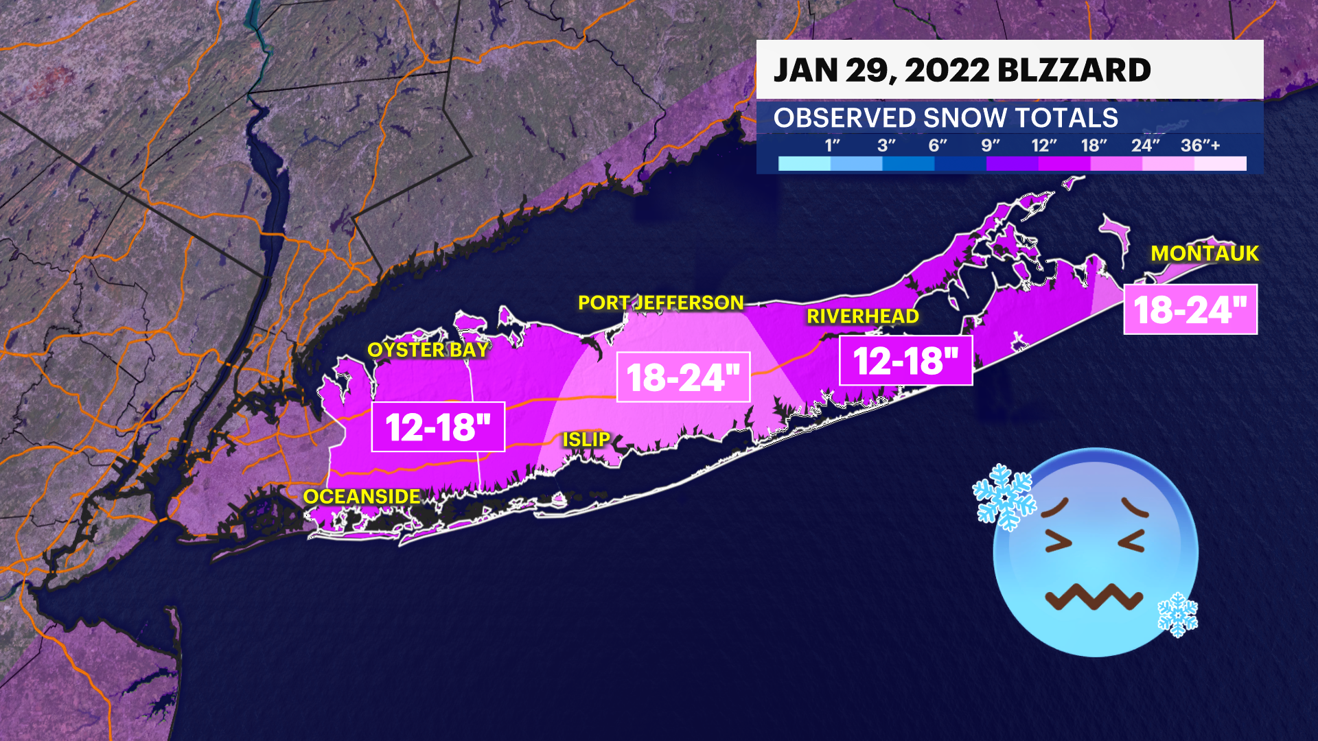
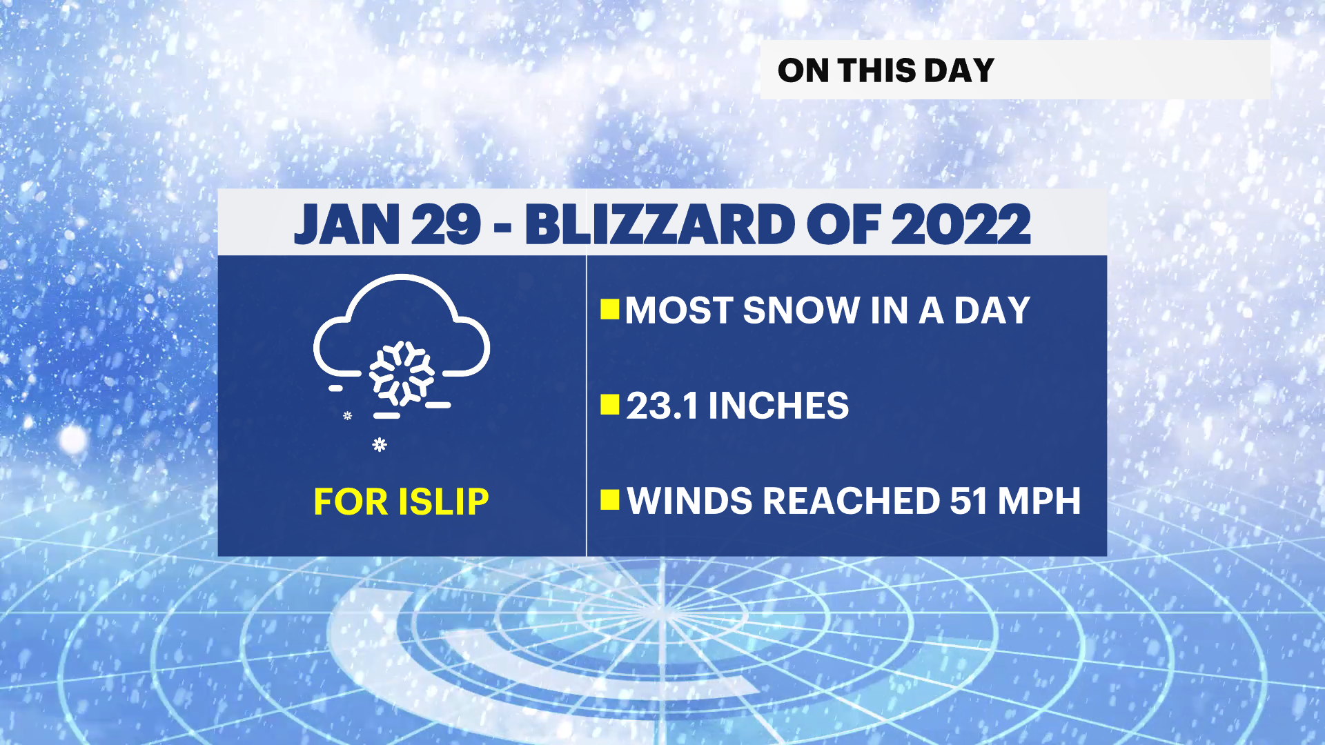
Long Island hasn't seen any measurable snow this January at the official observation station at MacArthur Airport in Islip, but it was just a year ago that Islip had its snowiest day on record - 23.5 inches of snow fell on Jan. 29, 2022. This beat the previous record of 23.4 inches in Jan. 2016. Records for the site go back to 1964.
Snowfall from the "Blizzard of 2022" started on Jan. 28, but blizzard conditions didn't arrive until about 7 a.m. the next day. A blizzard is declared after a three-hour period of time with winds sustained or gusting frequently to at least 35 mph and snow is reducing visibility to less than a quarter-mile. Peak winds at Islip reached 51 mph. In Shirley, winds reached 52 mph, producing snow drifts that measured 3 feet high in parts of central Suffolk County.
The biggest snow totals occurred over central Suffolk County between Patchogue and Port Jefferson. In this spot, official accumulations topped more than 18 inches. In total, Islip reported the most snow - officially 24.3 inches. Snowfall estimates in Nassau County exceeded a foot. In central Suffolk County and along the eastern end of the South Fork, totals were around 20 inches.
A look ahead
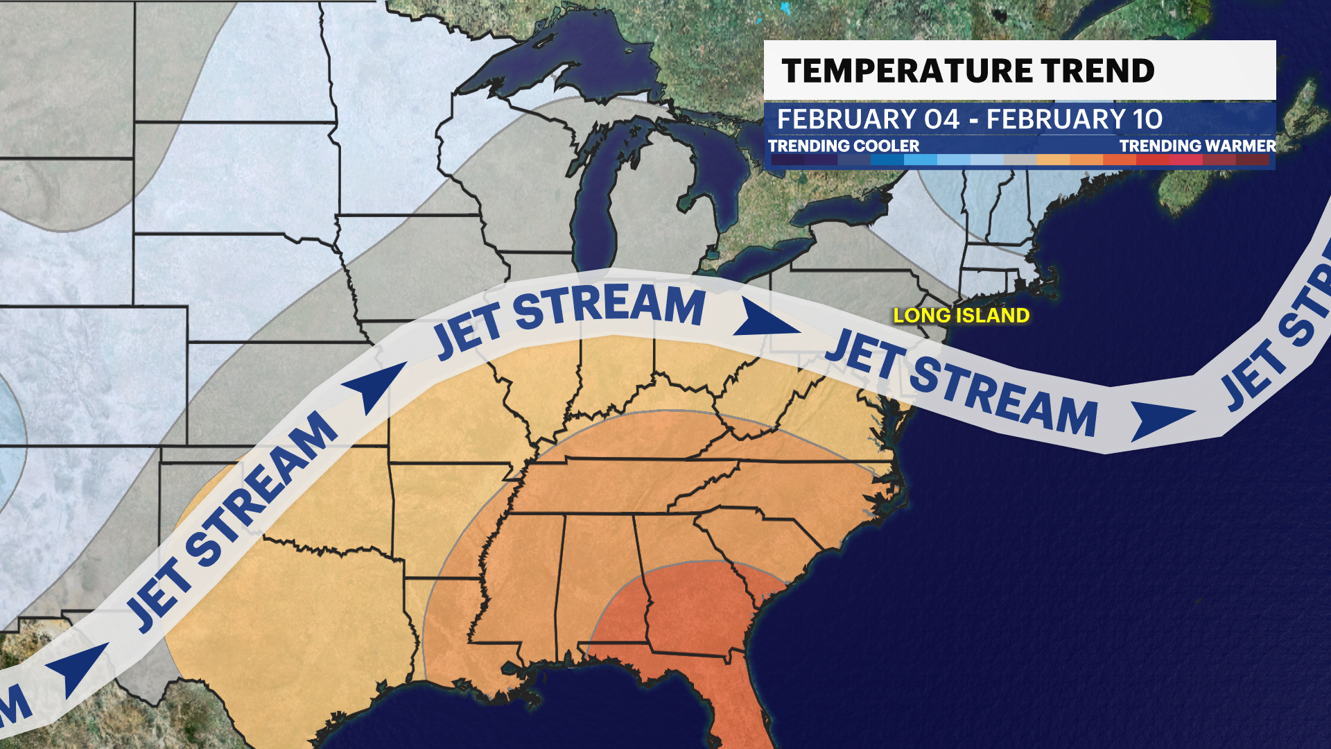
This year has been very different than 2022. Every day in January 2023 has seen above average warmth on Long Island. Right now, January is on track to be the warmest on record for Long Island. The daily mean temperature (an average of the daily high and low) is more than 40 degrees for the month, which is typical for March.
Things are changing in February. Cooler than average temperatures are expected for the first week of the new month with seasonable temperatures more likely through the middle of February. Although no snowstorms are currently in the forecast, this pattern is more favorable for wintry weather than it's been so far this season.
More from News 12
1:37

Warmer temps finally on the way after brutal stretch
1:26

Snail-slow thaw across the tri-state
1:56

Deep freeze: Mayor Ganim orders Bridgeport warming centers open around the clock
0:36

Bridgeport mayor urges residents to check in on the vulnerable during extreme cold
2:24

Body of homeless man discovered in frigid temps triggers call for cold weather safety efforts
3:20
